EPIC ROAD TRIPS
Road Trip: New Hampshire
I’ve driven from New York State to Key West, Florida.
I spent nights sleeping on the sand on the Cape Hatteras National Seashore.
Exploring the Outer Banks.
Driving Skyline Drive.
Tail of the Dragon in North Carolina and Tennessee.
Edisto Island.
The Florida Keys.
Some of the Great Lakes, including Huron, Michigan, Erie, and Ontario.
Several trips to Chicago.
And, from ’21 to ’24, Paulie’s Push, as the official media support vehicle four years in a row.
More than 35+ nights spent under the stars in my little climate-controlled sleeping pod.
Sixteen different campgrounds: everything from privately-owned to municipal and state parks and federal lands.
With plans to continue my journey west.
With the introduction of Red Rocket, my second Tesla Model 3, it was time to embark on a new journey.
I began a little tour of the waterfalls of New York State.
I spent time time doing a scenic drive along NY-5, the alternative to the New York State Thruway between Buffalo and Albany.
I visited bits here and there of the Great Lakes Seaway Trail, driving along the edges of Lake Erie, Lake Ontario, and the St. Lawrence River.
But I started to feel hemmed in by the borders of New York State, and I knew that it was time to head out on an interstate road trip - while staying off of the interstates as much as possible, of course.
This time I’d head east - about as far east as you can go in this country, through New Hampshire and, ultimately, Maine.
Along the way I’ll document scenic drives, a campground or two, and some of our national parks.
Enjoy this website, and if you have any questions or want some tips on your trip, get in touch.

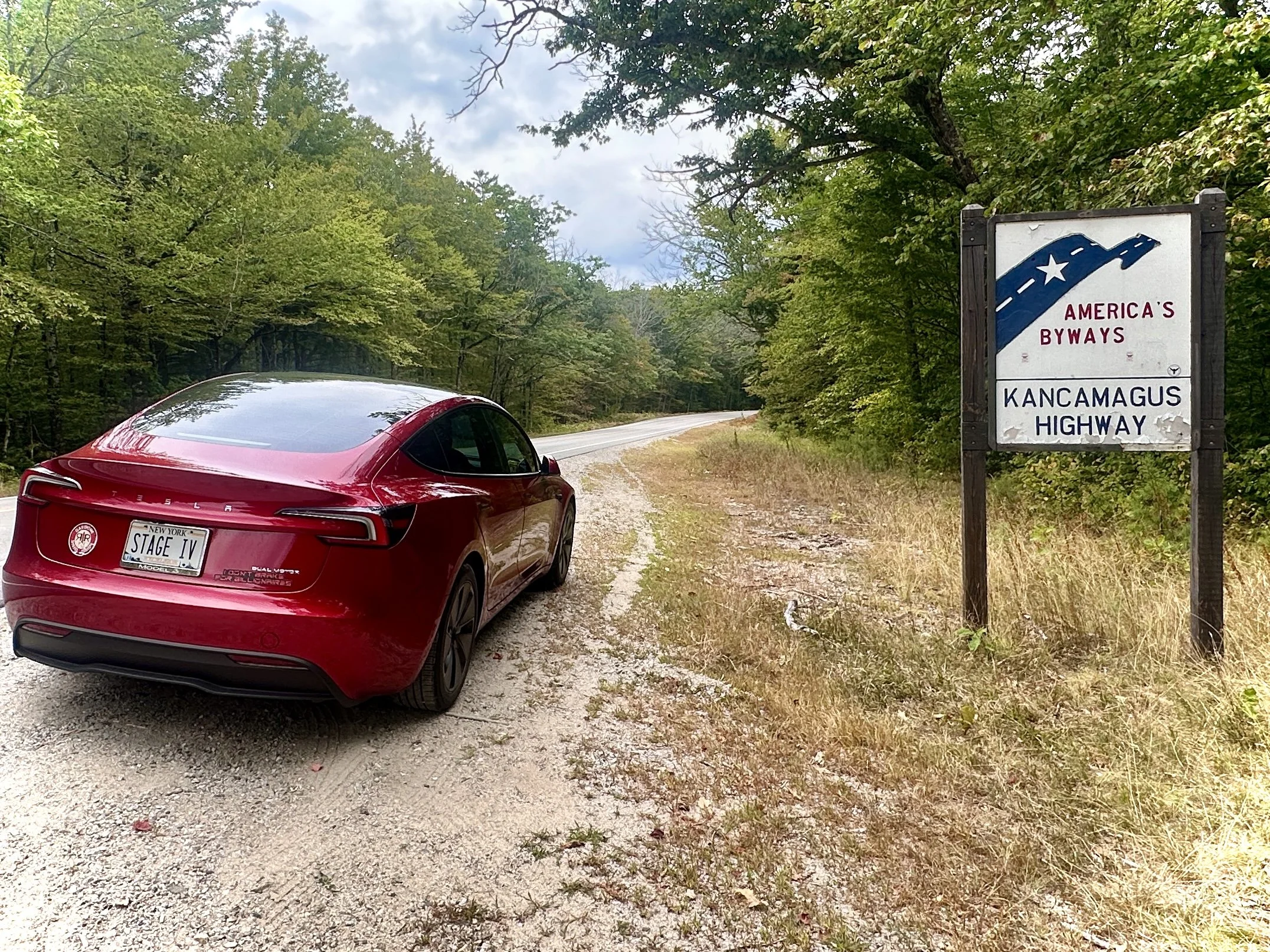
KANCAMAGUS HIGHWAY
The Kancamagus Highway, also known as New Hampshire Route 112, is a National Scenic Byway in New Hampshire's White Mountains, connecting Lincoln and Conway for 35 miles through the White Mountain National Forest. It offers panoramic views, especially of fall foliage, and features overlooks and hiking opportunities to waterfalls like Rocky Gorge and Sabbaday Falls. The Kancamagus Highway opened in August 1959, after two dead-end stretches of road were linked, creating a connection between US 3 in Lincoln and NH 16 in Conway. The road was paved in 1964, and in the winter of 1966–67 it was plowed for the first time.
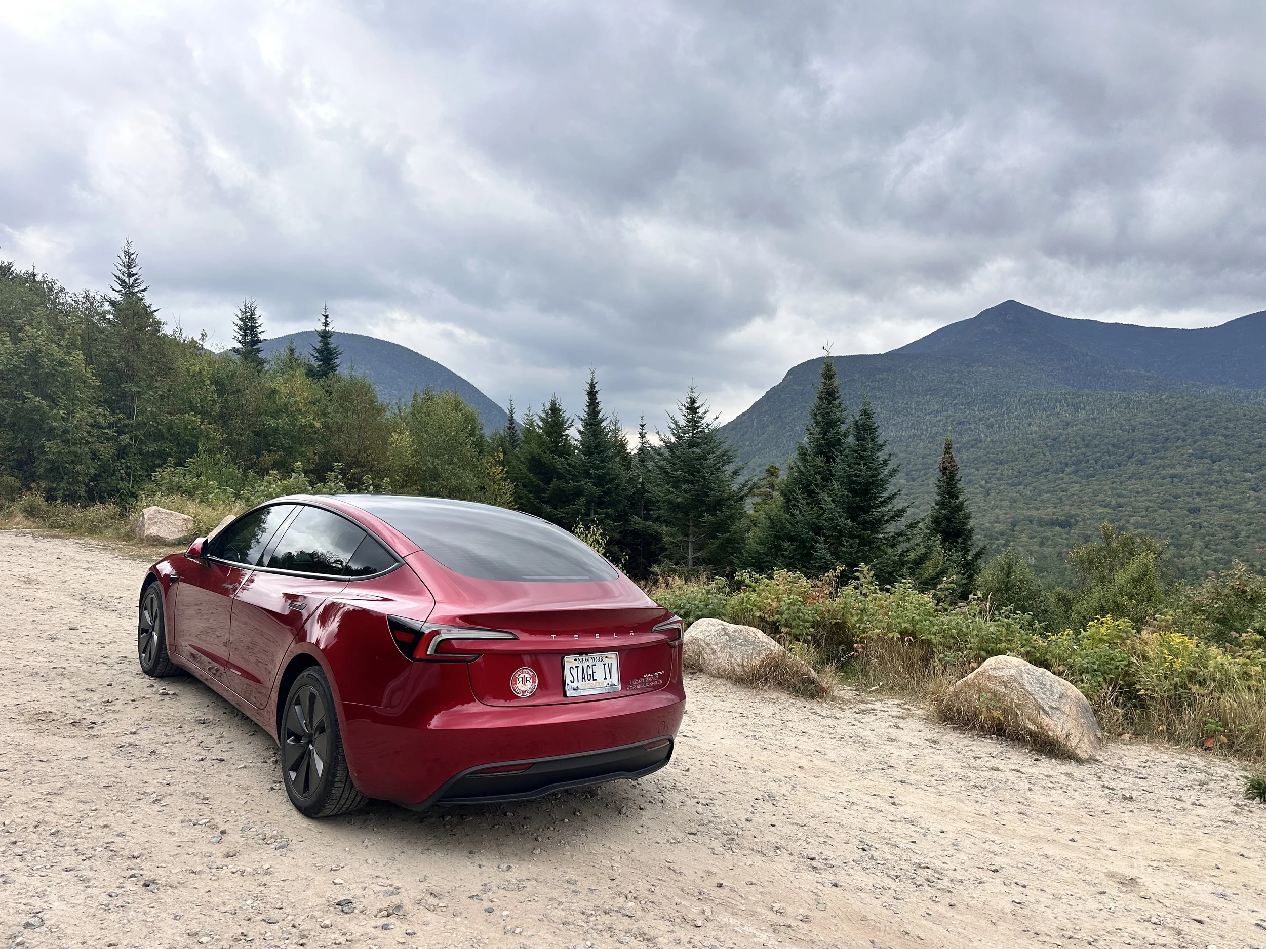
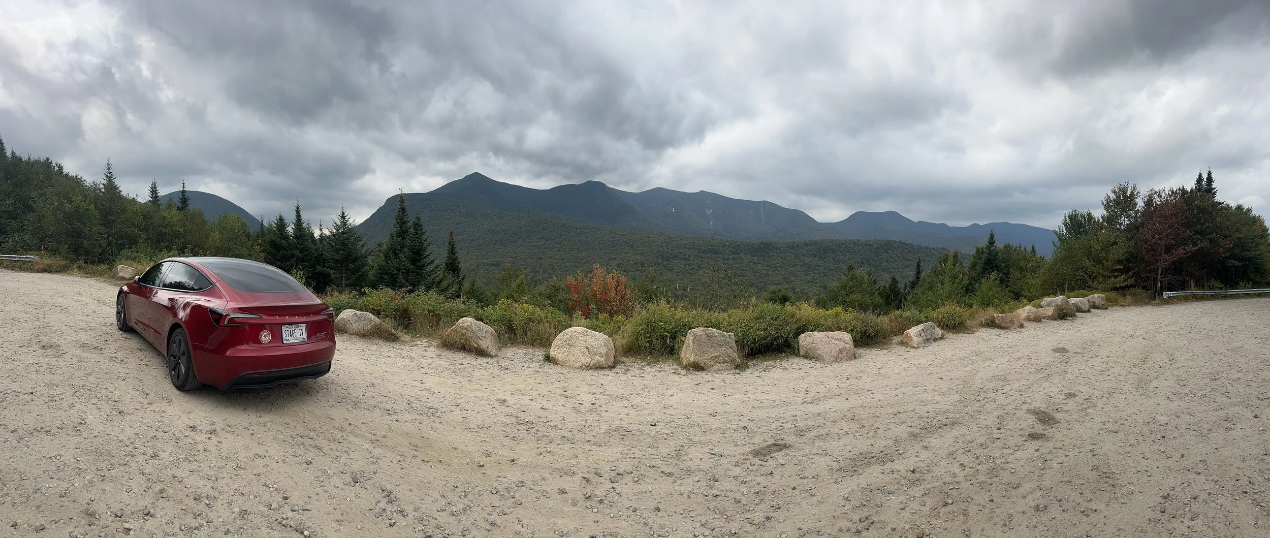
I visited in September 2025, for my first real road trip with ‘Red Rocket’: my home in upstate New York to Acadia National Park in Maine, via the White Mountains of New Hampshire.
The Kancamagus Highway, known to locals as "The Kanc," is often misspelled and mis-pronounced Kangamangus Highway, Kangumangus Hiway or Kancamangus Highway. The correct way pronounce Kancamagus is "Kank-ah-mah-gus." It is also known as the Kancamagus Scenic Byway, having been officially designated a National Scenic Byway in 1996, part of the Federal Highway Department’s National Scenic Byways Program, which recognizes roads in the United States that have outstanding scenic, historic, cultural, natural, recreational, or archaeological qualities.
For more information on the Kancamagus, visit https://kancamagushighway.com.


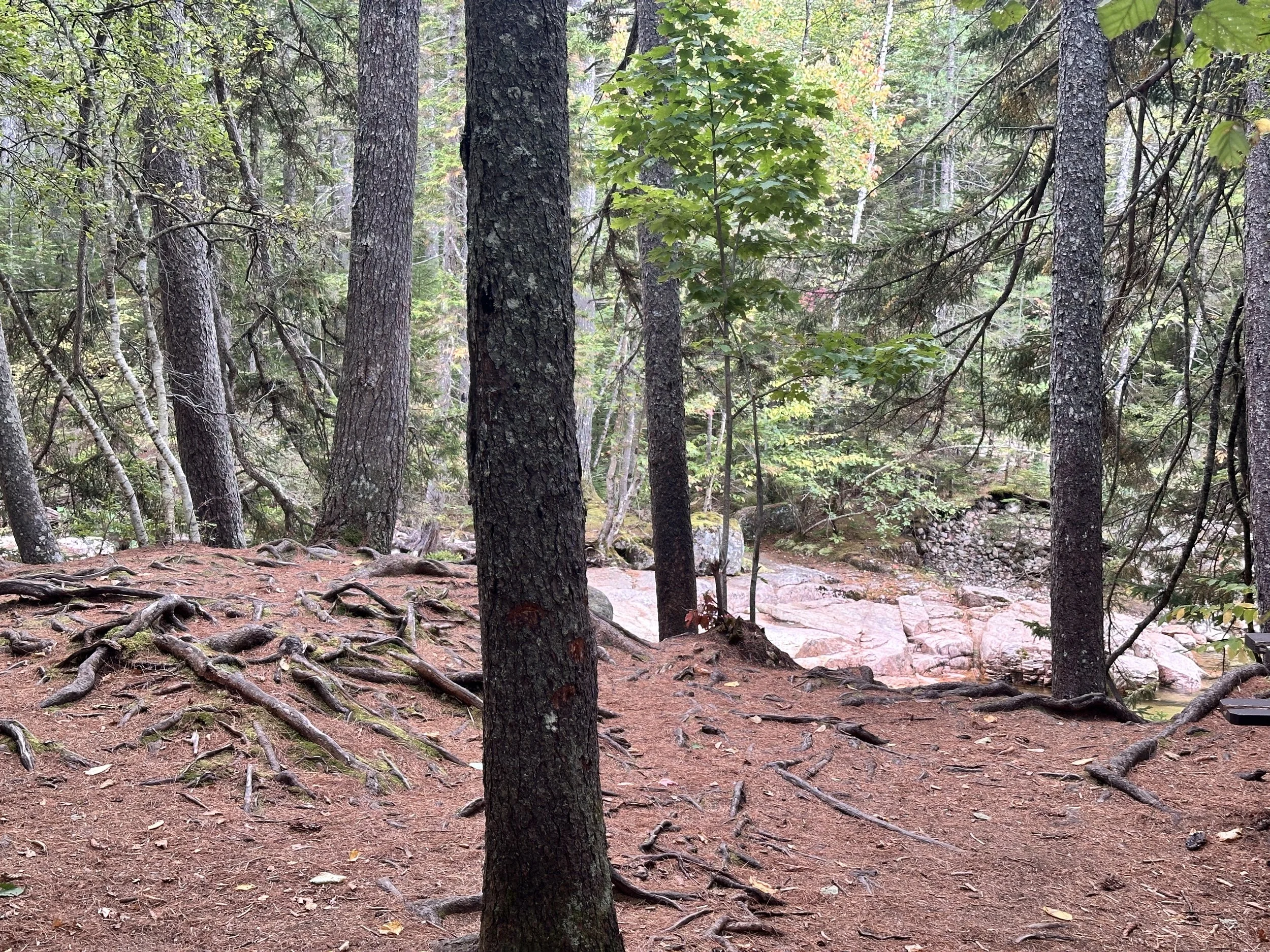


Much of NH-112 runs alongside the Pemigewasset River. The river originates in the area known as the Pemigewasset Wilderness, in the heart of the White Mountains, near Franconia Notch, and flows south through towns Lincoln, as well as Woodstock, Plymouth, and other towns, eventually joining the Merrimack River. I visited during a drought, and most of the river appeared to me to a rock bed with some water flowing through it. I’m told that the amount of water is much more impressive after a heavy rain, as well as in spring after a snow melt.
At several points along the way I stopped to take pictures of the Pemigewasset. There are points along the Kancamagus Highway where the river creates pools of water that have become local swimming holes, and although temperatures weren’t particularly warm for a September day I spotted people swimming in them on a number of occasions. (Local campers, finding a lack of bathing opportunities at the six campsites here, may just do a bit of eco-friendly bathing in the river, though I was careful not to get any photos of that).
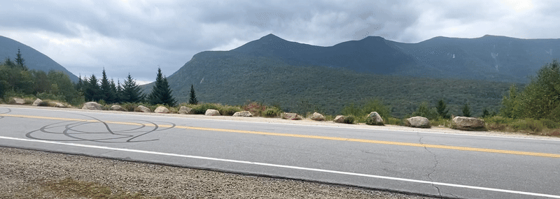
The Kanc is perfect for an EV road trip, what with stunning scenery on both side and a number of overlooks. These include:
Hancock Overlook, near the Lincoln end, before the hairpin turn; this offers a dramatic view of the Osceola Range and Hancock Notch, and is said to be a great spot for sunrise photos and photos on a foggy day;
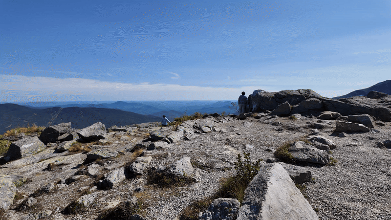
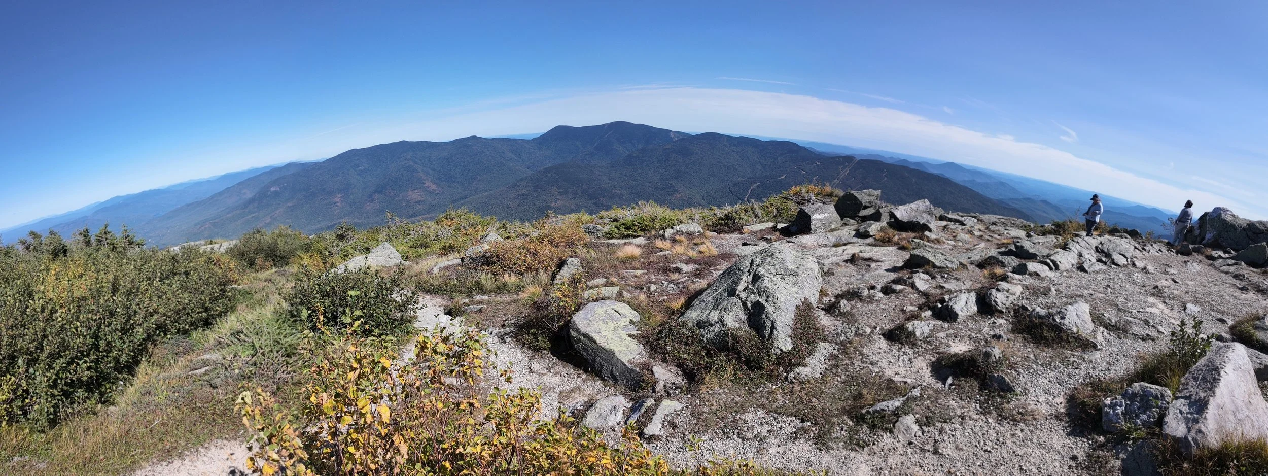
Pemigewasset Overlook, near the summit of Kancamagus Pass; one of the highest stops at ~2,855 feet elevation, offering wide panoramic views of the Pemigewasset Wilderness;
CL Graham Wangan Overlook, east of Kancamagus Pass, descending toward Conway; offering views of rolling hills and distant mountains;
Sugar Hill Overlook, closer to the Conway side; this overlook offers Sweeping views of the Swift River Valley and surrounding peaks, and is said to offer photographers prime foliage backdrops later in the fall.
Several other areas offer amazing views, as well, including:
Rocky Gorge Scenic Area – Beautiful waterfalls and pools on the Swift River.
Sabbaday Falls – A short hike to a scenic waterfall in a gorge.
Albany Covered Bridge – A classic New England covered bridge over the Swift River. I was surprised by this bridge - my GPS lead me over it - and although I would have liked to have stopped for photos, angry locals unhappy about sharing their pedestrian bridge with vehicular traffic lead me to keep it moving.
Lower Falls Scenic Area – Popular swimming spot with great river views.


Overall I found the Kancamagus to be beautiful - but I have to admit that it doesn't quite match the grandeur of the Blue Ridge Parkway, a road trip I took in 2022. The Kanc offers a compact drive filled with forested overlooks and rugged peaks, yet its relatively short length and limited variety can’t compare to the expansive, multi-state journey of the Blue Ridge, with its weaves through the heart of the Appalachian Mountains, its dramatic ridgelines, deep valleys, and a constantly shifting landscape that changes in both altitude and ecology.
Where NH-112 gives you a few stunning moments, the Blue Ridge Parkway offers an immersive experience that unfolds over hundreds of miles—each turn revealing a new vista more breathtaking than the last. That said, I haven’t done either during fall foliage, so maybe my opinion might be changed were my trips to have occurred in the fall, instead of late-summer (Kanc) or early spring (Parkway).
Curious to hear your views?


I did encounter motorcyclists and car enthusiasts on their own road trips during this trip, including one import race duo I shared several overlooks with. At one point I turned to a woman who was taking a photo of a man standing in front of a Camaro at an overlook, offering my services in case she wanted a picture of both of them; she rolled her eyes and said “Nope, this is ALL HIM.” That made me chuckle… not everyone gets the connection road trippers have with their vehicles, but some are lucky enough to have someone to come along to take the picture, at least. I continued packing up my tripod and got out of there.
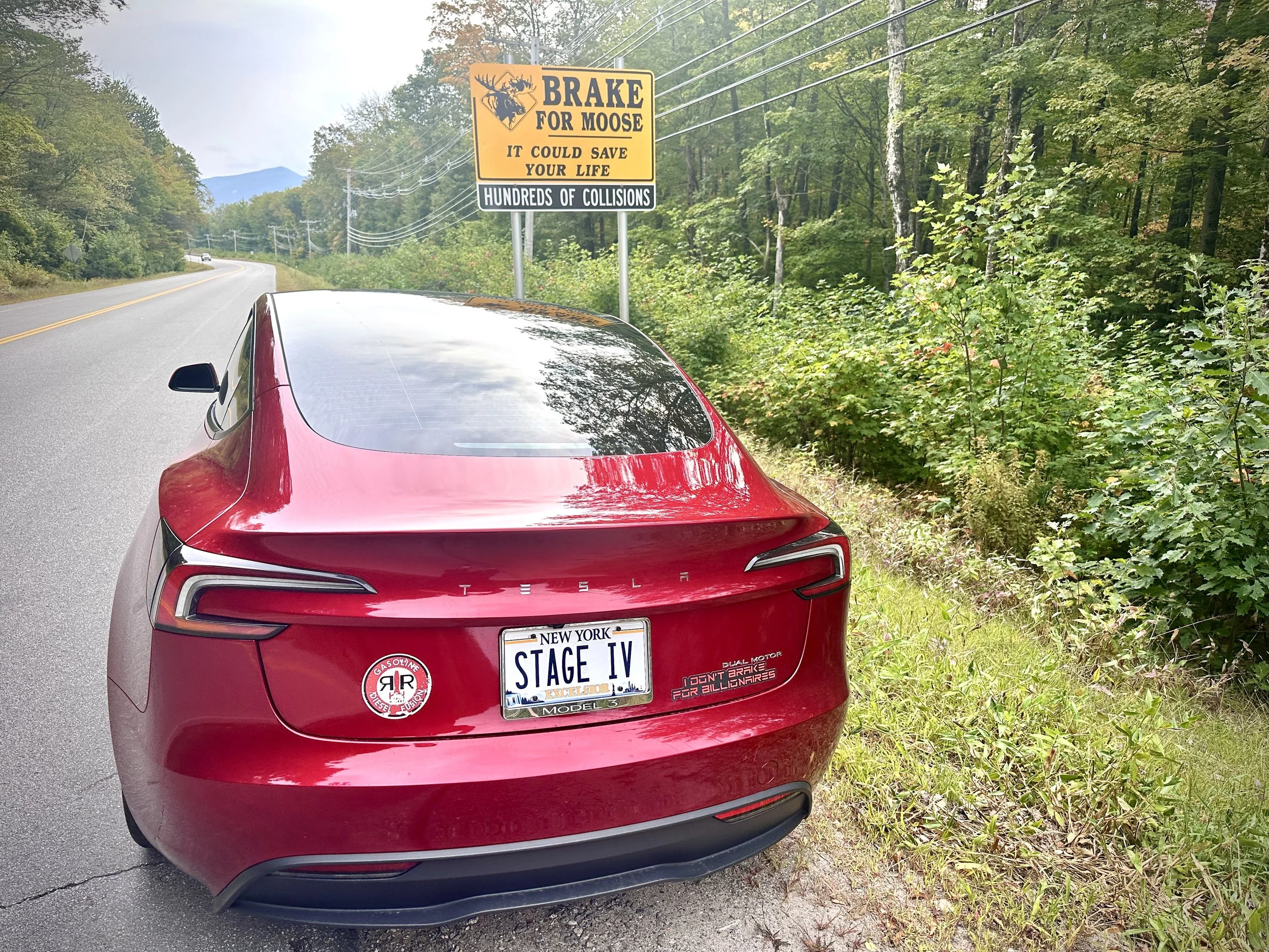
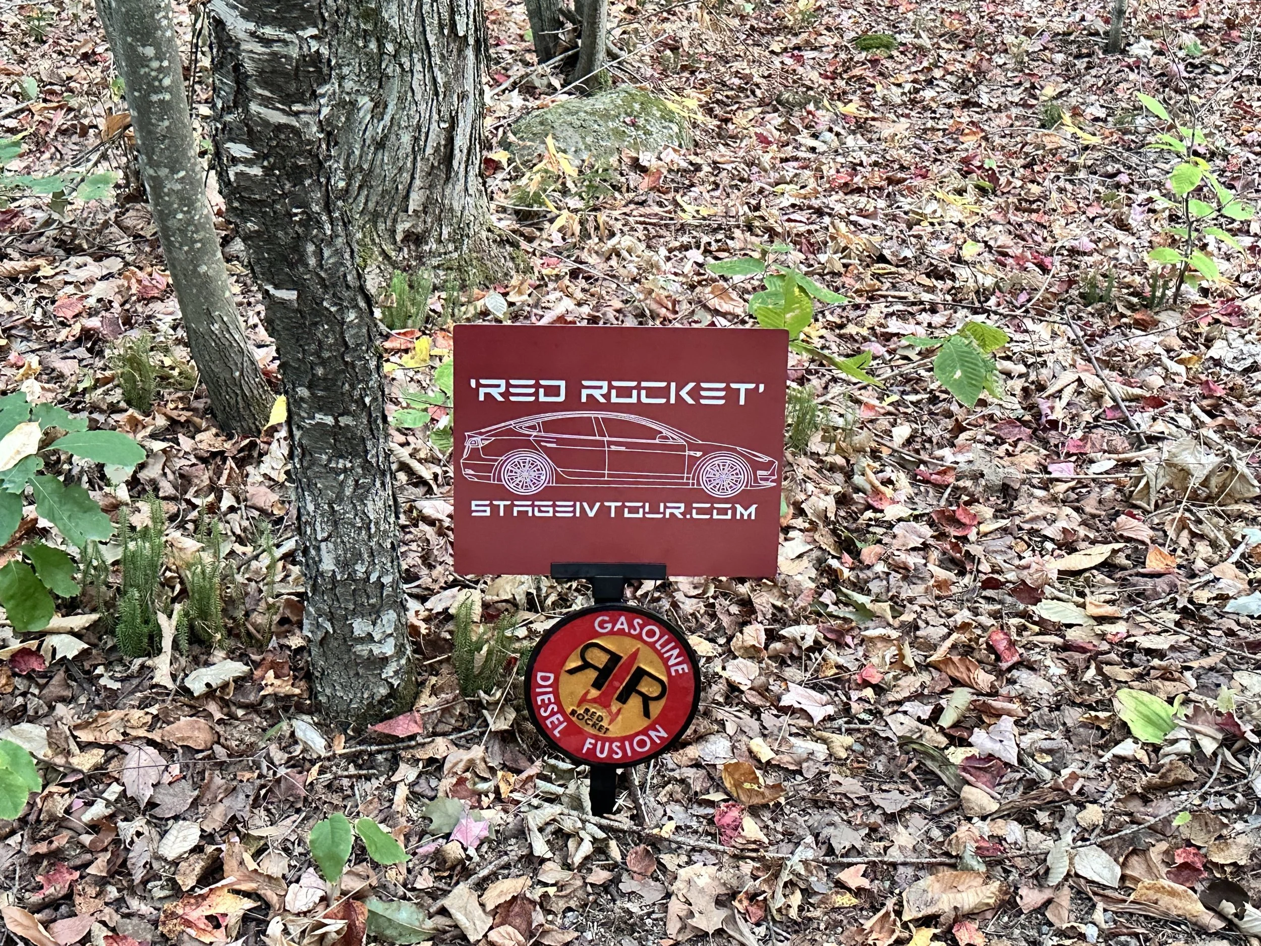
I did take a moment to put my “Stage IV Tesla” sticker on the backs of signs, along with the others already there, along the way. I’m always careful not to cover anyone else’s sticker. Sometimes I take a moment to look up the websites they represent, wondering what other road trippers are posting online. Here, unfortunately, I often had no data, so I missed a few. I’ll have to upgrade to satellite if that’s ever in the budget.
I’d love to return to see these rivers at their peak… and I’d definitely enjoy this area during peak foliage season, as well. But it’s likely that this trip will be a true ‘bucket list’ trip - checked off, and not to be repeated. It seems like more of a passing-thru trip, as opposed to a destination drive like some of the others I’ve done.
My next stop would be Acadia National Park, which might well be a return trip - you can read more about that [coming soon]. So who knows - a return to the Kanc might be in the cards as I pass through, after all…


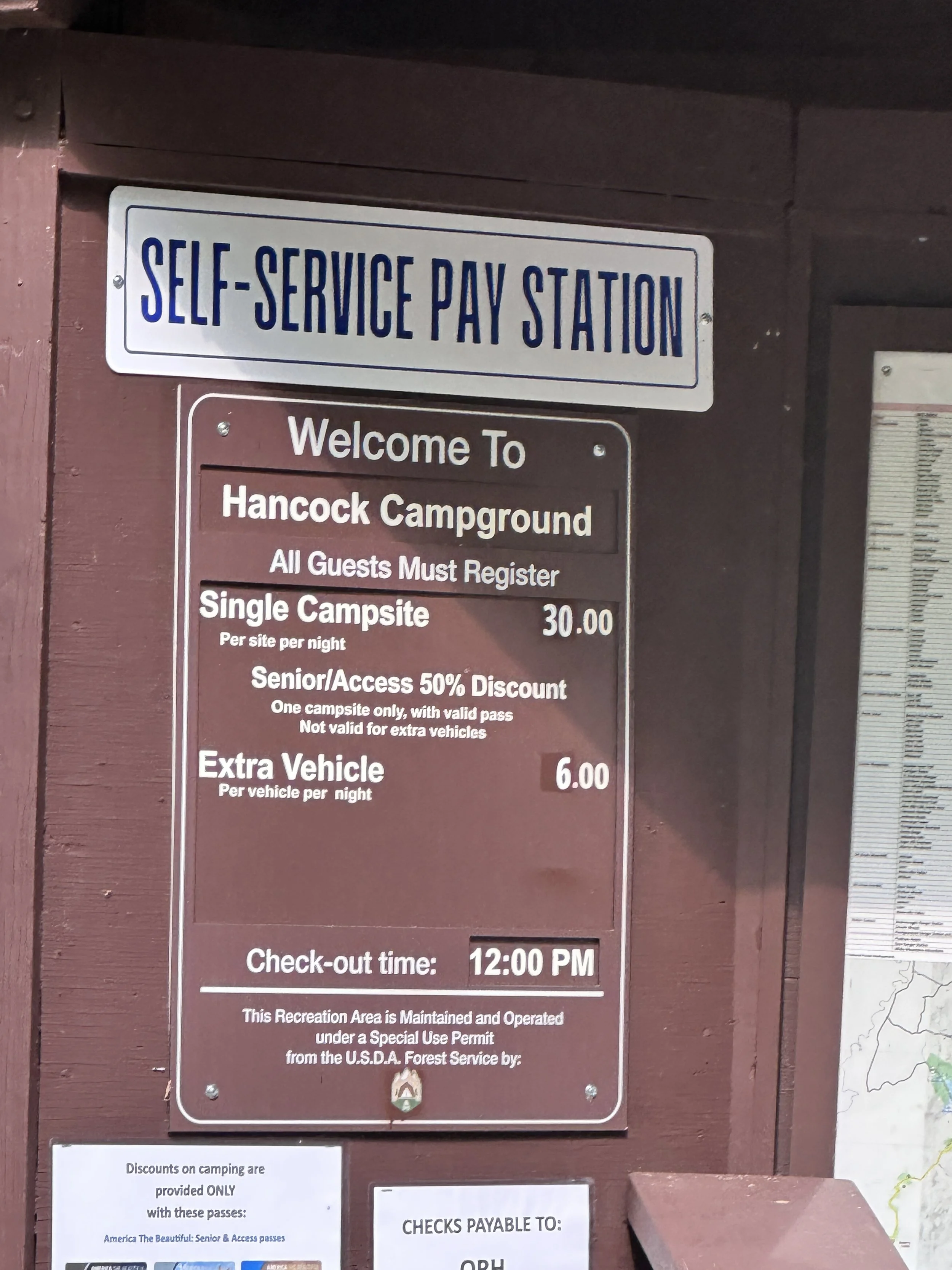
HANCOCK CAMPGROUND
133 Hancock Campground Lincoln, NH 03251
$15/night w/ my National Parks Access Pass; rates may vary.
The White Mountains of New Hampshire is part of the US Department of Agriculture’s National Forests system. Filled with hiking trails to waterfalls and other scenic views, these forests are very popular for hikers. The Appalachian Trail passes through the White Mountains; this 160.9-mile section is known for being rugged, with steep ascents, dramatic peaks, and more miles above the treeline than any other state on the trail.
Because of its popularity, there are a large number of campgrounds located within. These include the Dolly Copp campground and picnic area, the Jigger Johnson Campground - I’m told this one has the area’s only quarter-operated showers - and the Big Rock Campground - this one has a big, big rock located within, quite the sight to behold.
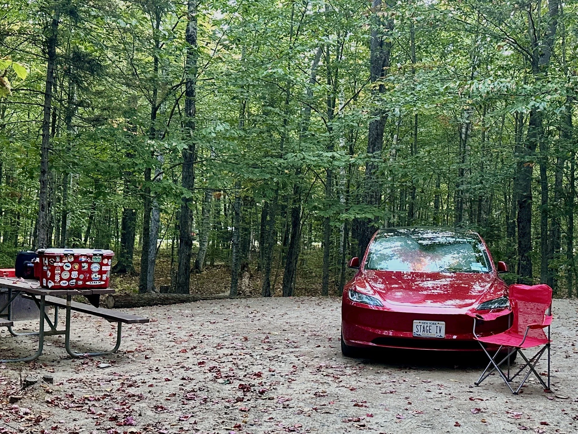
I chose Hancock Campground because it appears to be the largest - and with same-day reservations unavailable and a first-come-first-serve system in place, I figured I had a good shot at getting a site here. Also because it was the closest campground to the Lincoln, NH end of the Kancamagus, and my route home began in Lincoln. (It’s where the nearest Tesla supercharger is located).
From the Forest Service website:
“Located at the western end of the scenic Kancamagus Highway, this campground serves as an excellent place to start your White Mountain adventure. The nearby Lincoln Woods Visitor Center is the jumping off point for numerous hiking trails leading into the Pemigewasset Wilderness; the Kancamagus Highway is an extremely popular scenic byway with numerous hiking, picnic, and swimming spots; and the town of Lincoln offers many amenities. Hancock Campground has 56 wooded sites.”
Hancock was convenient because I was able to drive into town and grab a bite to eat for dinner - I’d arrived a bit too late to set up camp, and needed to head out the next morning. A short 10-minute drive put me within range of several restaurants. It also had sporadic cellular service with AT&T - many of the other campgrounds I visited had no cellular service, which means the Tesla GPS is limited.
As with any National Park campground that doesn’t offer same-day or week-of reservations, visitors simply drive into the campground and pick up a reservation ticket from the dropbox/paystation, then drive around the loops until they find a campsite that is not already marked with a ticket. Complete the receipt ticket and clip it to your chosen site, then drop off the reservation ticket and payment - cash or check - in the dropbox. Boom, done.
Hancock had several restroom facilities scattered throughout, as well as water spigots and trash, but no electric or showers. For me, this is perfect for an overnight, especially when I’m on my way home. Earlier in the trip, or a longer stay, would require shower options for me.
I prefer to camp with an electric hookup (RV site, 50 amp), but with hotels in Lincoln priced at somewhere between $100 and $300, with more typical/mid‑range being around $225‑$250, my $15/night with the National Parks Access Pass - they also offer the discount for the senior pass, but not for any other passes - plus a supercharger session cost of around $25 still adds up to $40, much less than the cheapest hotel in the area.


MOUNT WASHINGTON SCENIC ROAD
1 Mt Washington Auto Rd. Gorham, NH 03581
$36/person; open 8 a.m. - 5 p.m., seasonal.
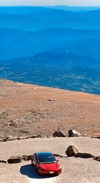
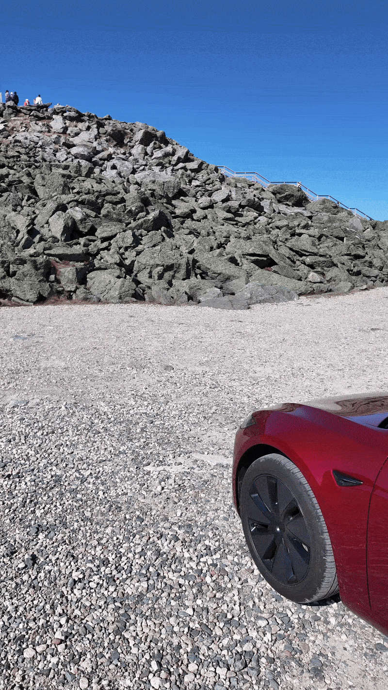
The Mount Washington Auto Road - sometimes referred to as the Mount Washington Scenic Road - is one of the most iconic drives in the northeastern United States. It’s a 7.6-mile privately-owned toll road - $36 per person! - featuring sweeping views of the White Mountains, the Presidential Range, and - on clear days - views up to 100 miles away, including Maine, Vermont, and even Canada and the Atlantic Ocean.
The Mount Washington Auto Road starts in Gorham, NH at Pinkham Notch. It features 7.6 miles with an elevation gain from ~1,500 ft to 6,145 ft - some sections have grades of over 12%. The road is mostly paved with a short unpaved section near the summit. There are no guardrails - caution signs recommend anyone with a fear of heights take the guided tour instead of the driving themselves.
The summit is 6,288 ft, accessible by stairs from the parking lot or drivable to vehicles with a handicapped placard.


I will say that I had second thoughts almost from the beginning of my journey, the moment I smelled burning brakes from a vehicle heading down. I’d previously done the Tail of the Dragon - famous for its 318 curves in just 11 miles - and had little trouble staying inside the lines. This, I thought, would be a piece of cake. I wasn’t prepared for the lack of guardrails, or the views that are literally straight down, and wondered what would happen if another vehicle with insufficient brakes couldn’t stop. It might not be my skills that would the test, here…
Still, realizing that hundreds of people do this drive every day gave me the courage to keep going.

One of the reasons I was so interested in doing the Mount Washington Auto Road was accounts in the EV Road Trippers Facebook group I belong to of watching range increase on the way down the mountain.
As you drive downhill, gravity helps move the car - you don’t need to use much throttle. (This is the same for ICE cars, i.e. those with Internal Combustion Engines, as well.) The difference is, when you slow down or coast in an EV, it uses the motors to convert that kinetic energy back into electricity, storing it in the battery in a process called regenerative braking. Instead of losing energy as heat (like in gas-powered cars), EVs reclaim some of it. The motor essentially works in reverse, slowing the car while sending energy back into the battery.
The Mount Washington Auto Road is approximately 7.6 miles long from the base to the summit. I expected to use at least twice that in range - the average grade is 11.6%, with some sections even steeper. Instead, I found that the car clocked a whopping 47 miles used on the way up. That means that for each mile I actually drove, the vehicle used approximately 6.18 miles! (On my trip to Shenandoah National Park, I found that heading up a mountain, in the cold, with windshield wipers and headlights on, used approximately 1.75 miles for every mile driven, and I’d used that as a benchmark ever since).
The good news was that what goes up must come down - so I ultimately reclaimed 25 miles on the descent back down, for a total range loss of 22 miles. That means that I actually used approximately 1.45 miles range loss for each mile driven. Not bad at all - that descent really saved me!
Plus, it was cool to see…