

Shenandoah National Park & Skyline Drive

THANK YOU FOR YOUR SUPPORT…
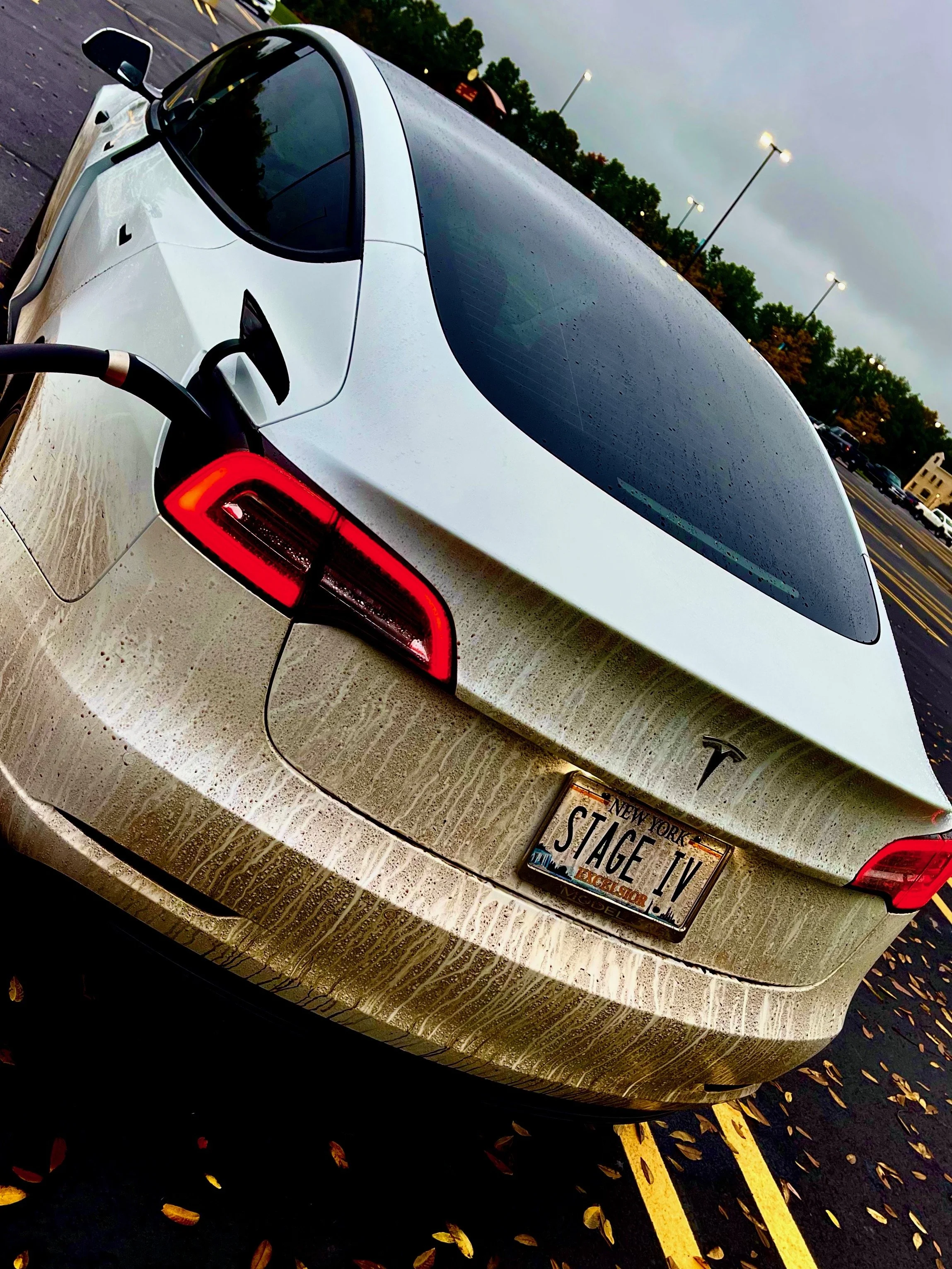
This journey wouldn’t have been possible without the support of family and friends I refer to as Team Stage IV Tour. My eternal gratitude goes out to them.


SKYLINE DRIVE DAY I
SKYLINE DRIVE PART I
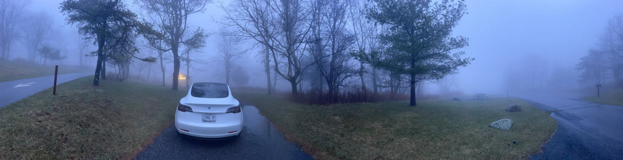
A steady drizzle and fog rolling in from all directions - not the way I was hoping to start my week-or-so on the Blue Ridge Parkway.
A fellow Tesla roadtripper from one of the Facebook groups had warned me about “foggy days in the mountains.” When the clouds rolled in, he said, you couldn’t see much of anything. “Split pea soup,” he called it. I decided I was in no rush to hit the gates, so I instead headed back into Front Royal for an early lunch before heading into Shenandoah - maybe the fog would lift over a good meal.
Front Royal is a charming little town, and it’s clear from the bright colors on so many of the buildings and the brightly-colored decor in the town square that it tries to be more than simply the northern entrance to Shenandoah National Park and Skyline Drive. I got a real sense of community here, despite the fact there were few people out and about on such a damp day - and also got a sense that this was a town that welcomes tourists, with its trolley taking people around town and a ‘welcome center’ and free parking adjacent downtown.
The theme of Front Royal - and Virginia, really - appears to be ‘LOVE’. “Virginia is for lovers,” they say. I found two LOVE signs around town, and I’m told that there are even more here and many others across the state.
Ever the tourist, I was sure to snap a picture of both of the ones I came across.


You’ll see from the photos that it was dreary and wet the morning I visited - but look at those bright colors! The buildings painted in various shades of blue, and the little ice cream stand in pink… you couldn’t help but feel cheery, no matter the weather, I felt.

ELEMENT
317 E. Main Street Front Royal, VA 22630
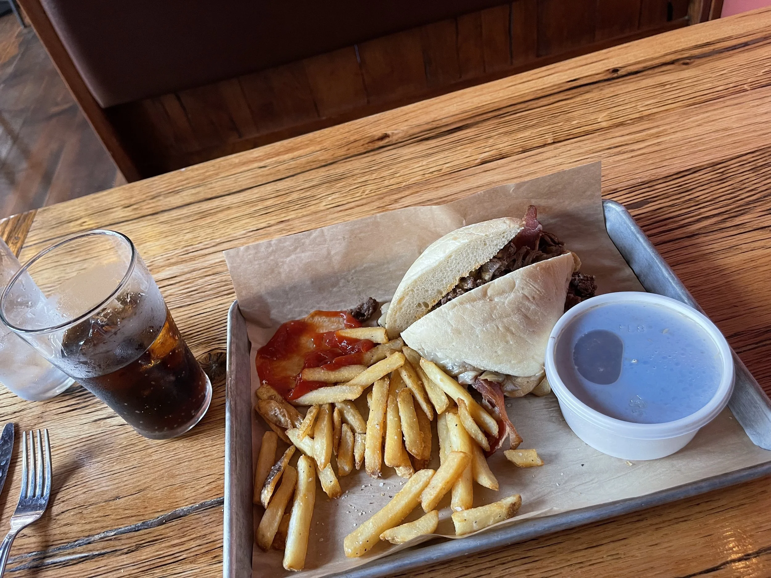
Tyson not available to give his culinary tips the night before, I decided to search out restaurants downtown - Front Royal is just minutes from the entrance to Shenandoah National Park, it turned out, and so not too far out of the way.
I’d charged the car up to about 90% at the campground, and figured I had plenty of juice for the day and part of the next - more on that later - but I didn’t want to go too far out of the way, since I hadn’t been able to get a full charge. Downtown Front Royal is just a few minutes from the Shenandoah National Park gates, so it seemed like the perfect place to look. I dialed up Yelp on the iPhone and put in “burger” - a burger joint seemed like the mood for the day, since I didn’t want something ridiculously expensive on the first real day of the trip.
My first choice would have been PaveMint. It just seemed like the kind of vibe that I was feeling that morning. Plus, a photo of one of their burgers - the Bacon Onion Jam - comes up if you search ‘burger’ + Front Royal. Yelp claimed that they were open. Alas, whatever former gas station they contracted into a restaurant is again under construction. Nobody explained just what they’re making when I walked in and found the floor slippery with grease and all of the tables with chairs up on top of them - they just sent me away with a “we’re closed.” But I gather something new is coming…
Next up: Two Fat Butchers. That sounded comical, at least - Yelp said they were open, but were they open open? I called, and the woman who answered the phone told me that they were open - and that they’re actually two fat butchers. “We’re not a restaurant, sweetie,” she said with a tone that said she probably gets a lot of Yelp calls - since they do appear under the ‘restaurant’ listings. “We sell cuts of meat.”
That was zero for two for Yelp so far…
Next up: the ‘cavern burger’ at Spelunkers. That sounded good. I drove around the block, pulled in, and was immediately turned off. They had a drive-thru. Might be a delicious burger, but it seemed kind of ‘fast food’ to me. I felt like burning an hour or so, hoping some of this fog would burn off, so I was hoping more for a sit-down-no-rush type of place. Back to Yelp…
Finally: Element.
I called, and they assured me that they were open, and that they did have a dining room. Yes! I put the address from Yelp in the navigator and it took me right around the block… to a building with a huge FRANKS sign on the front. Good lord.. would I ever find a place to eat? I parked at the ‘Welcome Center’ and got out, prepared to go in and ask them to recommend somewhere - anywhere - for lunch. I was burning off range just driving around this town.
Then, as I turned to go in, the window below the FRANKS sign caught my eye: Element.
Apparently Frank owns the apartments above the restaurant, I’d later learn.
Element was a little fancier than I was prepared for. I was definitely the only person in the joint who was dressed for a road trip. On one side of me a salesman of some type was selling a point-of-sale system to a bunch of gentlemen, and all were dressed to the nines. On the other side, a table full of women were celebrating a birthday - they were not to make a big deal about it, the birthday girl told them over and over! - and they, too, were dressed very nicely. This seemed to be a fancy place, so I was relieved when the menu they brought me had the same prices as the menu I’d seen on Yelp. I ordered a tomato crap dill bisque and the Gazebo - named for the one just out in front of the restaurant, I’m sure. Both were delicious, and my server was great.
I don’t usually do dessert, but the women next to me must have listed the entire dessert menu a dozen times - the Birthday Gal hadn’t allowed anyone to bake her a cake, but they’d be damned if she wasn’t getting something! and they were all. splitting. the. cost. They had creme brûlée. My friend Erin - Mermo - and I had a little game with creme brûlée - it’s always been my favorite dessert, and not enough restaurants near us offer it. If she noticed it on the menu she’d always order two without asking - one for each of us - and once we may have cajoled her fiancé, who hates sweets and doesn’t eat dessert, to order one for us to split when we each decided originally to go healthier.
Not that I would ever need an excuse to order creme brûlée, but if I did my trip dedication to Mermo would be it.


I was impressed when the waitress, clearly momentarily flustered by the request from the birthday table to have three separate checks and the fourth meal split evenly between the other three, pledged to figure it out. Nice place, nice people...
If you’re going to fuel up before your Shenandoah National Park trip, 10/10 recommend Element.

I finally headed into Shenandoah National Park, and onto Skyline Drive, in the early afternoon.
After stopping to snap a photo at the welcome sign, I headed for the gate. While the Blue Ridge Parkway is free - it’s a regular road all the way through from Virginia to North Carolina - Skyline Drive is part of a national park, and there is a cost for admission. Cars will pay $30.
Fortunately for me, my receiving social security disability insurance entitles me to a National Parks Access Pass at no cost. That makes entry to national parks free. I’d previously utilized this when visiting North Carolina on Stage I of the road trip, at the Wright Brothers National Memorial in the Outer Banks. (It also qualifies pass holders to half-price rates when camping in national parks). So far I’d saved $40 on entrance fees and $72 on camping, way more than the $80 annual fee this pass costs the general public. (Seniors 62 and over can get the same pass for a lifetime $80, and active duty military, veterans, and Gold Star families qualify for the pass free of charge - click here to view details). Definitely recommend…
This trip was planned in the early, early days of the Blue Ridge Parkway re-opening to tourism.
Snow and ice forces its closure across many parts during the winter months. Gates that can be opened or closed by parkway workers are sometimes the only way to know if you’ll be able to keep going or not. Online guides and message boards had suggested that early April would be an inopportune time to make the trip, as many things - welcome centers, attractions, and the like - would not be open for the season yet. This turned out to be true almost immediately, as the first welcome center I came to six miles in was closed.
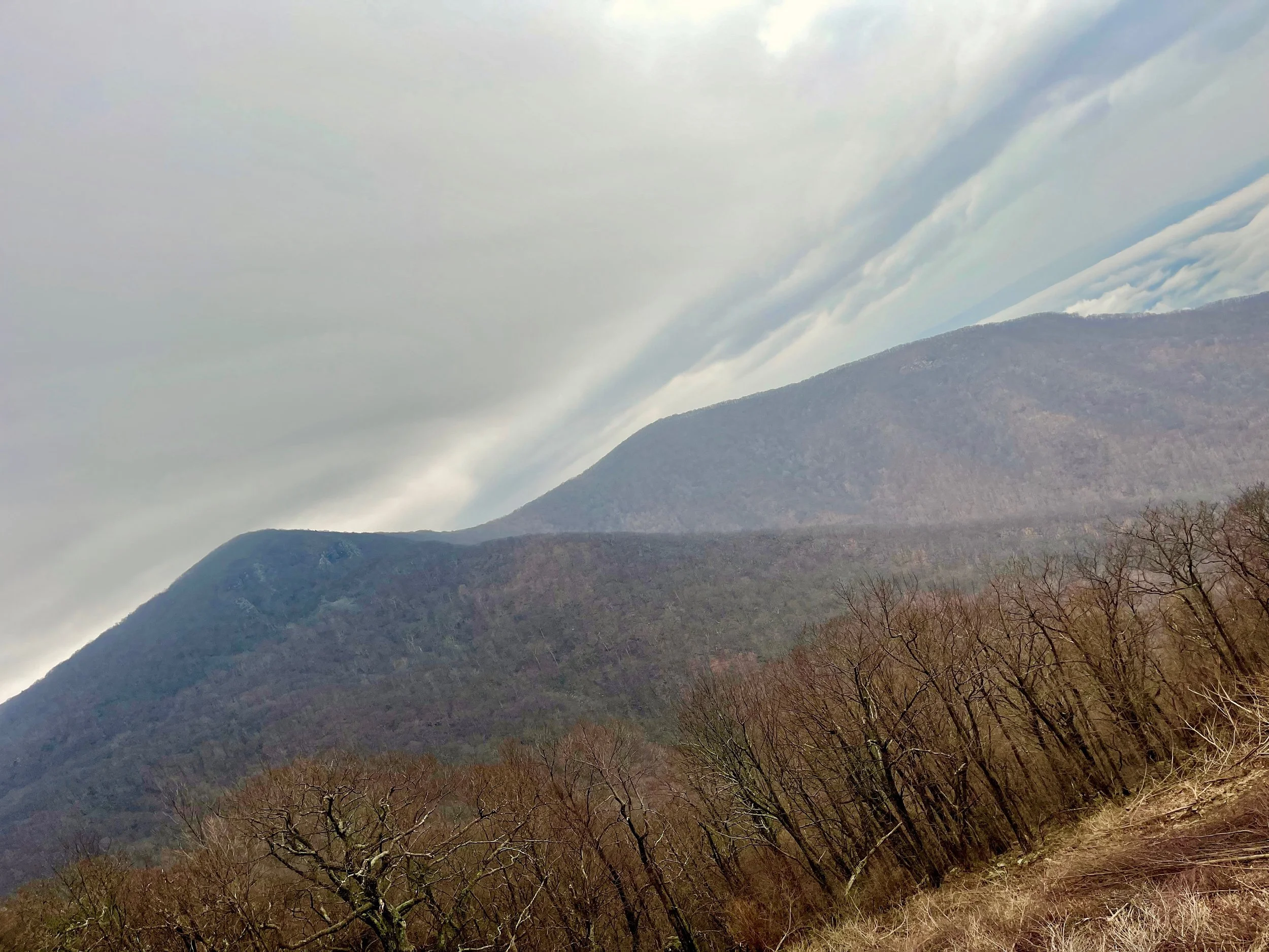
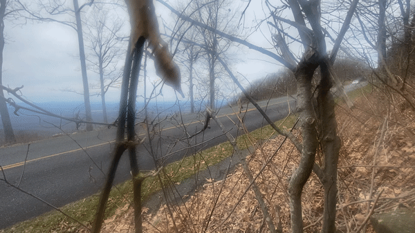
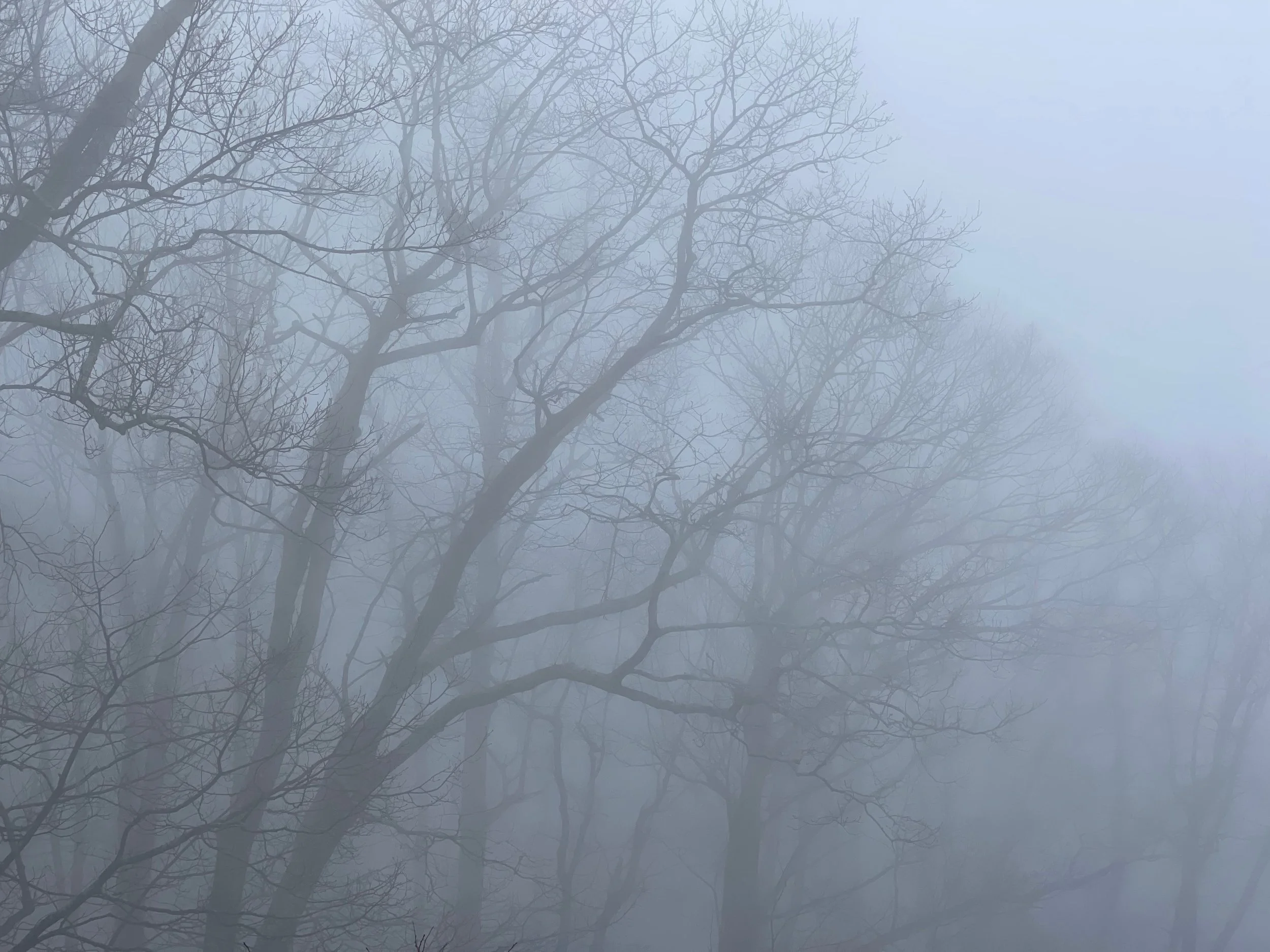
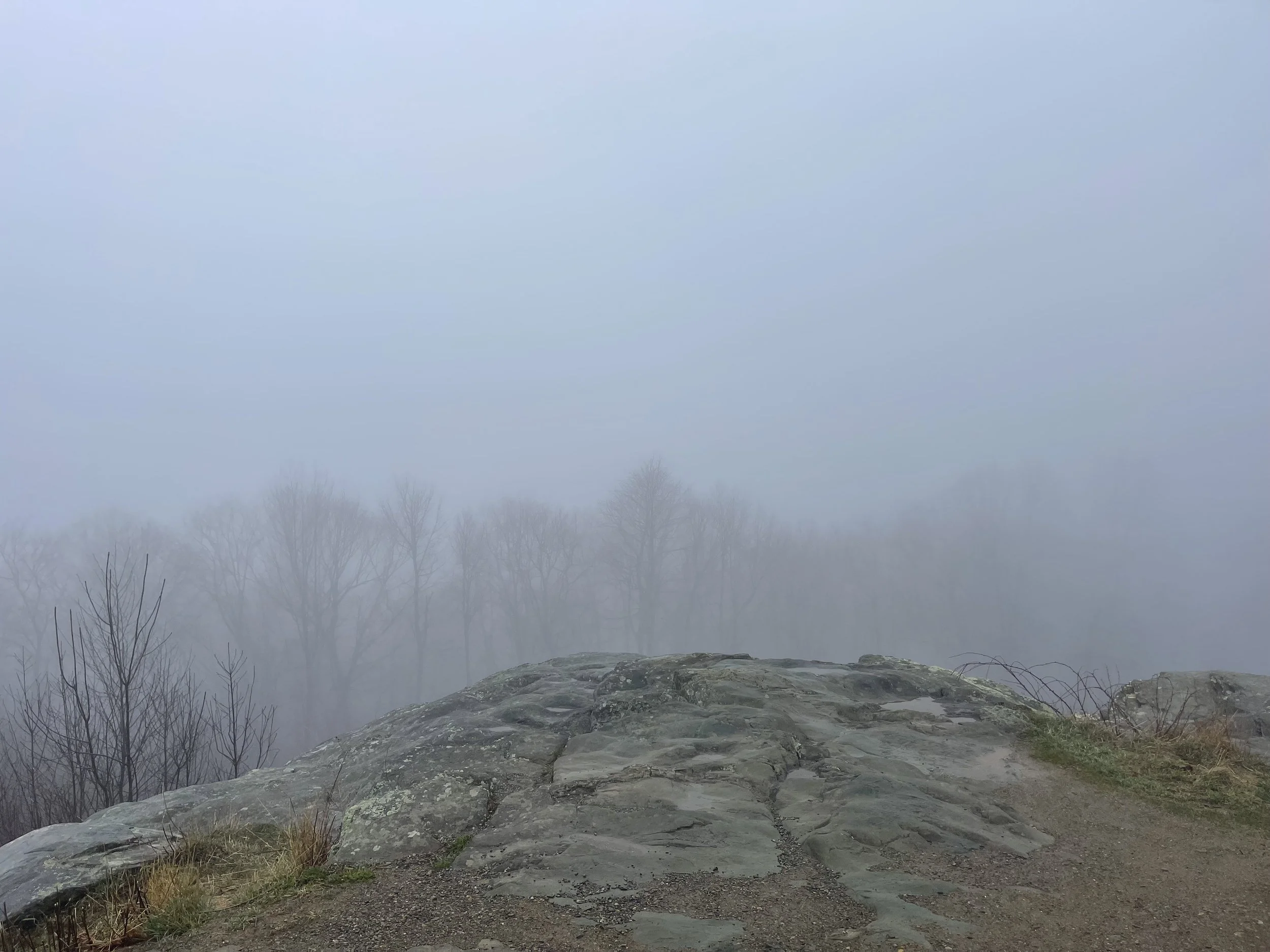
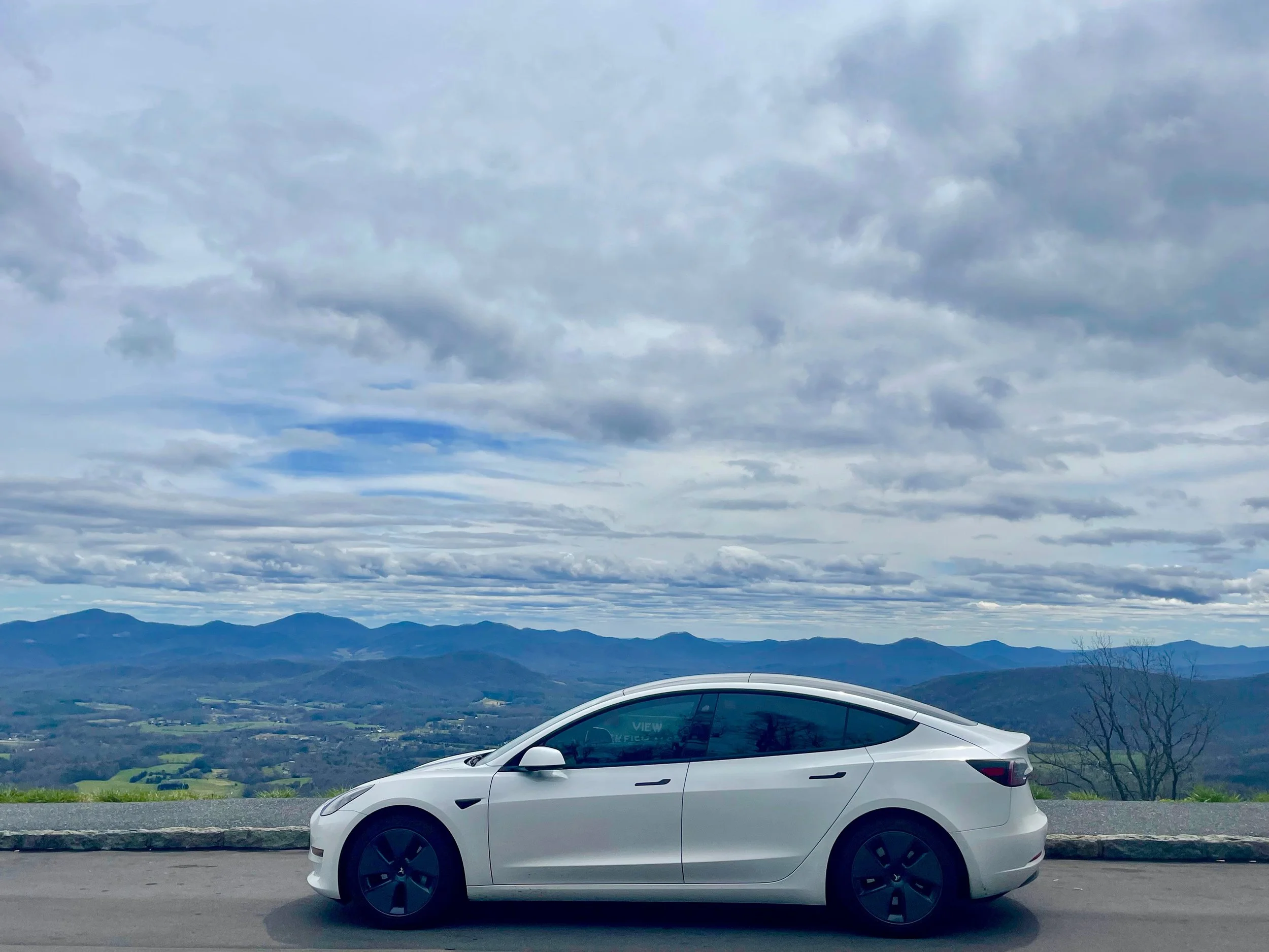
As you’ll note from the photos, the fog had not burned off - not entirely, anyway. I drove slowly, even below the posted speed limit, headlights on and windshield wipers set to ‘auto.’ Wish, wash. Wish, wash. It was cold, and I started off by turning on the seat heaters, and eventually turned the heat on a bit to keep the window de-fogged. The forecast was calling for sun later in the week, and I was definitely looking forward to that…
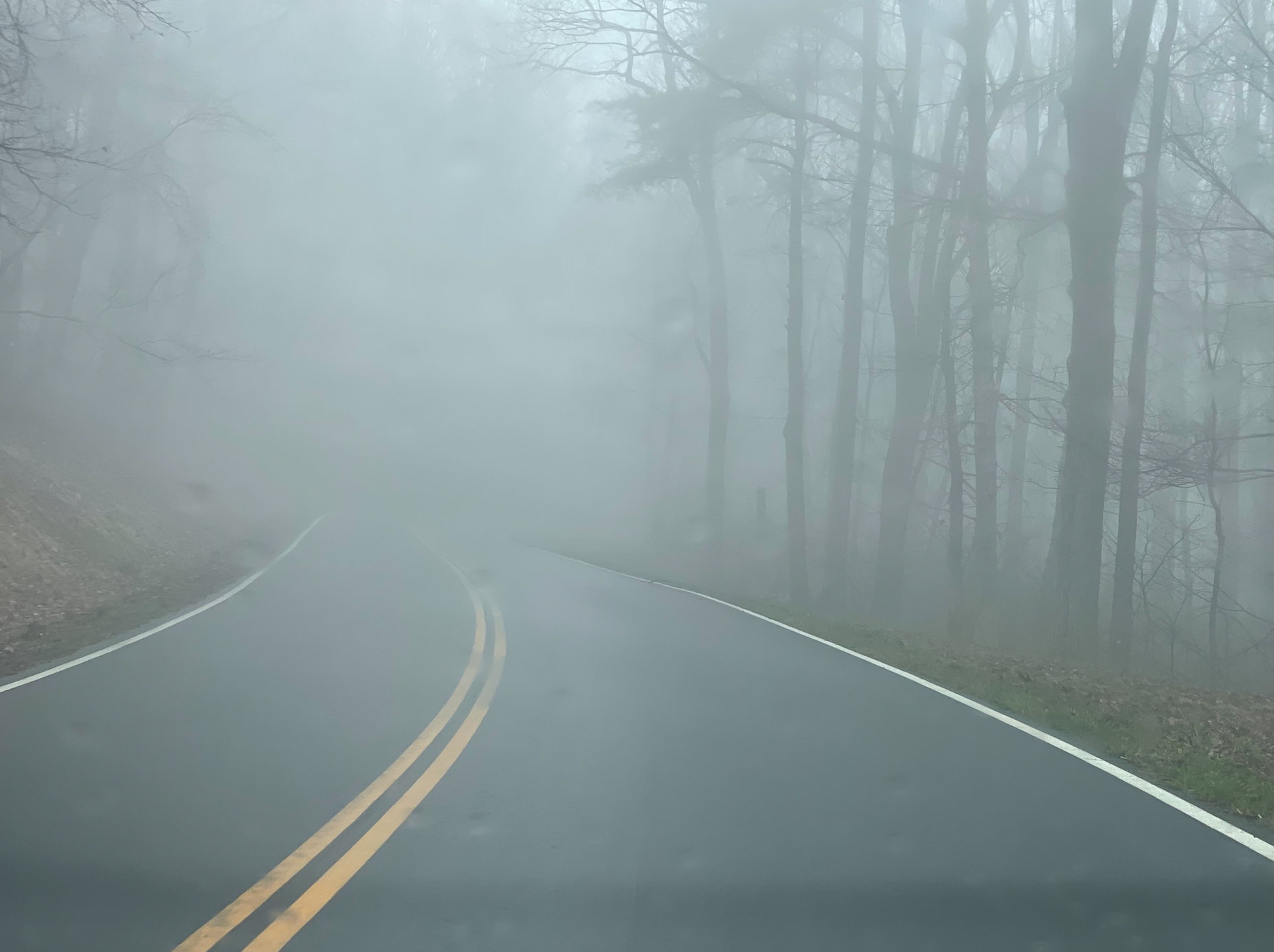


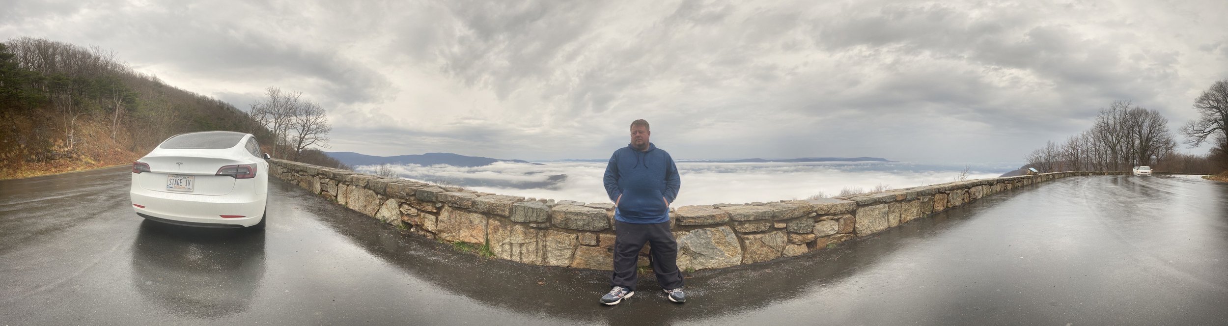
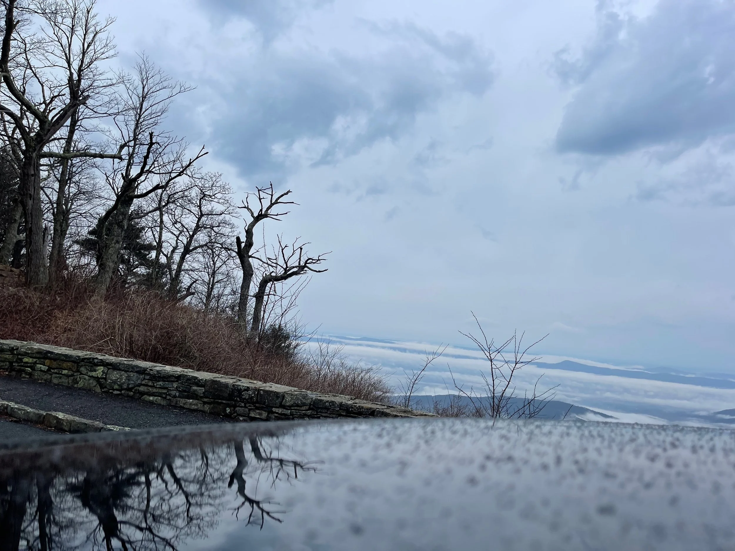
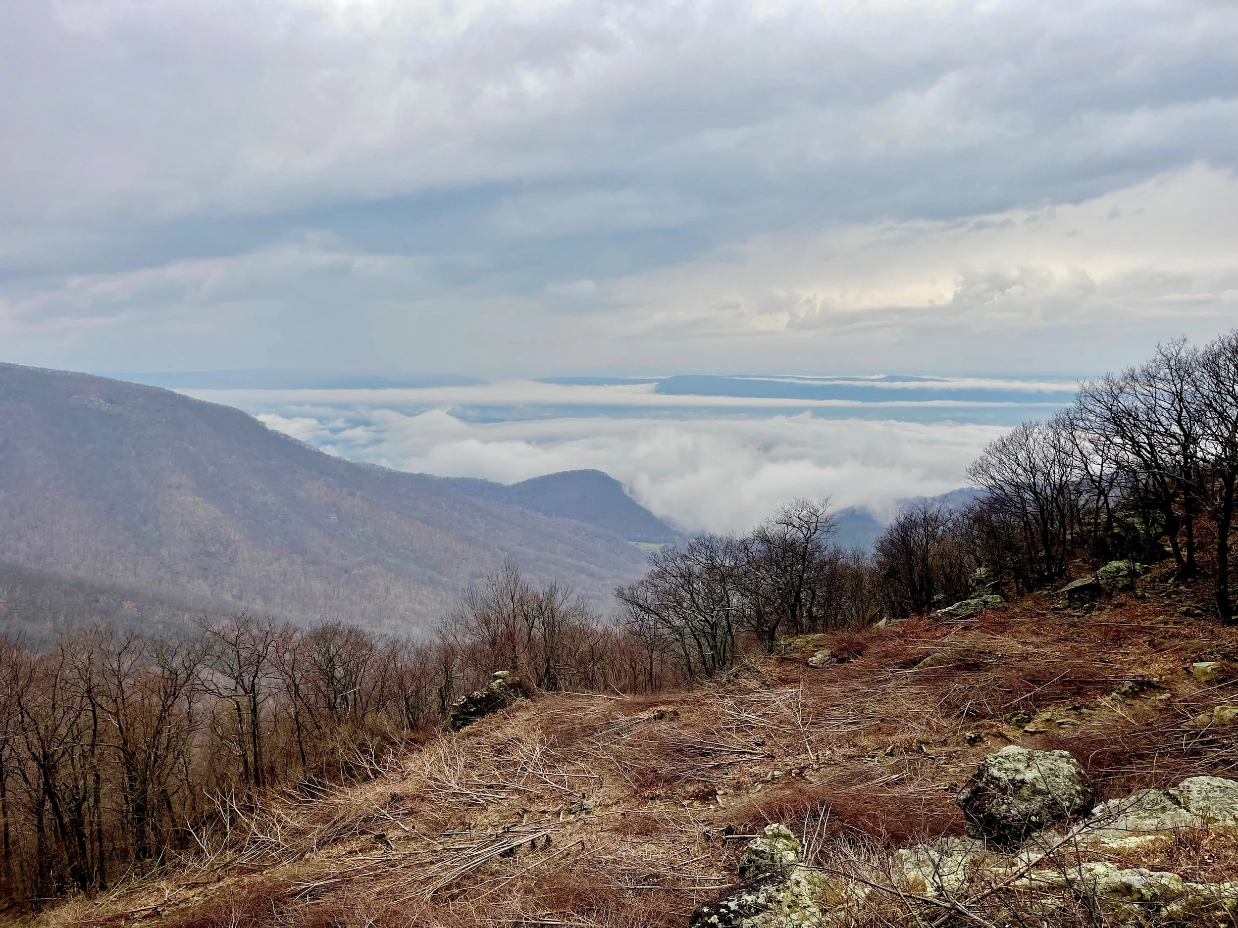
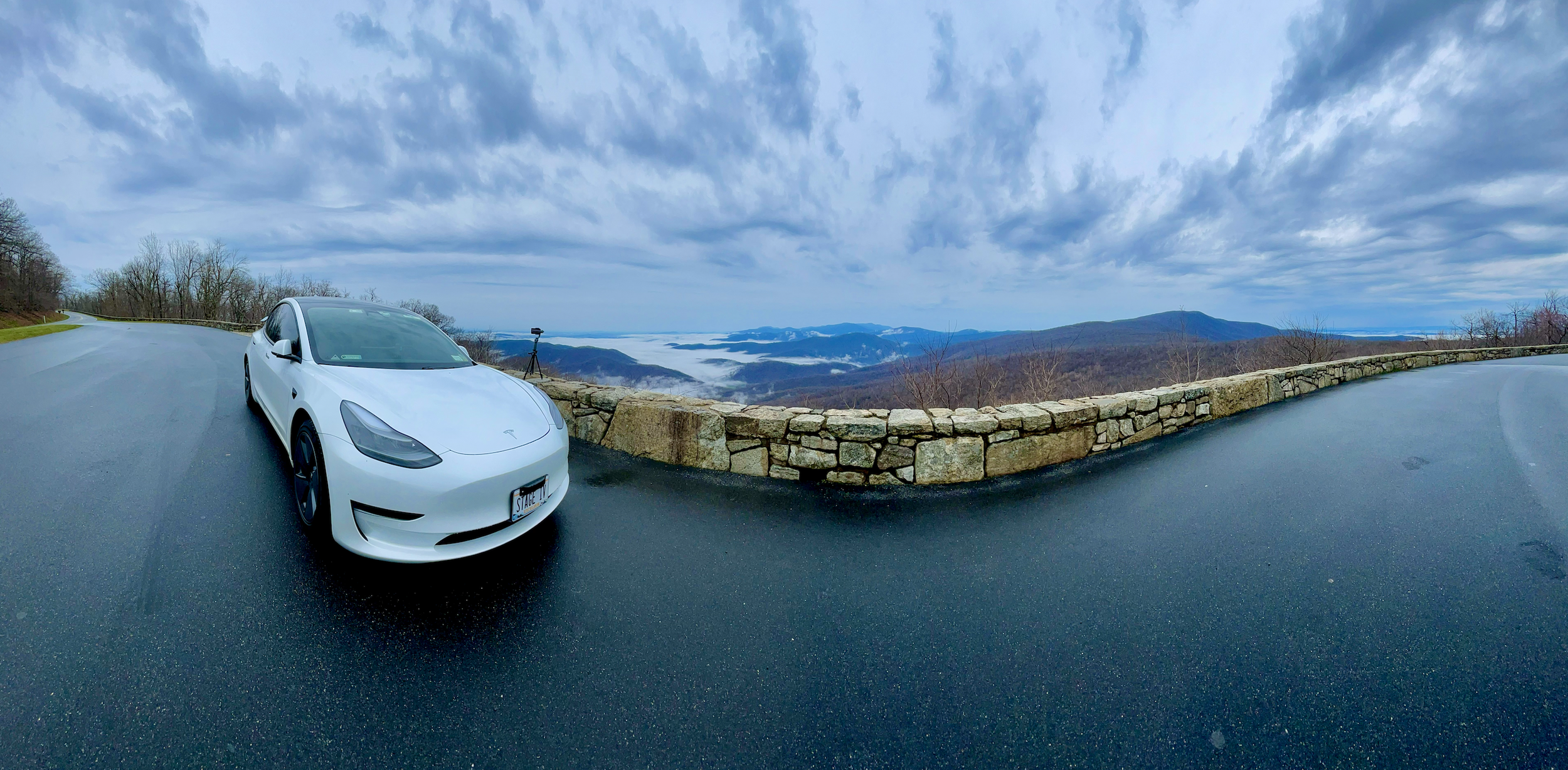
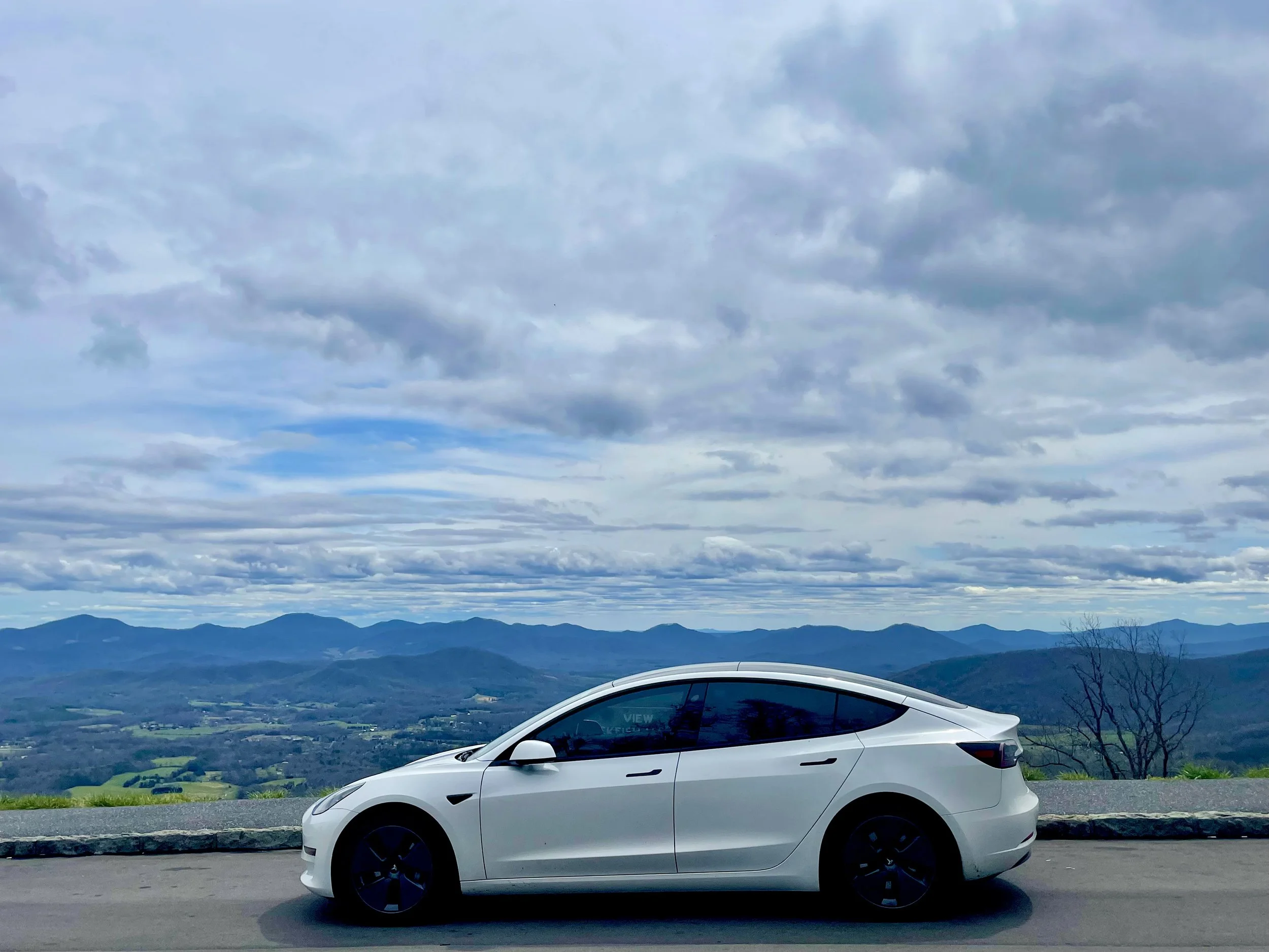
The first overlook I came to was an ‘unofficial’ one - a spot at the side of the road where people simply pulled over, parked, got out, and snapped photos. It would turn out, later, that we were simply over-eager… there would be dozens of better places to take pictures along Skyline Drive. This was just the first place, and it sucked in all of the newbies, like me, who didn’t quite understand what Skyline Drive was all about, yet. I, of course, pulled over and took some photos here.
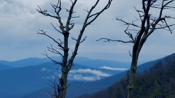
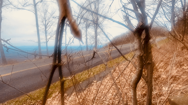
You’ll notice that in some places the clouds appear to be below Skyline Drive. It looks far more amazing in person than it does in photos - even the animated GIF here. I’m told that the weather largely determines the view you’ll be treated to on Skyline Drive - some days will be crystal clear, offering views for miles, while others will be so foggy motorists will have trouble traversing the trails. Photographers often quip that “bad weather is good” on Skyline, because it affords some beautiful photographic opportunities. Indeed, I’d be treated to sunny days on the Blue Ridge Parkway later in the trip, and I have to say I am glad I got to start off with this.


The first overlook I came to gave me a glimpse of some of the measures the parks take to deter bears, with their trash containers with heavy doors bears struggle to open, and small openings for recycling. These types of containers would be placed all along the route in various places.
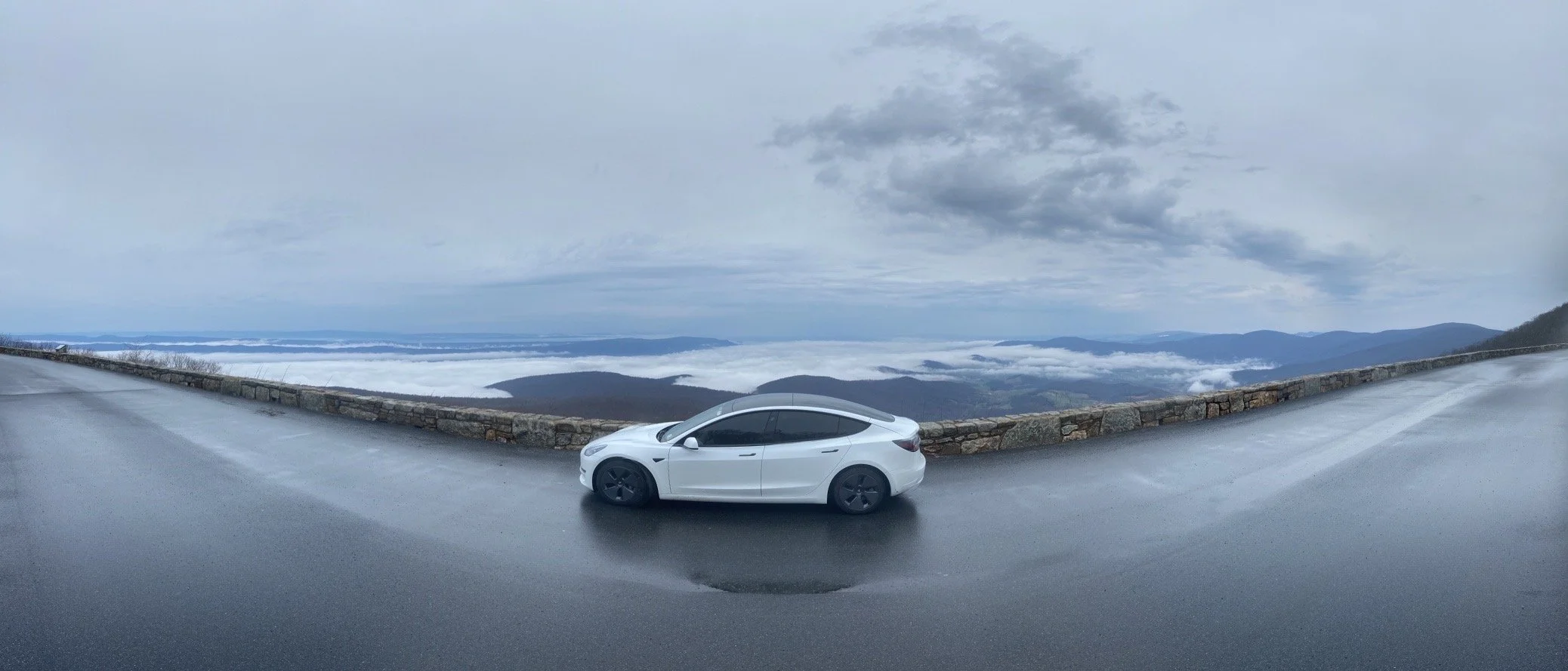
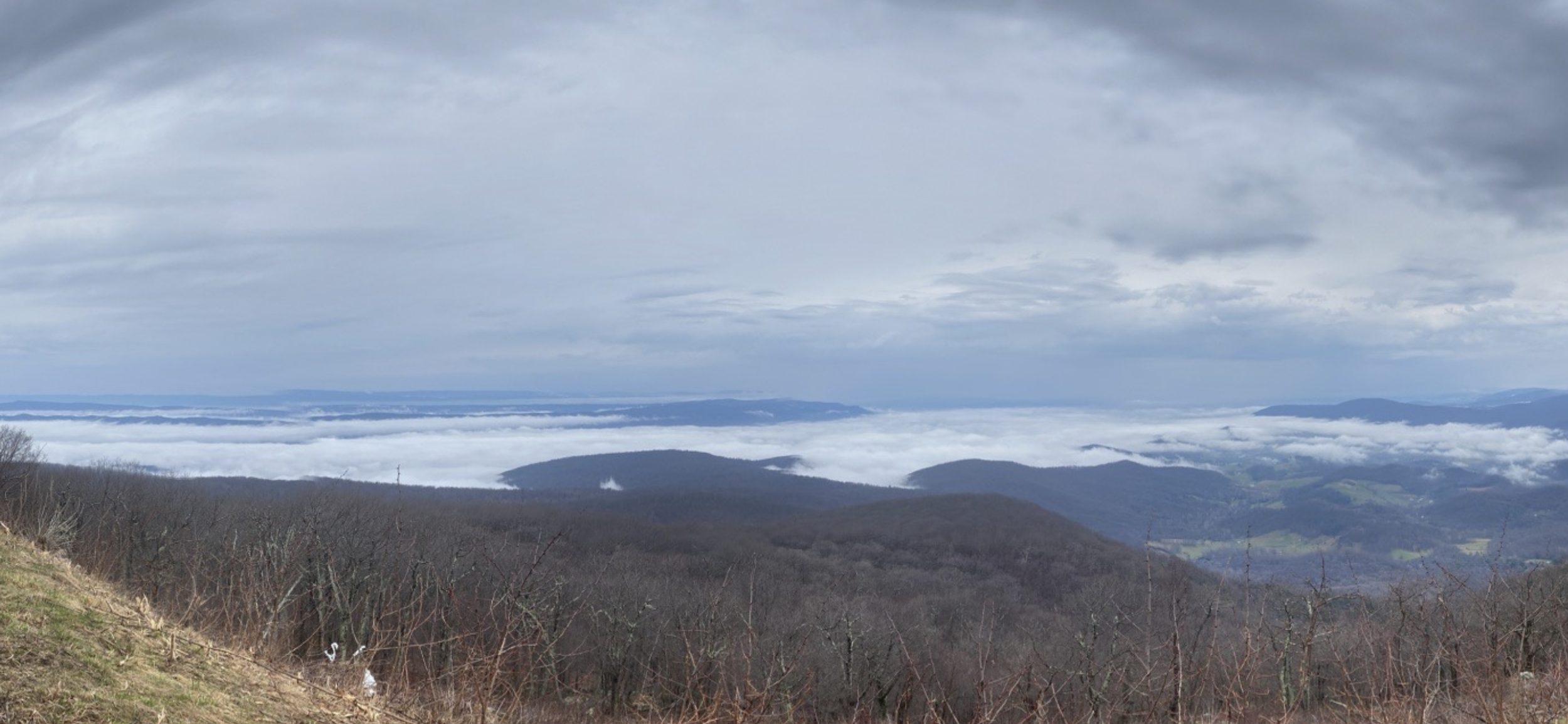
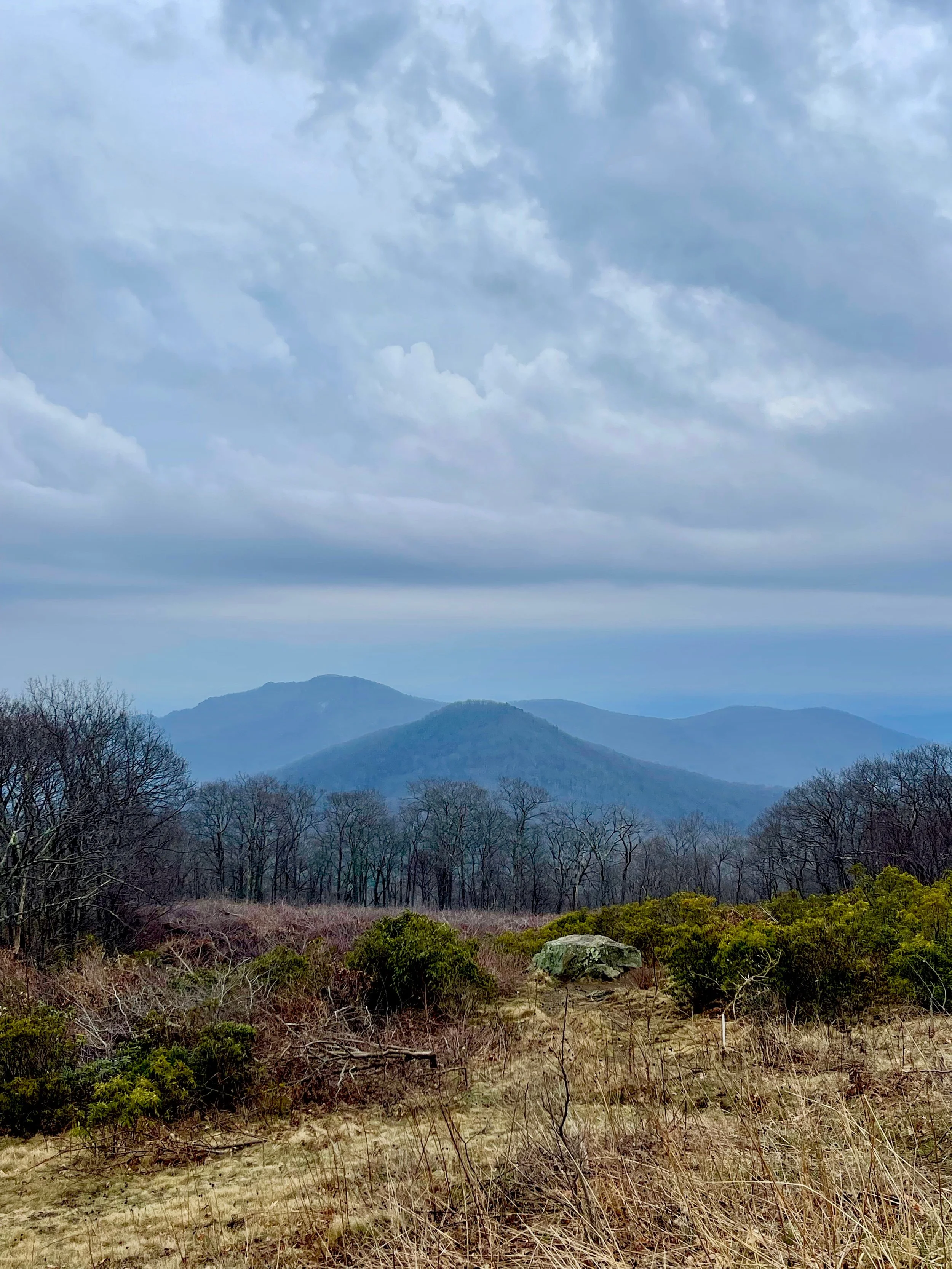
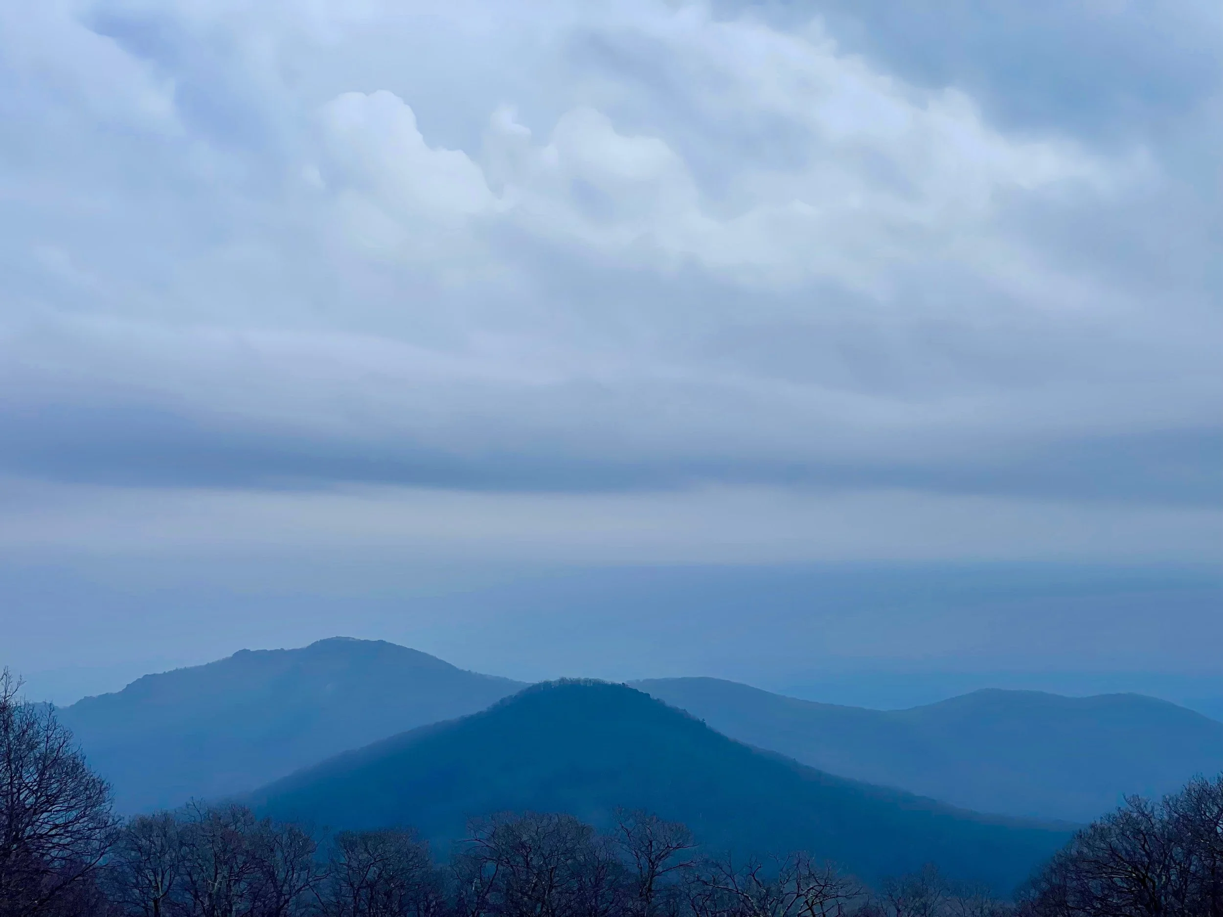
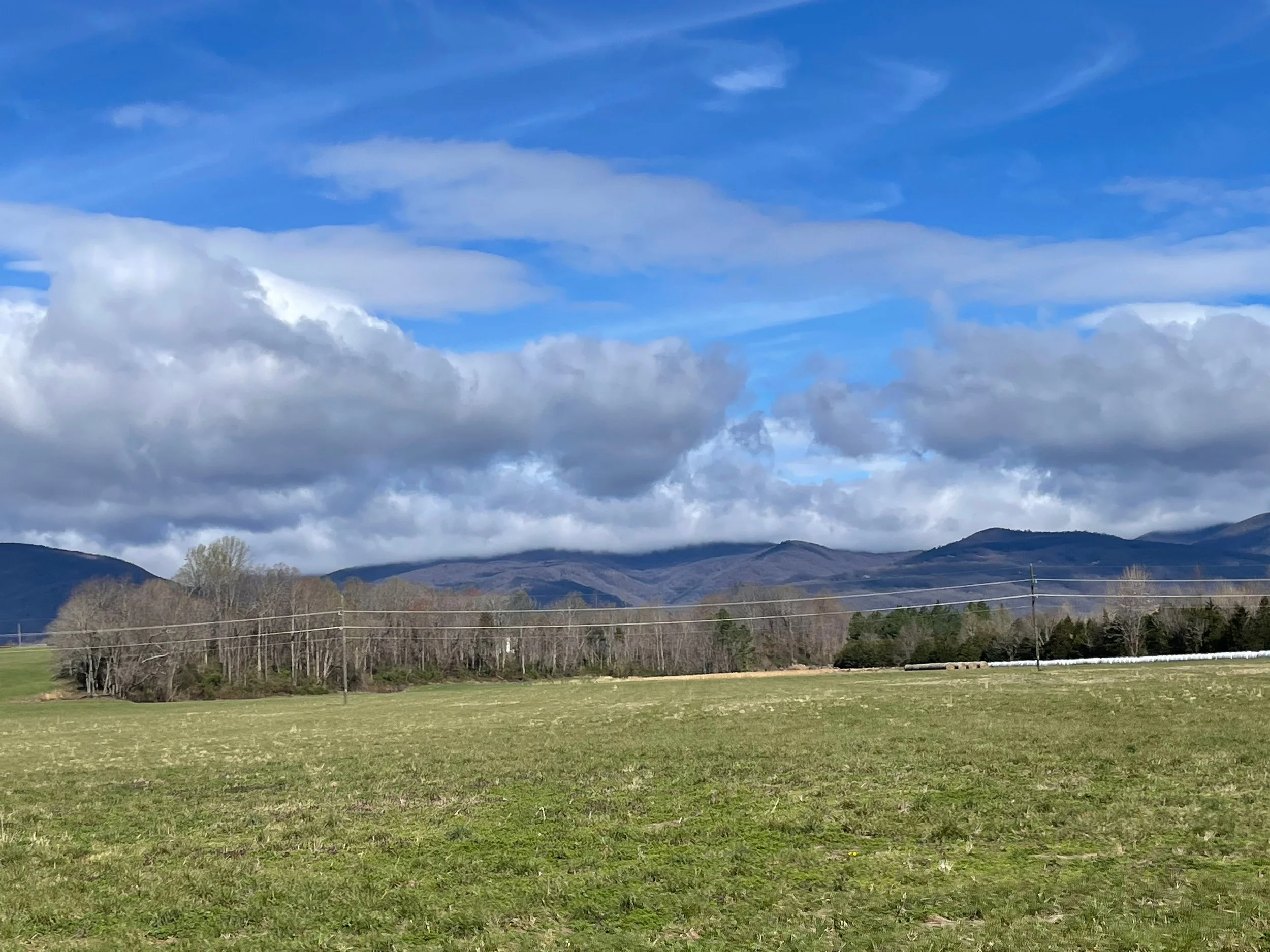
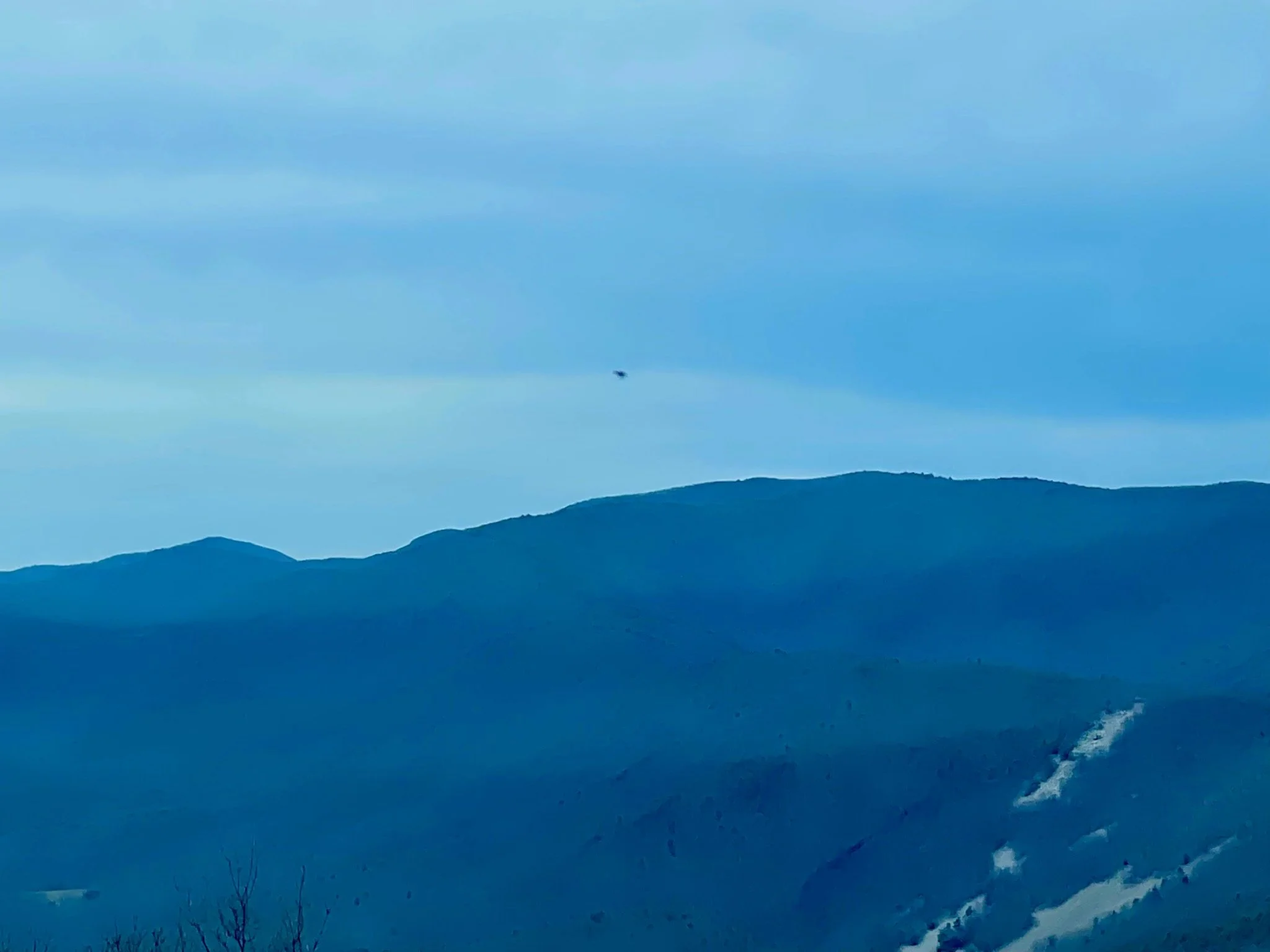
Wonder why these mountains are called the Blue Ridge Mountains? It becomes clear almost immediately - everything from the sky to the mountains themselves have a blue hue to them. It’s beautiful, really. Even on such a grey day, there was blue everywhere.


Jewell Hollow
Skyline Drive was largely constructed in the 1930s.
Something about that really romanticized this trip for me.
I pictured relatives as far back as my great grandparents driving through Skyline Drive on road trips in the 30s, 40s, and 50s, before airplane travel changed how Americans move from region to region.
I knew my own grandparents had visited here. I believed that my parents had, too. Skyline Drive has been a destination drive for many years. Its on the National Register of Historic Places, and is a National Scenic Byway.
I imagine it’s on many a bucket list.
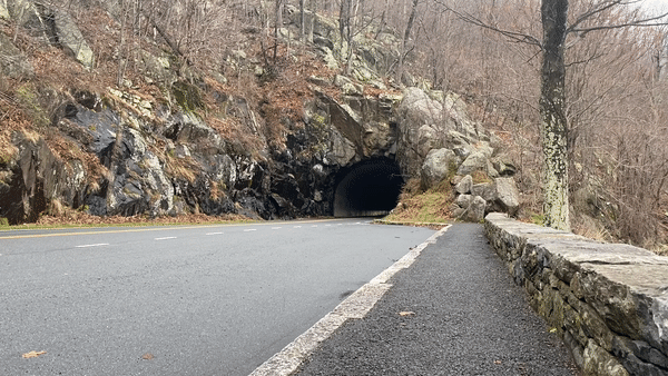
I pictured the national park road crews of the past doing the hard, heavy work building these roads through the mountains - and was very much looking forward to seeing Mary’s Rock Tunnel, bored through the rock ninety years ago.
The tunnel, 670 feet long, was bored through the solid granite of Marys Rock in 1932. Although justified as avoiding the necessity of creating an expensive cut on the existing slope and filling the down slope areas, thus creating a massive man-made visual feature, it has been suggested that the tunnel was built as a challenge to Bureau of Public Roads and National Park Service landscape architects. The tunnel was partially lined with concrete in 1958 to alleviate the formation of icicles in winter and water seepage in summer—a partially successful effort. [Source]
The road was practically empty today, so I decided to set up my tripod and capture some footage of the Tesla driving back and forth through the tunnel. I was very pleased to see how it came out. And even more pleased to see my tripod and iPhone weren’t swiped while I was driving back and forth through the tunnel.
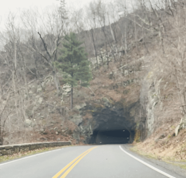
A view of inside the tunnel, as well…
I’d invested in a new tripod for this trip, and I was having fun playing with it for some creative photography and videography angles. I’ve often wondered how the solo road trip/vanlife bloggers I see in researching these trips get some of the shots that they get… the answer is GoPro cameras, tripods, mounts, and drones. I’m starting off with a tight budget, but I’ve got an extra iPhone and, now, a tripod… let’s see what we can do with them on this trip…
RANGE ANXIETY?
The campground I planned to spend my first night at had no electric hookups - none of the campgrounds on Skyline Drive feature electricity. Still, at only 51 miles in, I’d assumed I’d have plenty of range left. Plus, Big Meadows is located very near to both Skyland and Byrd Visitor Center, both of which showed EV charging options - a level 2 charger at Byrd, and a Tesla destination charger at Skyland that I’d been told was open to the public.
Problem: open to the ‘public’ means when Skyland is open to the public. It wouldn’t open to the public for another week.
Problem #2: the charger at the visitor center would be determined to be broken, and a parts backup would render it nonworking for an indeterminate amount of time - something that would only be updated toward the end of the planning stages of this trip.
Problem #3: my Tesla Model 3 SR+’s range would be drastically reduced by the conditions this day: cold temperatures, intermittent rain, thickening fog, and a mostly-uphill climb meant that for every 1.769 miles my car registered that I’d traveled, I’d actually traveled just one mile.
By the time I got to mile marker 51.2 my car believed I’d traveled more than 100 miles.
I wasn’t sure if I’d even make it to the next charger.
If you know anything about Tesla vehicles you probably know that letting them get to zero - i.e. die - is said to be bad for the car. Components can be damaged - and getting them started again typically involves a tow on a flatbed - using something called ‘tow mode’ that can’t be accessed when the car is dead - and jumping the starter battery. In some order that many people, including me, fail to grasp.
In other words: avoid avoid avoid zero at all costs.
Normally scoping out nearby chargers would be easy - simply check the navigation screen in the car for Tesla-branded chargers, or pull up the PlugShare app on your phone to see all chargers.
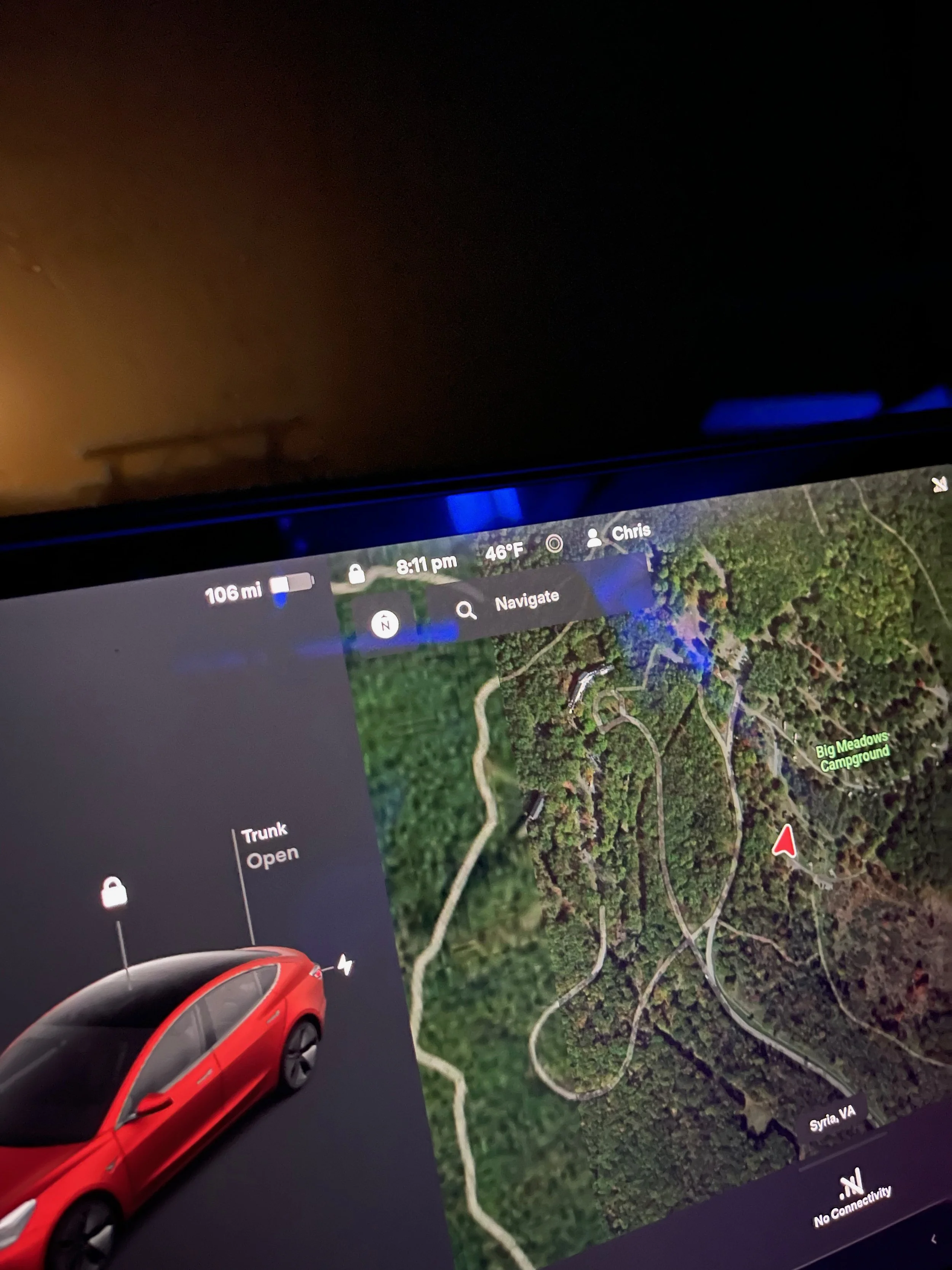
In this part of Shenandoah National Park - and in much of the Blue Ridge Mountains - phone service doesn’t exist. AT&T had no service for at least 30 minutes heading into the campground. A park employee would later tell me that no companies service that area. So I went to bed with 106 miles of estimated range, unsure of where the next charger was or how far it would be until I reached it.
Would it even work?
I’d awake the next morning to speak to the park ranger, who informed me that cellular service started a few miles down the road. I’d turned off the heat overnight for as long as I could, but the temperatures had dropped quite a bit - I felt bad for those camping in tents around me - so I eventually warmed things up around 3 a.m. I left with just under 70 miles of predicted range, and was down into the 50s when I drove back into cellular coverage. A few taps on the screen and I found that I was actually fairly close to a Tesla supercharger, and that there were several others in the region.
I’d worried for nothing.
While I’d hoped to remain on Skyline Drive for the entire two days of my trip, the charging situation - broken, waiting for parts, closed for the season, etc. - would make that impossible.
My verdict: Skyline Drive, with its limited EV charging infrastructure, isn’t ready for prime time when it comes to EV travel.
Hopefully it will get up to speed soon.
PLANNING A TRIP? MILE MARKER 0 TO MILE MARKER 57.6
The website SkylineDriveOverlooks.com has a list of suggestions for what they believe are the best overlooks. Among them are Range View Overlook - Mile 17.1 - which “offers a view down the length of the Blue Ridge to Stony Man Mountain. Looking south from 2,810 feet, the viewpoint stretches from Jenkins Mountains to Gimlet Ridge, Massanutten Mountain, and Alleghenies beyond.” Also: Hogback Overlook - Mile 20.8. “the longest in the park. You can’t take it in without getting out of your car or driving a bit to the other end of the vista. From here you can see the Shenandoah River below, the two ridges of Massanutten Mountain, and the Alleghenies. In the foreground is the valley of Overall Run, Matthews Arm, and Gimlet Ridge.” Another notable overlook is Spitler Knoll Overlook - mile 48.1. “Skyline Drive curves, and the overlook curves along with it.” I look forward to stopping to see all three of these on this leg of the trip, and a number of others.
MM 0.0: US 340 to I-66 – Skyline Caverns, Luray, Front Royal
0.5: Front Royal Entrance Station
2.8: Shenandoah Valley Overlook
4.6: Dickey Ridge Visitor Center
5.4: No Name Overlook
5.7: Signal Knob Overlook
6.8: Gooney Run Overlook
7.3: Gooney Manor Overlook
10.4: Compton Gap
10.8: Indian Run Overlook
12.4: Jenkins Gap Overlook
13.9: Hogwallow Flats Overlook
14.9: Browntown Valley Overlook
17.1: Range View Overlook - best overlook
18.4: Gimlet Ridge Overlook
19.0: Mount Marshall Overlook
19.7: Little Hogback Overlook
20.1: Little Devil Stairs Overlook
21.0: Hogback Overlook - best overlook
21.9: Rattlesnake Point Overlook
22.1: Piney River Ranger Station
22.2: Mathews Arm Campground
24.0: Elkwallow Wayside
24.2: Elkwallow Picnic Grounds
26.4: Jeremys Run Overlook
27.6: Thornton Hollow Overlook
28.5: Beahms Gap Parking
30.1: Pass Mountain Overlook
31.5: US 211 – Washington, DC, Luray
31.6: Panorama
32.2: Marys Rock Tunnel
32.4: Marys Rock Tunnel Overlook - best sunrise
32.9: Buck Hollow Overlook - best sunrise
33.0: Hazel Mountain Overlook - best sunrise
35.1: Pinnacles Overlook
36.4: Jewell Hollow Overlook
36.7: Pinnacles Picnic Grounds
38.6: Stony Man Overlook
39.7: Hemlock Springs Overlook - best sunrise
40.5: Thorofare Mountain Overlook - best sunrise overlook, best sunrise
41.7: Skyland - electric vehicle charging, MM 41.7 & 42.5
43.3: Timber Hollow Overlook - best sunset
44.4: Crescent Rock Overlook - best sunset
46.5: Old Rag View Overlook
48.1: Spitler Knoll Overlook - best overlook, curves with road
49.0: Franklin Cliffs Overlook - best early sunset
49.3: Fishers Gap Overlook
51.2: Big Meadows / Byrd Visitor Center - electric vehicle charging

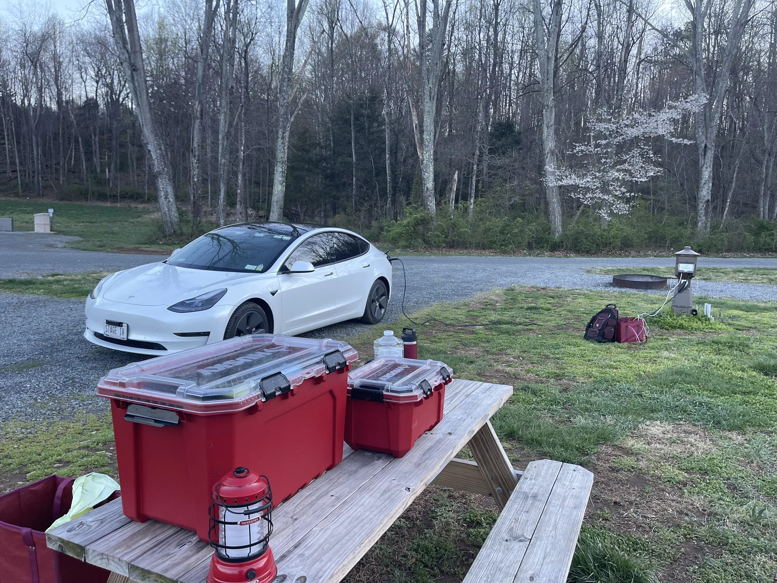
BIG MEADOWS CAMPGROUND
Skyline Drive MM 51
$30/night - First Come, First Served ($15 with Access Pass)
My original plan had been to spend the night at a campground called Lewis Mountain, part of the National Parks system of campgrounds.
One drawback of visiting Skyline Drive in early April is that most of the parks aren’t open. The admission booth is fully-staffed, but everything beyond that is hit-or-miss. Mostly miss, this time of year. The visitor center was closed. Many of the restroom facilities were closed. And most of the campgrounds were closed. Including, unfortunately, Lewis Mountain.
I’d selected Lewis Mountain early on, before gaining a fuller understanding of the seasons of the Blue Ridge Parkway region, because it boasted amazing mountain views.
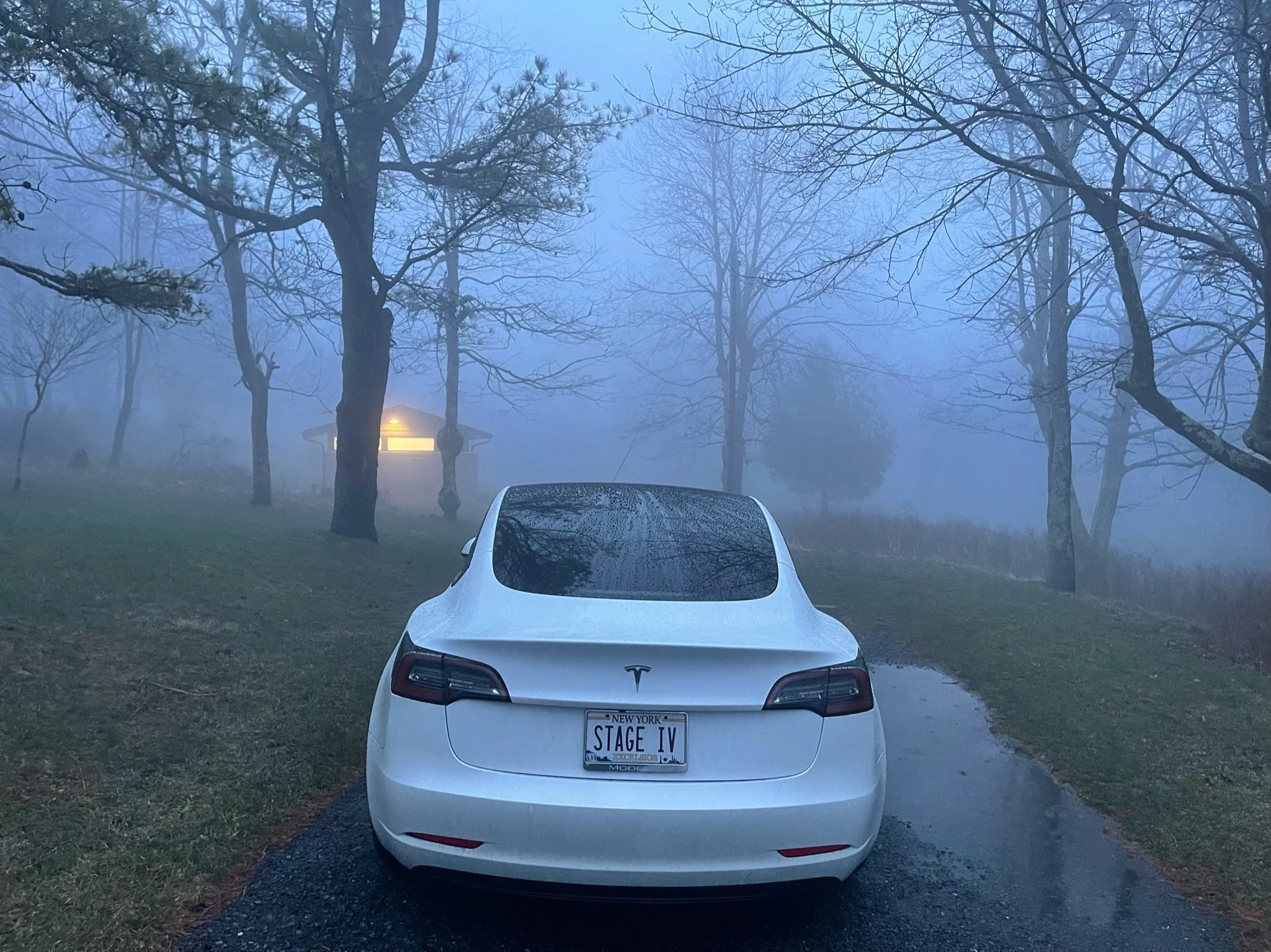
As it would turn out, the clouds would roll in so thick on my first night on Skyline Drive I wouldn’t even be able to see my car from the bathhouse at one point. Mountain views would have been wasted on me on this night, anyway.
I’d updated my itinerary for an overnight stay at Big Meadows Campground, at MM 51.2.
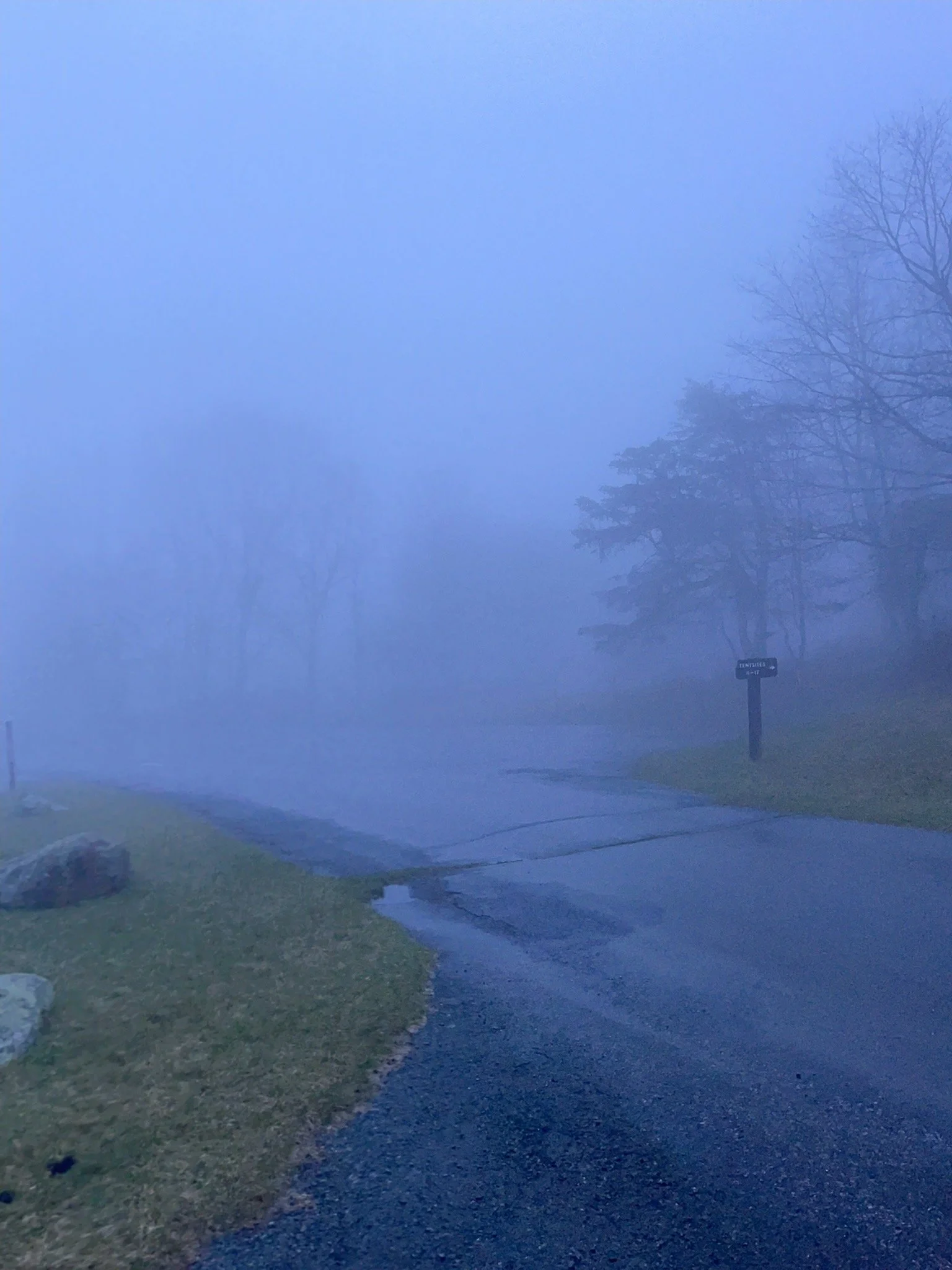
Even if I’d hoped to go further, thickening fog would make that impossible. In the miles before I arrived visibility would drop to near zero, and I’d struggle to see just to drive. Worse, deer by the dozens would make their way out to the roadway, grazing on the grass on either side of it.
And those deer! I was driving very slowly now, behind several other cars that also seemed to be struggling, and I noticed that, while the deer appeared to pay other cars no mind - obviously used to them - the Tesla startled them and made them anxious. Several times deer eating grass put their heads up and took notice as I passed, and I was surprised to see them begin to run at one point, as well. Could the quietness of these cars scare them?
Anyway, I arrived at Big Meadow just as an absolute monsoon of a rainstorm began to fall from the skies.
The system of selecting a site at this campground, while ordinarily one I would have appreciated, turned out to be an awful one in fog and rain.
At Big Meadow campers drive through the grounds until they see a site they like. Then, if there is no colored card on it, they drive back to the office, complete such a card, leave part at the office with their credit card info or payment, and take the other half back to their campsite, placing it on a post to indicate that the campsite is now ‘reserved’.
In the fog, though, I found myself having difficulty staying on the roadways. I couldn’t see the signs that indicated which way traffic should go. I had to get out of my car to see the site number. And some sites were beginning to flood - including, it turned out, the one that I selected.
Still, I chose a site close to the bathrooms, drove back to the office, completed a card, and took it back to my site. I parked half on the pavement and half on the grass, set my car up for sleep, and climbed inside.
The photos below were taken as I searched for my campsite. By the time I got back to it, visibility was literally zero.
At one point during the night I had to exit the car and walk through water-logged grass to use the bathroom. (Bathroom buildings are located around the campground, making it easy to find a site near one.) Walking through darkness and fog, trying to avoid stepping in puddles, with the knowledge that bears may be in the area - an experience I hope to not have to repeat.
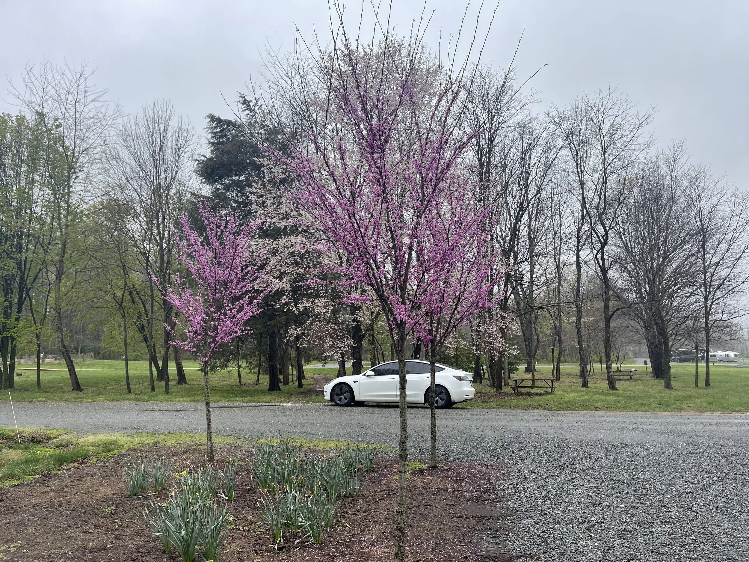
In the morning I awoke to fog just beginning to clear. I could see that there were a number of campers nearby - almost all car and truck campers, with a tent or two scattered about. I was surprised by how many campers were here so early in the season. On the drive out I found myself taking turns based on the level of fog in the direction I would be driving - things were clearing, but were definitely not in the clear just yet…

SKYLINE DRIVE DAY 2
SKYLINE DRIVE PART II
MILE MARKER 13.1 TO MILE MARKER 86 + FIRST 13 MILES OF BLUE RIDGE PARKWAY
My first priority on Day 2 of Skyline Drive was to find a charger.
‘Range anxiety’ is real, and with my two charging options being unavailable to me - one due to a charger being ‘out of order’ and a backlog on parts, and the other due to the facility hosting the Tesla destination chargers being closed for the season - I knew I would have to leave the park to find charging in the ‘real world’, instead.
I had no cell service for the first few miles as I headed south. The park ranger I’d spoken with when I was checking out had informed me that service should begin again soon - but he suspected that the fog might reduce it. He told me this like someone who believes aliens walk among us tells you of that belief, like the idea that weather might affect cellular quality was a conspiracy theory. I believed him anyway.
Sure enough, I’d driven at least five miles - in slow, dense fog - before I got a flicker of signal.
I’d worried all night that I might not have enough charge to get to my next destination. Now I could see that there was a Tesla supercharger under 30 miles away, in a town called Madison, VA.
Driving 30 miles off of Skyline Drive seemed like defeat. I’d hoped to make it all the way through Shenandoah National Park on Tesla battery power alone - and free power, since I’d originated with a full charge at a state park, and had expected to top off for free in Shenandoah, as well. Instead I’d drive 60+ miles round trip, and spend $10-15 to charge the car.
Still, the five or so miles I’d drive so far had been a fog-filled journey with views of nothing…

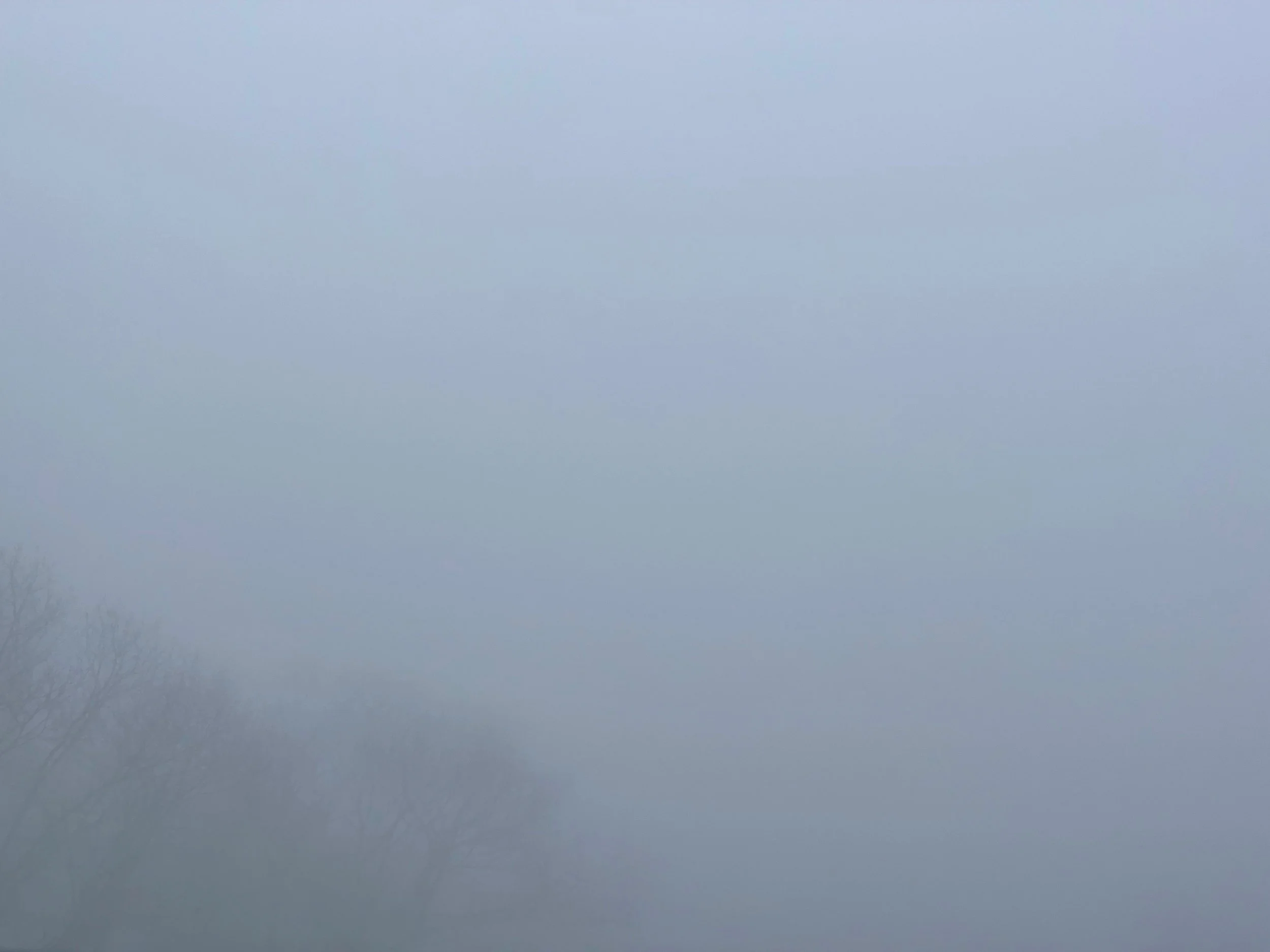

Nothing but fog.
Perhaps an hour or two away from the park would give the fog time to burn off?
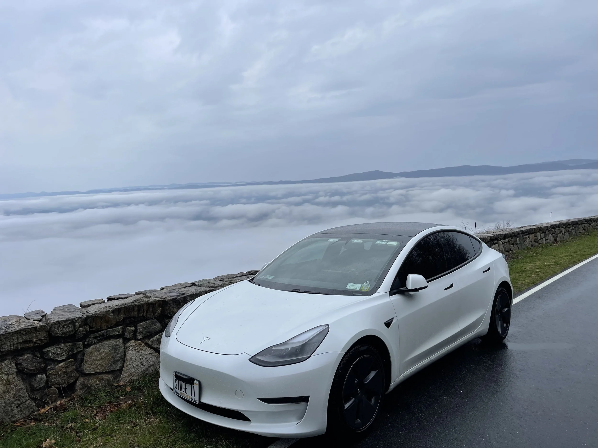
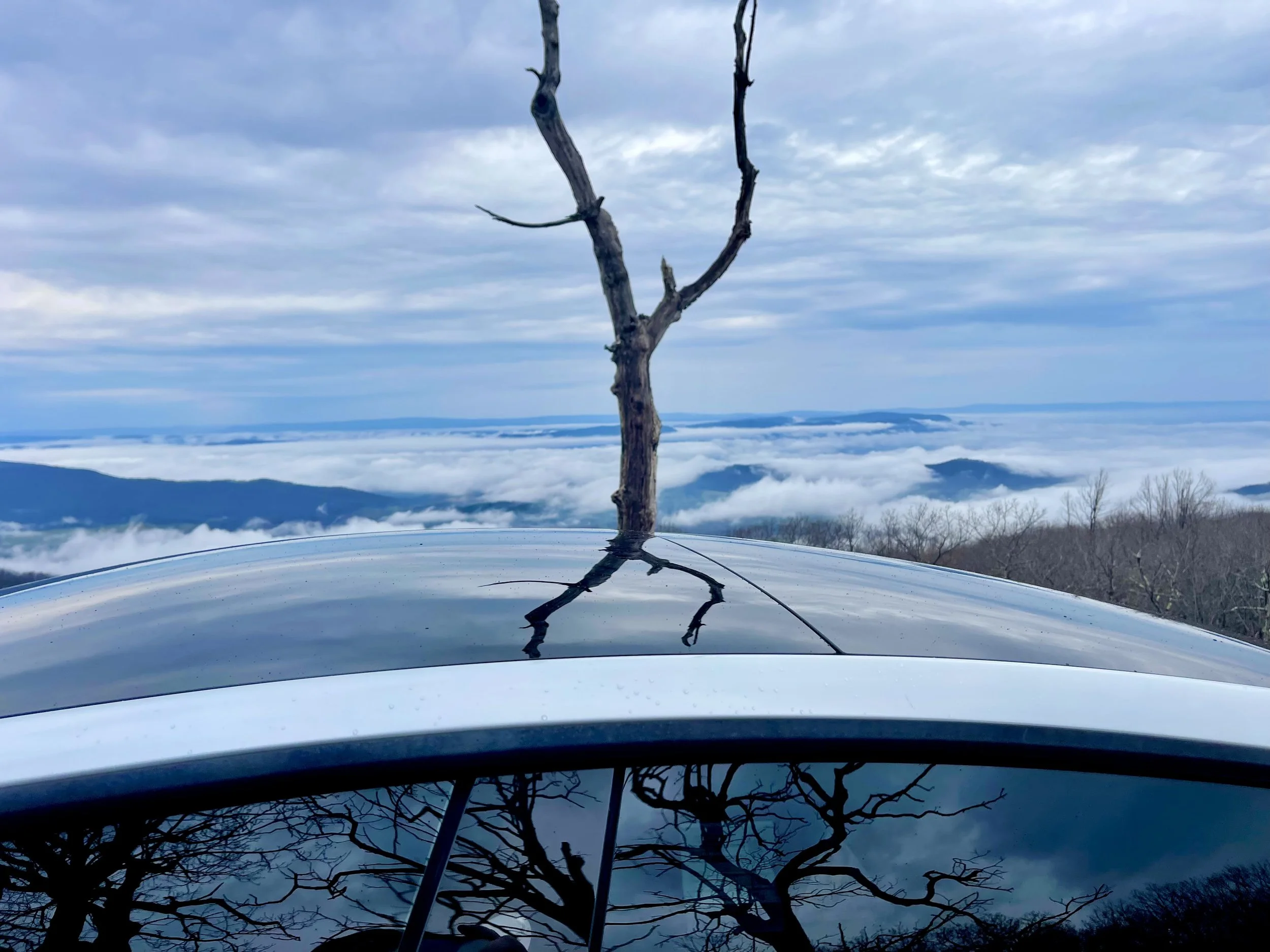
I was surprised to find that, as I drove down a descent into the roads leading to Madison, the fog disappeared.
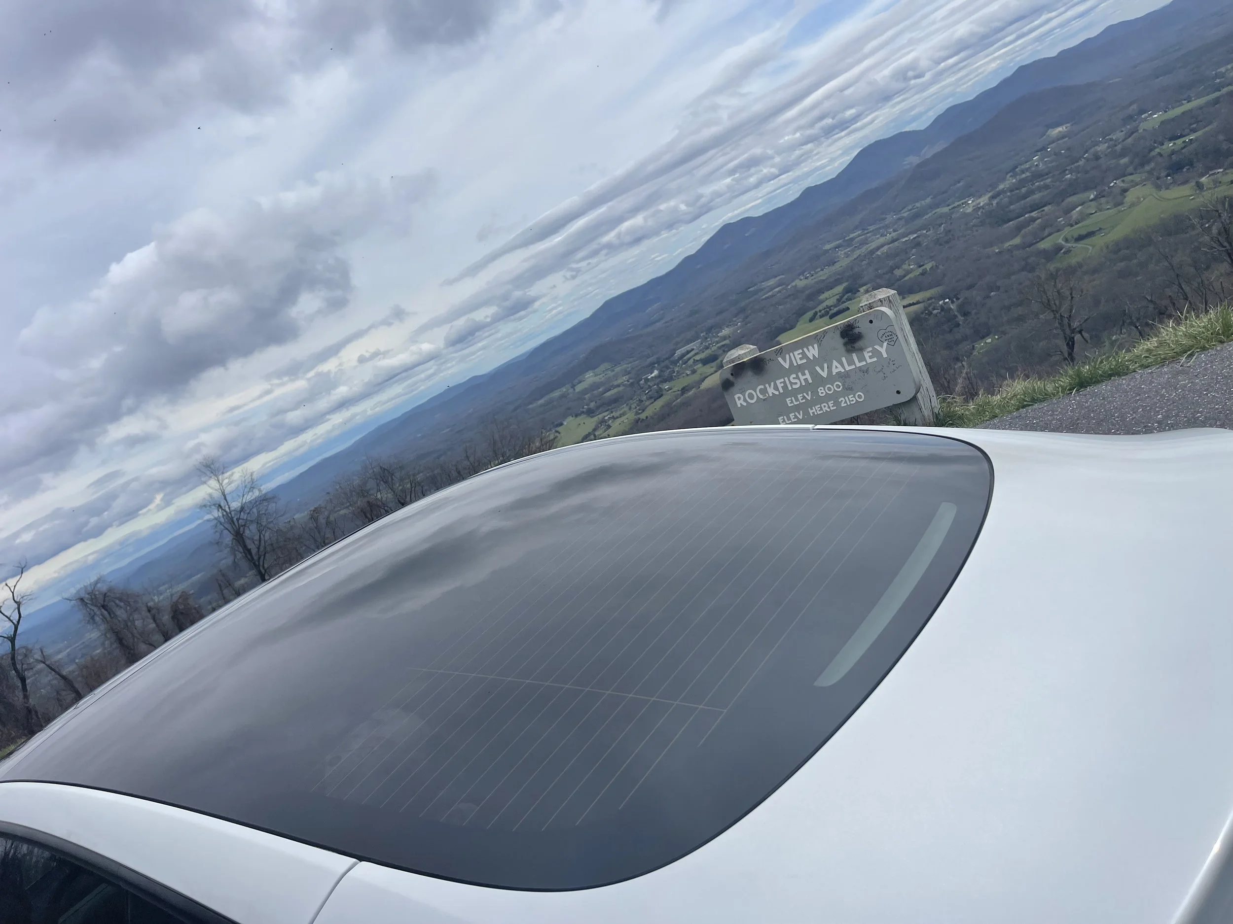
It wasn’t until I was on a long, flat road and looked toward toward the mountains that I realized why: I hadn’t been driving in fog, but in the clouds. The mountains rose into them, and as I drove from overlook to overlook in search of photo ops the clouds came with me, blocking any views I hoped to see.
“That’s the parkway this time of year,” someone would tell me later.
I charged a bit at Madison, and took stock of the situation. Partial cloudiness was predicted all day. I didn’t want to drive the 30 miles back to Shenandoah National Park only to drive through overlooks with no views to them. I decided to head for Charlottesville, instead - I’d grab some lunch, finish supercharging there, and then head toward the exit of Skyline Drive exit. I’d just have to do the second half of this trip if I were fortunate enough to come back again…
Side note: I had been hoping to wake up early enough to catch a sunrise from one of the overlooks near my overnight camp spot. I’d thought I might wake up and drive straight to Thorofare Mountain Overlook; several travel and photography blogs name it best sunrise overlook or best sunrise on Skyline Drive. The fog wreaked any plans of beautiful sunlight photography for me, unfortunately.
For your Skyline Drive travel plans, the markers I encountered that morning, as well as the ones that I missed are as follows…
51.5: Tanners Ridge Overlook
53.2: Naked Creek Overlook
54.4: Hazeltop Ridge Overlook
55.6 :The Point Overlook
57.5: Lewis Mountain Campground
MM 59.0: The Oaks Overlook
61.2: Baldface Mountain Overlook
62.7: South River Overlook
62.8: South River Picnic Grounds
64.4: Hensely Hollow Overlook
64.9: Hensely Ridge Overlook
65.5: US 33 – Richmond, Harrisonburg
67.2: Swift Run Overlook
67.8: Sandy Bottom Overlook
69.3: Bacon Hollow Overlook
70.3: Eaton Hollow Overlook
71.2: Rocky Mount Overlook
72.2: Beldore Hollow Overlook
73.2: Simmonds Gap Ranger Station
74.4: Loft Mountain Overlook
76.2: Two Mile Run Overlook
76.9: Brown Mountain Overlook
77.5: Ivy Creek Overlook
78.1: Rocktop Overlook
79.5: Loft Mountain Wayside
81.2: Big Run Overlook
81.9: Doyles River Overlook
83.0: Browns Gap
83.7: Dundo Overlook
83.7: Dundo Group Campground
86.8: Trayfoot Mountain Overlook
88.6: Horsehead Overlook
90.0: Calvary Rocks Overlook
91.4: Riprap Overlook
92.0: Moormans River Overlook
92.6: Crimora Lake Overlook
93.7: Turk Mountain Overlook
95.3: Sawmill Run Overlook
95.9: Sawmill Ridge Overlook
96.8: Jarman Gap
98.9: Calf Mountain Overlook
99.8: Beagle Gap Overlook
102.4: McCormick Gap Overlook
104.7: Rockfish Gap Entrance Station
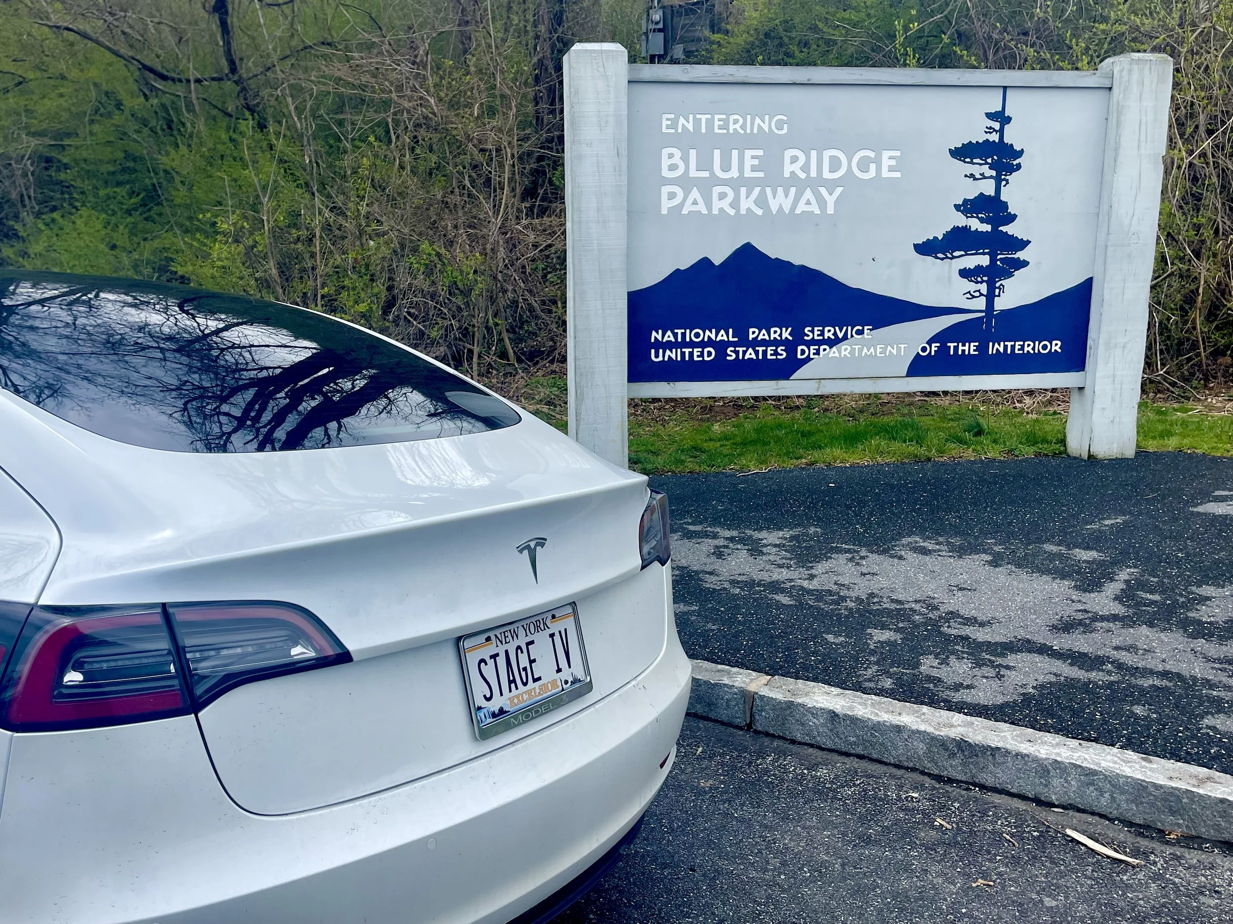
105.5: US 250 to I-64 – Charlottesville, Waynesboro, Blue Ridge Parkway south
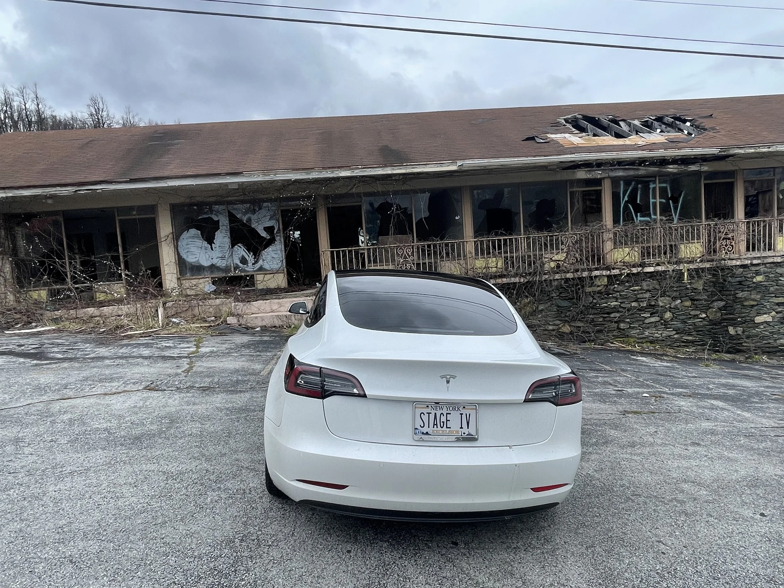
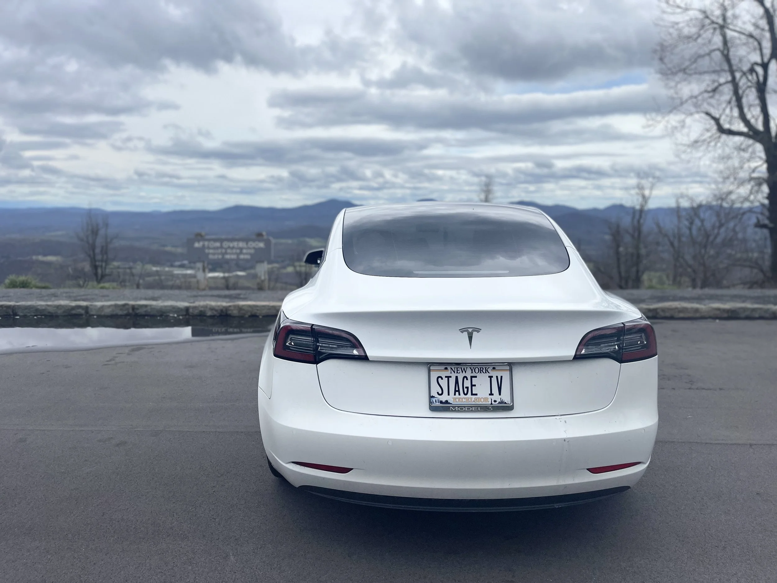
After meandering around Charlottesvile a bit, snapping photos of some abandoned hotels and the Blue Ridge Parkway ‘welcome’ sign, I headed into the Parkway to begin the next part of my journey…


This is where it all falls apart.
There are dozens and dozens of overlooks and scenic vistas between Skyline Drive and the Blue Ridge Parkway.
And, in the weeks leading up to my trip, nobody had them more organized than I did.
I had read travel blog after travel blog.
I’d scoured the official websites of the National Parks Service, and websites of area chamber of commerce sites and the like, as well.
I knew which overlooks I wanted to hit, and what photos I wanted to take.
And I had a plan in place to keep all of those photos organized, as well.
I even bought a little white board to travel with. The idea: write the name of the overlook on the white board, and take a photo of the white board with the view from the overlook behind it.
Let’s just say my plan didn’t work.
Hundreds of photos were taken, on two different iPhones, some from a DJI Osmo 2 gimbal.
By the end of Day 1 I had photos in three places: iPhone #1, iPhone #2, and the DJI app.
By the time I had consolodated all of them in one place and began pouring through them I came to the conclusion that I couldn’t tell which overlook many of the photos were taken from.
My next plan: upload photos, in order, to a Google Drive folder.
The problem? The internet in much of the Blue Ridge Parkway is sketchy to nonexistent. Creating folders for each overlook, and uploading photos from three different places would be time consuming, not including the lag and upload failures I’d be sure to experience.
To complicate things, my MacBook Pro, with me for more than 7 years, has storage issues that result in problems syncing devices. (On a whim I sent a sponsorship request to Apple before my previous road trip, hoping they might be interested - I did not hear back, and based on what I can see from travel bloggers they’ve sponsored, they tend to save their product test donations for blogs that one might describe as ‘sexy’ or ‘extreme’. Or both! Nothing sexy or extreme about stage IV cancer or a road trip taken at a plodding pace.)
Maybe one day in the future I’d make this trip again with a partner, or a photographic assistant. I’d snap photos, and then had the devices over to someone in the passenger seat to index, categorize, upload - maybe even take dictation as I speak blog entries for immediate updating.
For now, though, I had two choices: pull over in areas with adequate wireless signal and do all of the work myself; or, live in the moment.
I decided to live in the moment.
I didn’t know if I’d ever have a chance to come back - and I wanted to enjoy every moment of this trip.
So I did my best with the white board, and took some photos in front of overlook signs, and uploaded as I could, but mostly I just drove and enjoyed the view.
If you see errors on the pages that follow, feel free to email me (mail@stageivtesla.com) and let me know.
Otherwise, we’ll call this a ‘rough draft’ for a future trip. Just enjoy the beauty, as I did, and know that even if overlooks aren’t identified, or identified correctly, you’ll find the same once you get you get out there.
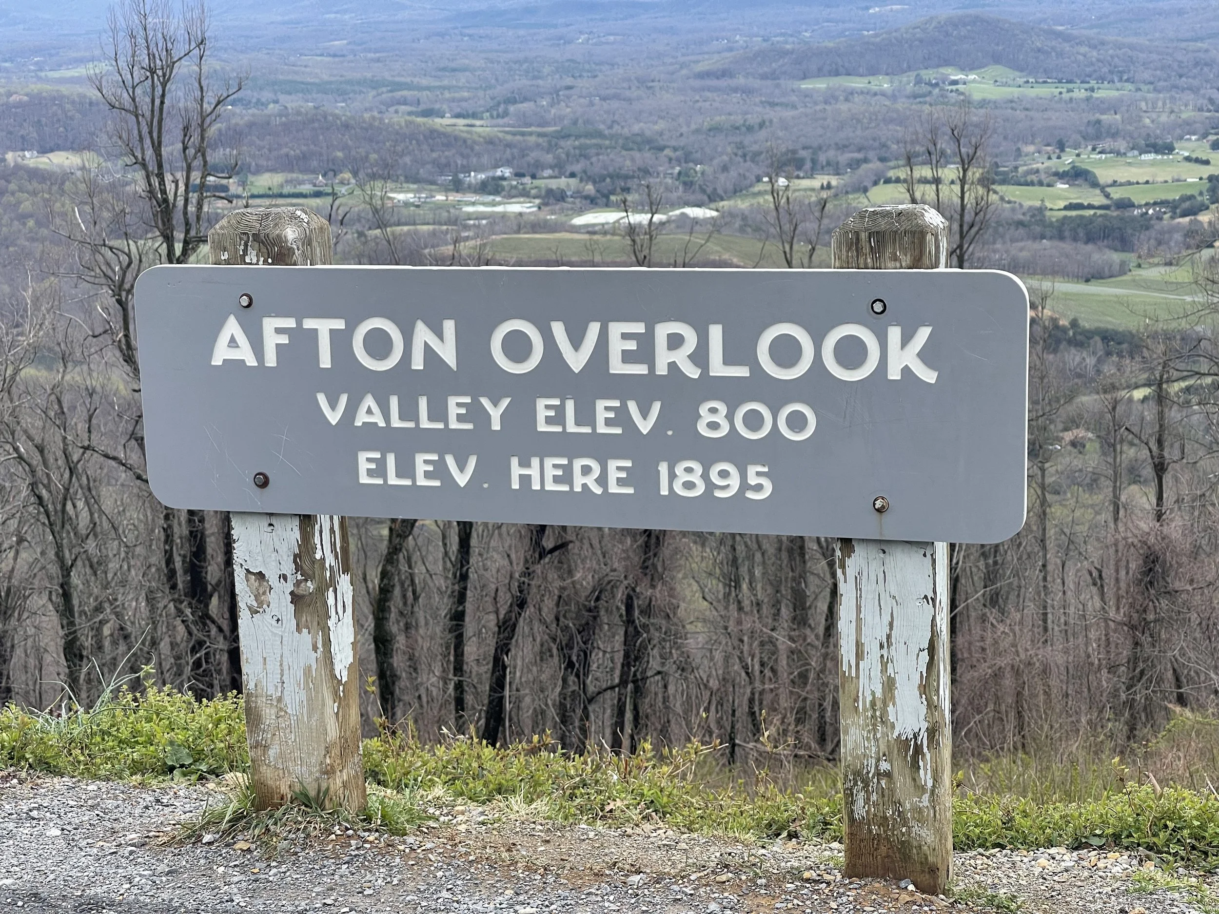
For your trip planning purposes, the most notable of the overlooks I encountered on my first day on the Parkway:
Mile 0 Rockfish Gap near Waynesboro, Virginia, is the northern end of the Blue Ridge Parkway. To the north the parkway connects directly to Skyline Drive, which winds 105 miles (169 km) through Shenandoah National Park.
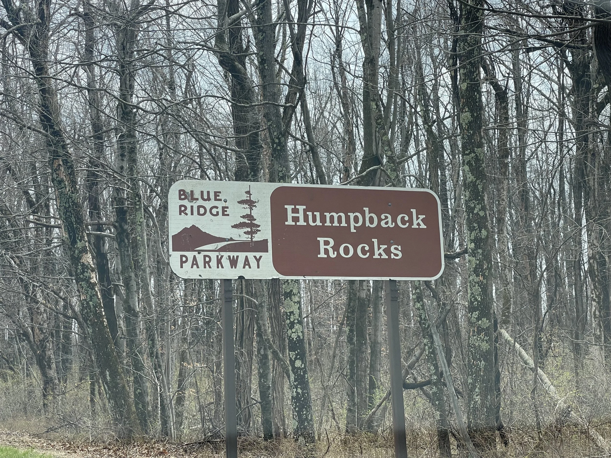
5 to 9.3 Humpback Rock has a self-guiding trail through a collection of old Appalachian farm buildings. A hiking trail from the parking area (at mile 6.1) leads 0.75 miles (1.21 km) to The Rocks, whose humped appearance gives the area its name. Greenstone self-guiding trail (8.8).
10.7 Ravens Roost offers vistas of Torry Mountain and the Shenandoah Valley to the west. The overlook is built above a cliff, so it is frequently used for rock climbing and hang gliding. There is also a single picnic table.
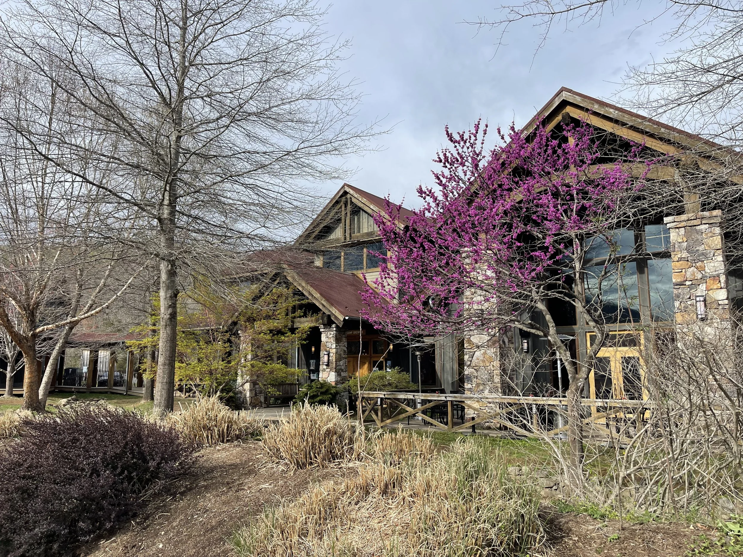
DEVIL’S BACKBONE BREWERY
50 Northwind Lane Lexington, VA 24450
Maybe I should say… drink local?
Devil’s Backbone got its name from frontier surveyors, who found the path to its summit notoriously difficult to climb. Fast forward nearly 300 years, and you’ll find a brewery and campground at its summit. The story goes that founders Steve and Heidi Crandall were on a ski trip in the Alps when they tried their first craft beer, a German Weisse at a brewpub, and fell in love. (With the beer - they were presumably already in love with each other). They returned with a goal of creating their own brewery in the mountains here, and aimed for it to be “a place where folks could drink and tell stories about their time on the trail or ski slope, or all of the above.” Their philosophy, according to the website, is that “being slow by nature is of mighty importance. It’s why we take our time brewing our lagers and it’s why we’re smack dab in the middle of the Blue Ridge Mountains.”
The brewery was acquired by Anheuser-Busch in 2016.
The type of cancer I have doesn’t allow for a lot of alcohol consumption, but reading about this place made me want to try it. All the way from New York. Road trips are all about experiences, and I think the future of road trips will include electric vehicles - that’s the entire point of this website, right?
Campgrounds that accommodate EVs and offer dining and other experiences… I feel like I have to try them.
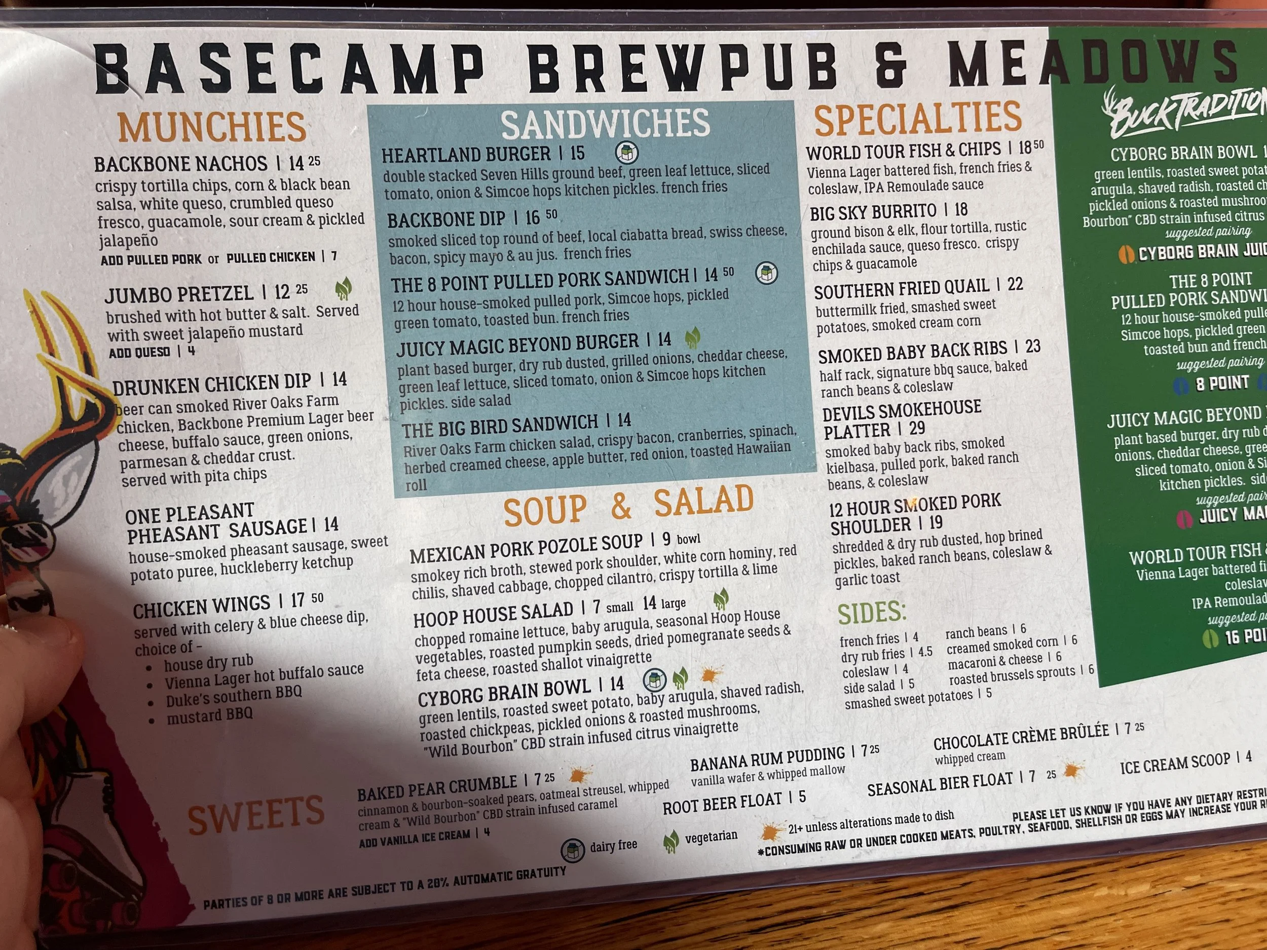
The menu at Devil’s Backbone Brewpup was extensive, offering everything from BBQ and burgers to salads and steaks. Vegetarian? Vegan? You’ll find that on the menu. I went with the Backbone Dip and fries. They had two desserts I’d wanted to try, but I couldn’t decide so I decided to skip entirely. That banana rum pudding, though…

DEVIL’S BACKBONE CAMP
30 Three Ridges Lane Roseland, VA 22967
$58.10/night - includes access discount
The campground is not adjacent to the brewery, but is just a short drive down the road on the property next door. I imagine that it would be easy enough to walk to. It’s located in a meadow surrounded by mountains and trees, and is one of the more pleasant settings for campgrounds I experienced on this trip. It appears to be fairly new, with modern electric and picnic tables that look like they’ve never been used. Sites are big - they all appear to be designed for ‘big rig’ RVs - but fairly close together. In busy summer/fall months I imagine that it might feel as though your neighbors are on top of you here, but when I visted in early April there was space between nearly every RV, and my nearest neighbors was a few hundred feet to either side.
In some ways, Devil’s Backbone Camp is nothing more than a big parking lot. For a road tripper, though, it’s the perfect stop for an overnight: dinner right next door, beautiful views, sleeping under the stars… definitely would stay here again.
Only downside: the bathrooms and showers are a fair distance to the side - if you don’t mind a hike you’ll not mind, but if you’re looking for a site closer to the restrooms and showers take a look at the map and choose a side close to the entrance-end.

WITH GRATITUDE…
This trip wouldn’t have been possible without the support and generosity of my family, closest friends, and some support from within the Tesla community. Thank you all so much for helping me complete ‘Stage I’ of this adventure. From my brother, Jeff, who bought me a Tesla Model 3, to my parents and Santa, who helped with the outfitting of it. To my friends and ‘family’, who have supported the idea of a ‘road trip’ from the very beginning. From those who met me on my route and took me out to eat, and to those I didn’t get to meet but who extended offers of meals, free overnight stays, and more - thank you, thank you, thank you!

OFFICIAL GPS & MAPPING SOFTWARE:

Tesla Camping
Traditional ‘car camping’ is eschewed by campgrounds for obvious reasons: internal combustion engines carry with them everything from the annoyance of an all-night hum to the risks of carbon monoxide poisoning, illness, and death. #vanlife #vandeath
EV (electric vehicle) camping, on the other hand, turns your Tesla or other vehicle into an emissions-free, climate-controlled sleeping pod on wheels. Join us as we work to educate the camping public on the differences - and convince campgrounds that #evcamping is the future, one campground at a time…
The Gear
This ain’t no #vanlife over here - we’re traveling in a Tesla Model 3 with a limited amount of space. If it doesn’t fit in the trunk, the sub-trunk, or the frunk, it can’t come.
Check out the gear that makes #teslacamping as comfortable as possible. From tents that extend the vehicle’s climate control to portable toilets that extend campers’ ability to go off-the-grid, if we fit it in, we’ll showcase it here…
