
EPIC EV ROAD TRIPS
Waterfalls of New York State
EV Road Trip: Waterfalls of New York State
First, if you’ve stumbled across this website following an internet search for ‘waterfalls of New York State’, my apologies for all of the car photography and videography you’ll see below. This website chronicles my EV road trips - day treks, weekend jaunts, and even weeks-long quests in a Tesla Model 3. It offers tips and suggestions for other EV drivers who may wish to follow my path, or blaze their own, driving across the US on kilowatts. (Some of us even ‘Teslacamp’ and ‘fuel up’ for free at campsites). You should know that I love my Tesla, but abhor the politics of Elon Musk - the only place you’ll find politics on this site is here. I keep it for dog mode, a feature Trojan and I would find it difficult to live without. And I truly do love the car. If you don’t like Tesla vehicles, try to imagine it as some other type of car. If you don’t appreciate car and video photography, try to look past the car at all of the beautiful waterfalls behind it. If you’re a Tesla or EV owner looking to day trip or road trip to visit the waterfalls of New York State, please enjoy. And if you’re someone with tips for me on waterfalls I may have missed - in New York or anywhere else - send them here. Get something out of this page? Any support of the journey is appreciated.
My strategy for EV road trips is simple:
Drive - “it’s a road trip, stay off the interstate.”
Eat/Drink Local and Do Cheap/Free Stuff - “eat with the locals, spend time with the yokels”.
Teslacamp - find state and federal campgrounds; they generally cost between $35-50/night.
Charge at the campsite: subsidize your stay with savings of around $15-25 a day on Supercharging costs.
Use all of that money saved on hotels and ‘fuel’ to do more stuff!
I love checking out waterfalls because they’re beautiful, they’re relaxing, and they’re often free or available for nothing more than the cost of an entry fee to whatever park they’re located in. On my previous road trips (New York to Key West in 2022, Shenandoah National Park & the Blue Ridge Parkway in 2022, or trips through PA, OH, MI, and IL in 2023, I’ve always researched waterfalls in the areas I’ll be staying.
Now it was time to do the same in my own home state of New York.
I was familiar with a number of falls throughout the Finger Lakes region - my home for most of my life - and of course everyone in the world knows the famous Niagara Falls. But I wondered if New York State had other beautiful waterfalls worth a day trip or weekend drive? I aimed to find out.
My research brought me to an article on Syracuse.com, among many others: 17 must-see waterfalls that should be on your Upstate NY bucket list.
That, and some inquiries with ChatGPT, Grok, and the other artificial intelligencia, gave me a good list from which to start my GPS journey…
The Finger Lakes
For the years that I’ve been blogging and posting my EV road trips on social media I’ve gotten a number of inquiries from other Tesla roadtrippers about my home state of New York. So many come through here on trips between Niagara Falls - which will be featured here eventually - and points south, including New York City. Many pass through my region, albeit on the New York State Thruway. They tell me they’ve always wondered what these ‘Finger Lakes’ are, and whether it would be worth it to them to exit the interstate and take a more scenic route. I tell them it absolutely would. With this page on my website, I hope to show them…
Seneca Lake
Seneca Lake is my adopted home. I grew up an hour away, outside of Syracuse, New York. My grandparents lived in Geneva, a small city about one hour west situated on the north end of Seneca Lake. That lake had called to my grandfather in the 1940s, when he built a small cabin to house his sailboat. He went off to war, returned, and met my grandmother. She refused to spend her summers at his cabin because it didn’t have a kitchen, so he built her one. That cabin - and an outhouse on the hill - became our family’s paradise. A fire during the summer of 2000 lead to the cabin’s demise, and its replacement: a small cottage atop the cliff just behind the beach. That is where I spend my winters, now; during the summer I live on a 1970s-era cabin cruiser, also on Seneca Lake.
I’ve been exploring Seneca Lake since I was young. As a teen I took my first ‘day trips’ around the lake. I still remember the night my friends and I drove south along the lake just to see where the road would take us, and were absolutely flabbergasted to crest a hill and see the lights of a whole community at the other end of the lake. Somehow I’d never been that far down Seneca, and I’d somehow imagined civilization ending around the end of my field of vision. Instead, Watkins Glen was a bustling village filled with homes, and businesses, and people. And a marina, which is where I slipped my first boat, circa 2004. And a NASCAR track.
I think it was that moment, driving down into Watkins Glen as a teen and realizing I’d found a whole new place to explore, that gave me a love of road trips. Today’s trips are much more technologically-based: it would be impossible to drive to not know exactly where you’re headed, what with the GPS display front-and-center on the dash of my Tesla Model 3. What’s more, the internet - and websites like this one - would likely have given me a pretty vivid idea of exactly what’s on the other side of that hill. Still, as the miles pass on my road trips - a ‘Dry Run’ to Presque Isle State Park in June 2021, Cape Hatteras National Seashore and south to Key West in January 2022, Skyline Drive and the Blue Ridge Parkway in April 2022, and others - I live for the possibility of a magical moment much like that one. Occasionally, I find it.
Then I always return back home, to Seneca Lake.
With an average depth of 291 feet (89 m) and a maximum depth of 618 feet (188 m), Seneca Lake is the deepest of the Finger Lakes. At 38 miles (61 km) long, it is the second-longest of these 11 glacially-formed bodies of water, and it has the largest volume, containing roughly half of the water in all the Finger Lakes. The lake is named for the Seneca nation of Native Americans.
Seneca Lake is fed by underground springs and replenished at a rate of 328,000 gallons per minute. These springs keep the water moving in a circular motion, giving it little chance to freeze over. Because of Seneca Lake's great depth its temperature remains a near-constant 39 °F (4 °C); during the summer the top 10 to 15 feet (3.0 to 4.6 m) warms to 70–80 °F (21–27 °C), making it ideal for tourism. Due to this unique macroclimate it is home to over 50 wineries, many of them farm wineries; these wineries make up the Seneca Lake Wine Trail, a major source of tourism to the area.
Seneca Lake was once home to Sampson Naval Base, used during World War II. This became Sampson Air Force Base during the Korean War, used for basic training. After that closed the airfield remained as Seneca Army Airfield, but it was closed in 2000. I remember growing up with protest encampments in the area due to rumors that the military was using the grounds for the storage of nuclear weapons. Today a state park, campground, and marina occupy much of the land that once housed sailors, airmen, and soldiers.
There is still a Naval facility on Seneca Lake, the Naval Undersea Warfare Center (NUWC) Sonar test facility. A scale model of the sonar section of the nuclear submarine USS Seawolf was tested here during the development of this ship in the 1990s, and other submarined and unmanned underwater vehicles have been, and still are, tested here as well.
In the future I plan to do a separate website on the Finger Lakes, including an EV road trip and day trip map with suggestions of sights to take in and things to see along the way. For now, on to the waterfalls of Seneca Lake…
AUNT SARAH’S FALLS
e was probably an Aunt Sarah, but there doesn’t seem to be any traceable history to who she was, or why a waterfall in Montour Falls was named after her. Yet as you drive along Route 14 from Watkins Glen toward Elmira, there she is in all her splendor: 90 feet of falling water visible from the road.
Amazingly, Aunt Sarah’s Falls is well over several hundred feet tall from the top of the gorge, but the top two-thirds is not visible or accessible. According to waterfall website NYFalls.com, Aunt Sarah’s Falls first free-falls about a third of the way, then fans out on a steep slope of shale for another third before free-falling again into a shallow plunge pool. That final third is the part travelers can see from the roadway. I parked in a small lot adjacent to the pool for the videos and photos I took; you can likely do the same, although beware of traffic entering the lot quickly on busier days. There is also a small parking lot across the street.
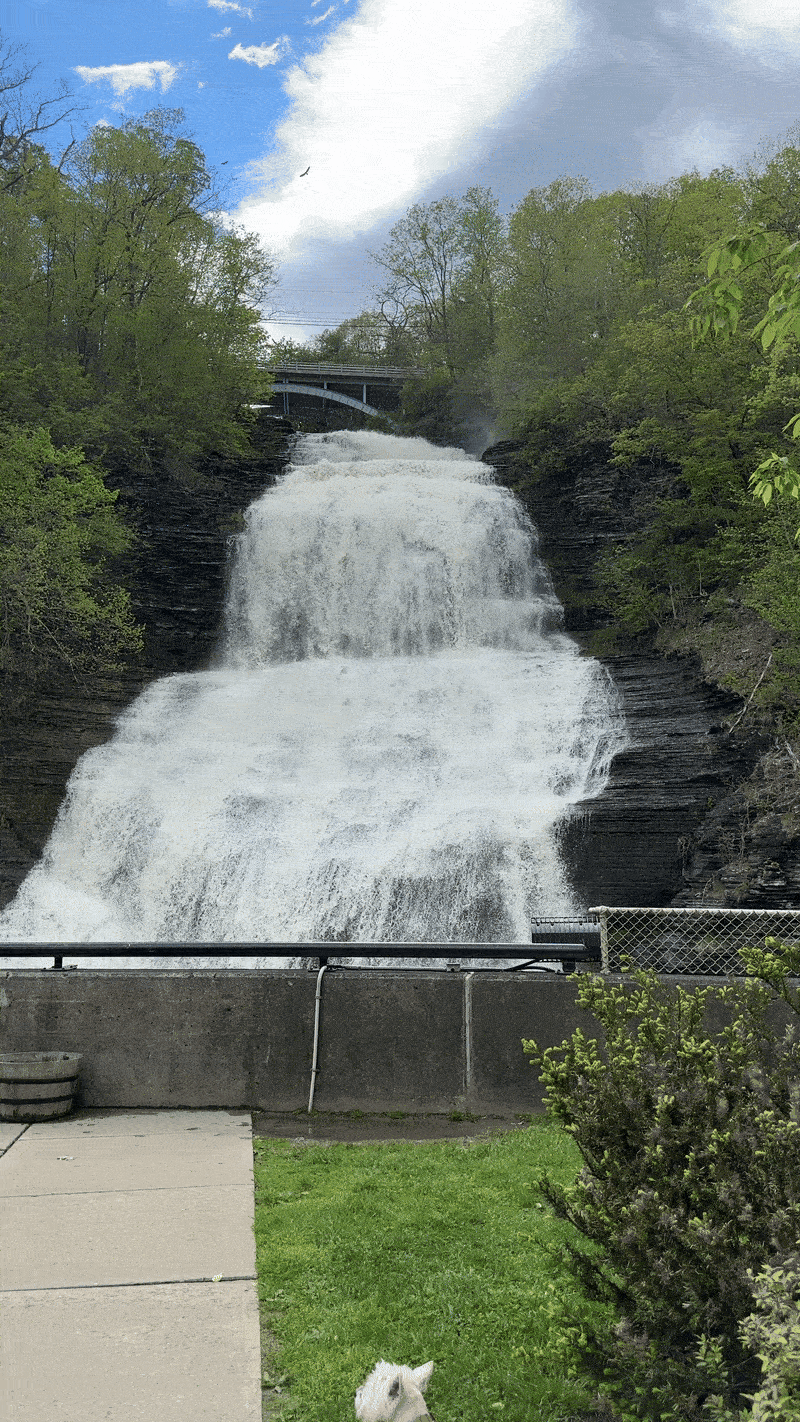
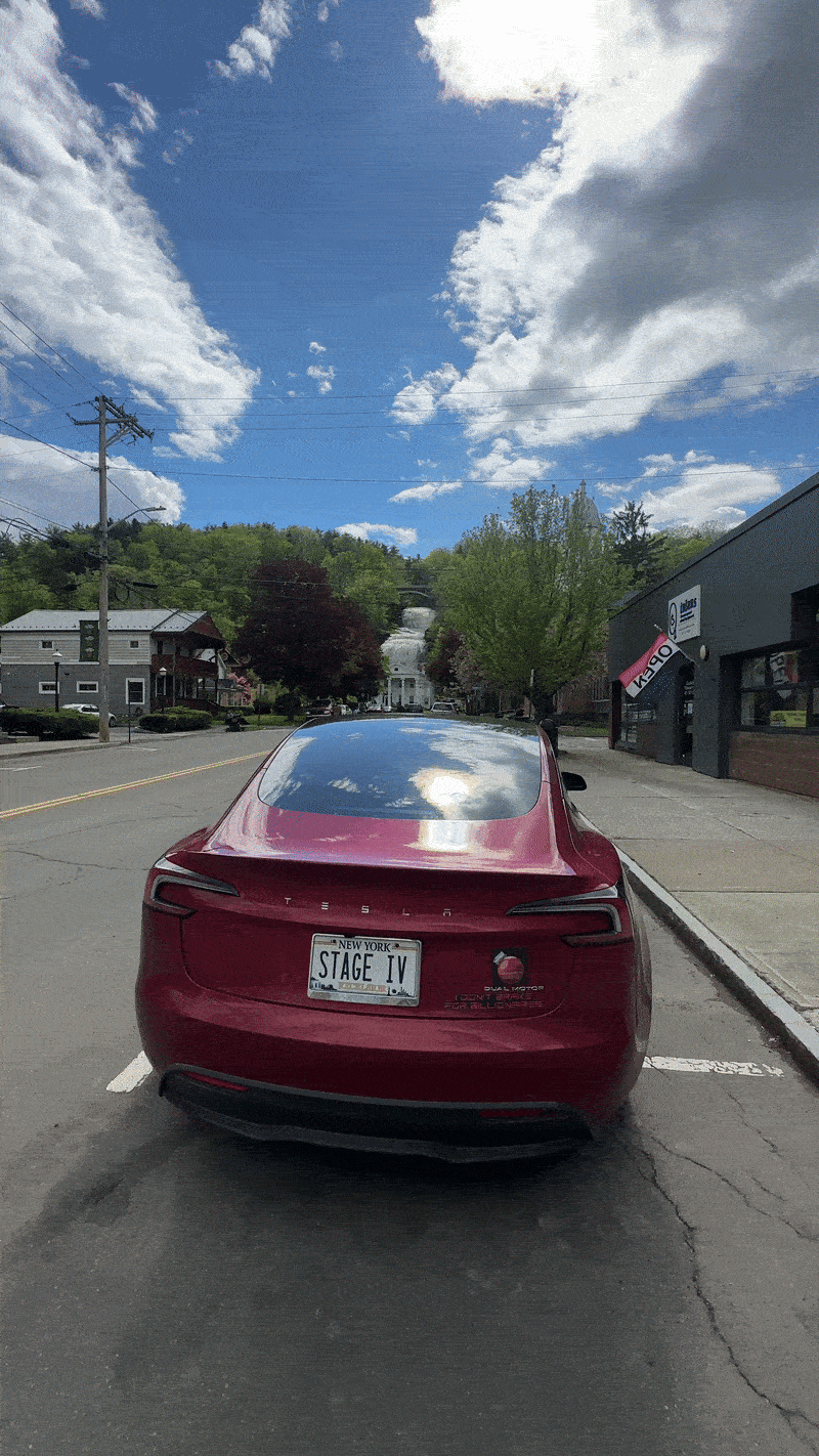
SHEQUAGA FALLS
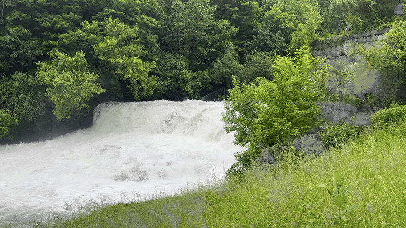
Less than a mile from Aunt Sarah’s Falls you’l find Shequaga Falls, in the village of Montour Falls, 156 ft in height. It passes under the Mill Street bridge - you’ll see it at the top of the falls in the photos and video here - before emptying into a large pool at the bottom.
According to waterfalls website NYFalls.com, Shequaga Falls is a part of Shequaga Creek, which begins uphill 8 miles west in the town of Dix. Shortly after falling over Shequaga Falls, the creek turns to the north, flowing through a tunnel under the road and meandering north and emptying into the Seneca Lake Inlet just north of the village at the marina, before traveling through the village of Watkins Glen and flowing into Seneca Lake.
There is a small park here, complete with benches. Two parking spaces allow for up to 30-minute parking, and a number of parking spaces in the village are within walking distance.
In 2022 I brought my friend Tyson to the Mill Street Bridge to snap a quick photo of my former ’21 Tesla Model 3 SR+ with the sweeping scenery afforded by the height of the bridge in the background. The road above is narrow and winding, and there are signs that direct motorists not to park on the bridge, so I asked him to exit the vehicle and snap a quick photo during a break in traffic. Instead he stood at my window interrogating me the reason for the car photography, right up until a vehicle came barreling down the road honking for us to get out of the way. We never got the photo, and I haven’t been back. One of these days I’ll return and get that photo. If you have a moment, take a drive up along Mill Street - even if you don’t stop (and you probably shouldn’t) the view up there is absolutely glorious. If you do stop, look down from the top of the waterfall below.
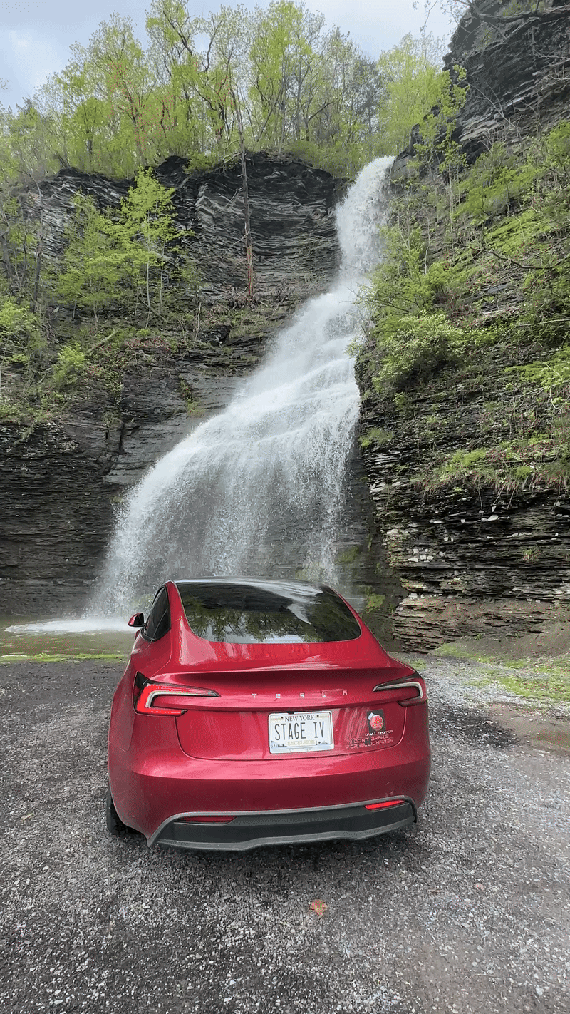
HECTOR FALLS
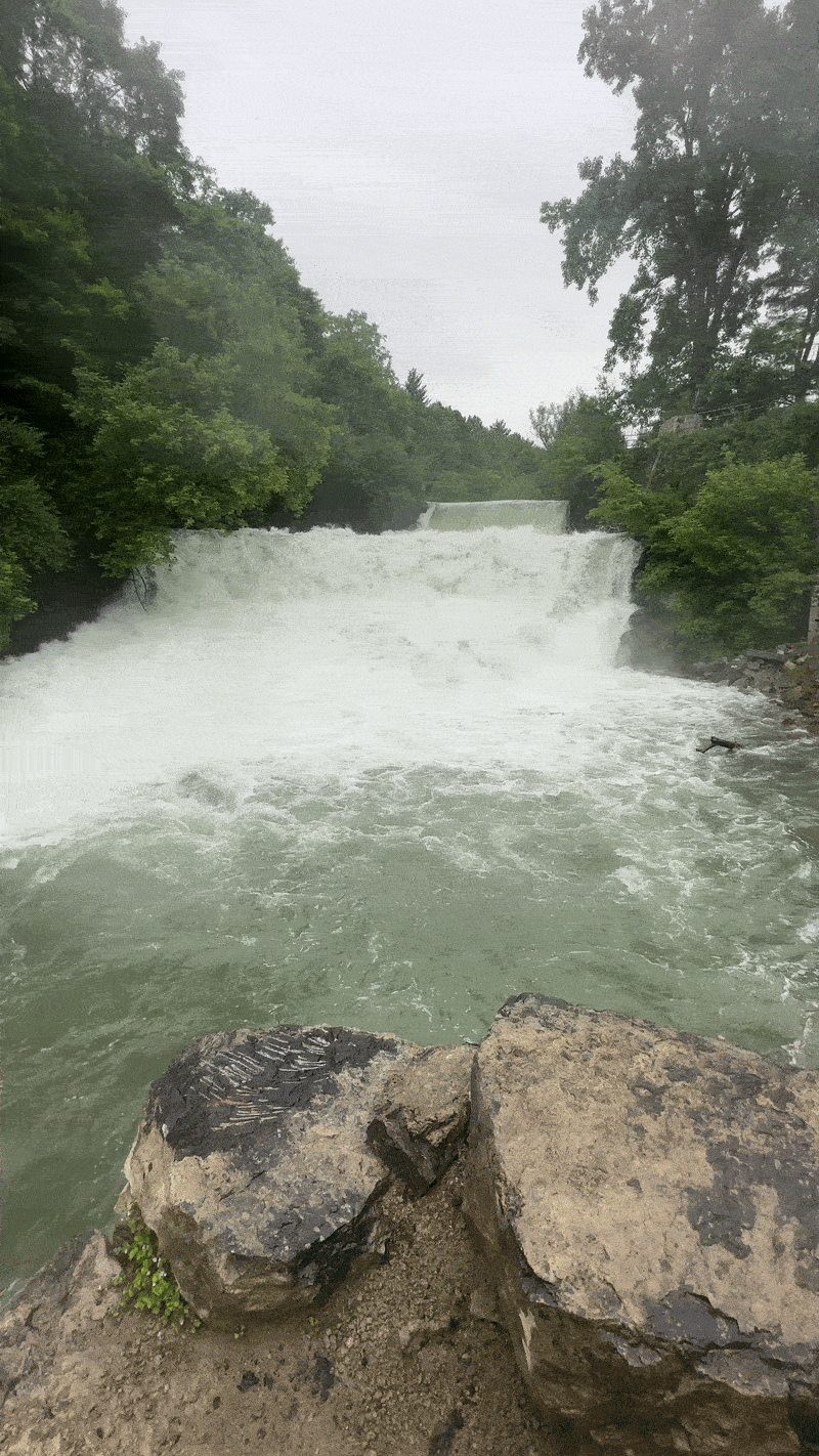
You’ll find Hector Falls north of Watkins Glen, in the town of Hector, along NY-414 on Seneca Lake’s eastern shore. Visitors should park on the shoulder of NY-414, on either side, before or after the falls. During busier times this area can fill up quickly, and there are very few safe turnaround spots south of the falls, so if you’re headed to Watkins Glen and can’t stop it may be a while before you can turn around to try again. Use extreme caution - the speed limit here is 55 but vehicles will speed by much faster at times, and some locals resent tourists and the safety hazards that they pose, especially after a snow thaw or spring rains when the waterfall is at its most magnificent. Expect to be honked at, or worse.
The main waterfall that makes up Hector Falls is 165 feet high. Only a portion of this can be seen from the road - you’ll see part on the eastern side of the bridge, and another portion as you look down toward the west across Seneca Lake. In truth, over 250 feet of waterfalls combine to make up this waterfall, including a portion that can only be viewed from the lake - consider a boat tour during summer if you’d like to see it all - and portions upstream that can’t be seen from anywhere without the use of a drone. According to waterfalls website NYFalls.com, from the lake visitors can see the final stretch, yet another fanning cascade, the widest of all.
My friend Jesse once took his then-girlfriend for a short hike down into the tidal pool just below the base of the upper portion of falls, where he proposed as I videotaped from the bridge. (They broke off the engagement later). I’ve seen people sitting in lawnchairs in the water in the stream just west of the bridge. If you choose to hike or wade down below, use extreme caution - those rocks are slippery when wet, and it’s a long, long way down to the base.

WATKINS GLEN STATE PARK?
The waterfalls and gorge at Watkins Glen State Park are world-famous. They involve some hiking and significant steps along a trail that involves quite an incline. I may wait until I have my own portable defibrillator for that one!
Just kidding. But this park is its own day trip, so it will be a bit before you’ll see it here. Hoping to combine it with a little Tesla camping, and perhaps a few more scenic waterfalls around Seneca Lake. This is, as they say… “coming soon”.
CHECK OUT THE YOUTUBE
During a day trip with Trojan to see as many waterfalls as possible I put together a short YouTube video of what we encountered. This was after a major spring rain with flooding, so the waterfalls were performing very well. During drier months, especially after summer draughts, you can expect to see all of New York’s waterfalls cascading much, much less.
For more information on Seneca Lake and its waterfalls, visit SenecaLakeScenicByway.com.
FOR MORE INFORMATION
For more information on Seneca Lake and its waterfalls, visit SenecaLakeScenicByway.com.

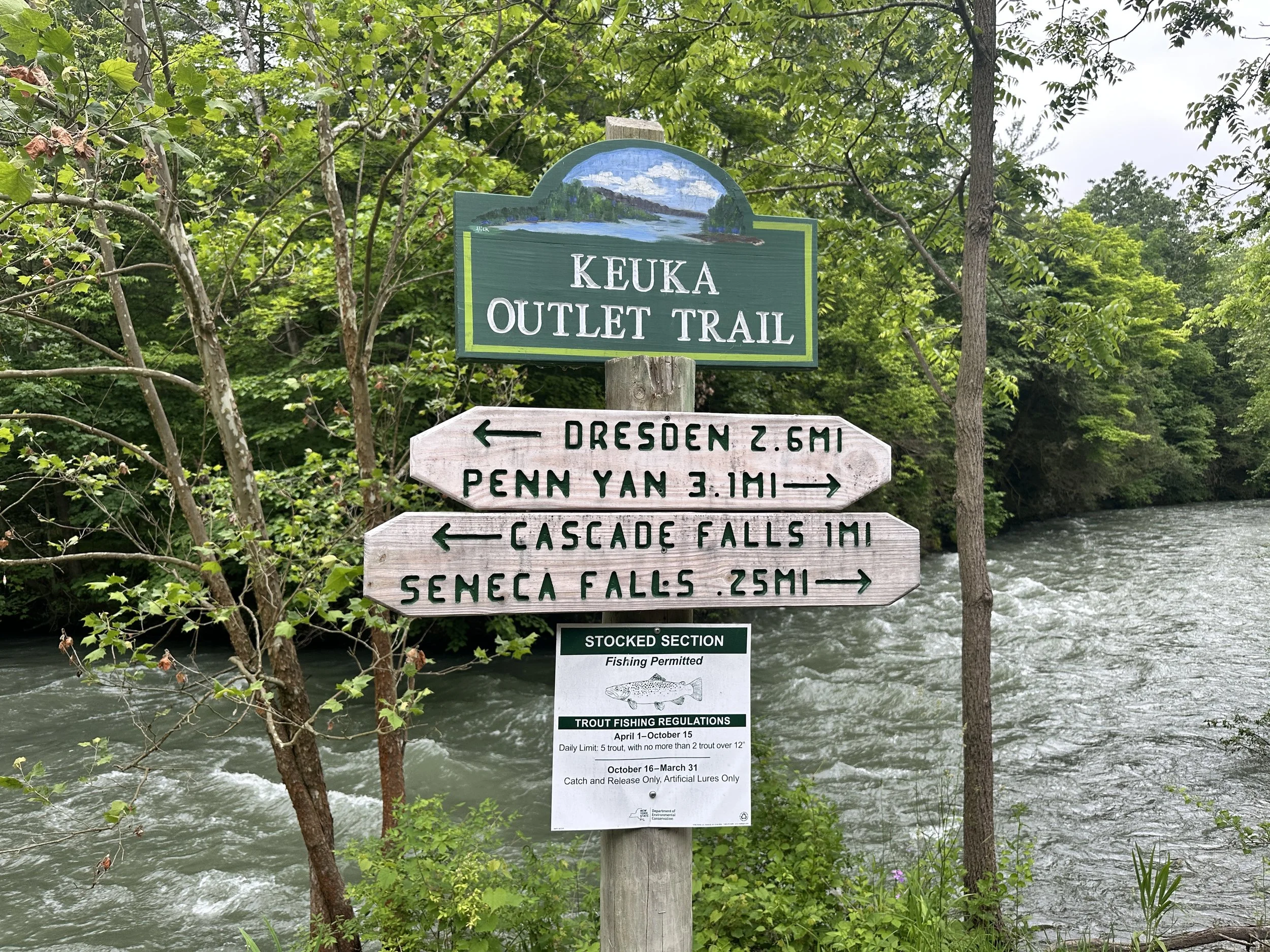
Keuka Lake Outlet
Keuka Lake Outlet is a body of water located in Yates County, New York. It drains Keuka Lake and flows into Seneca Lake by Dresden, New York. The Crooked Lake Canal was developed along the route of the river. The canal was later replaced by a railroad which is now a hiking and cycling trail, the Keuka Outlet Trail.
In June 2025 I joined my friend Ryan, an avid hiker, for a short jaunt along the Keuka Outlet Trail to check out the ‘rapids’ that had been created by a recent downpour and the flooding that had resulted. We made a stop at Seneca Farms in Penn Yan first - more on that here soon. Then we drove over to a parking area, parked, and went for a quarter-mile walk along the trail.
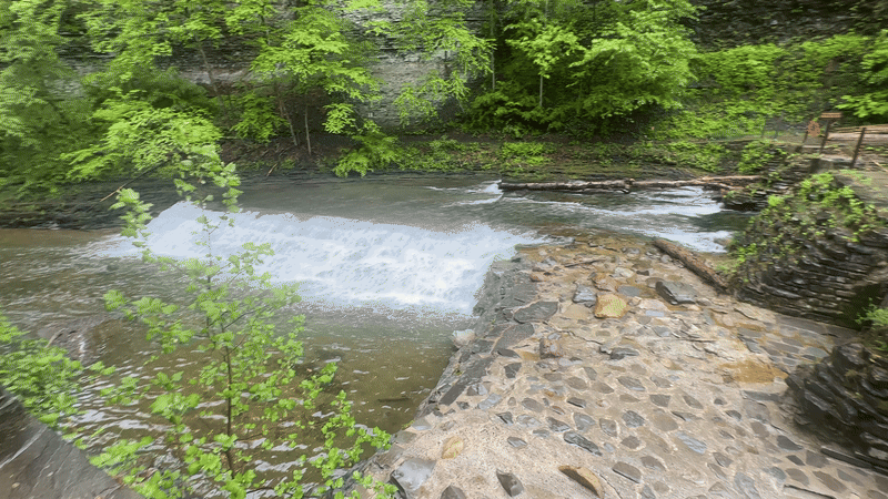
Our first stop was Seneca Falls… not to be confused with the Village of Seneca Falls, an upcoming stop on my Tour of NY-5.
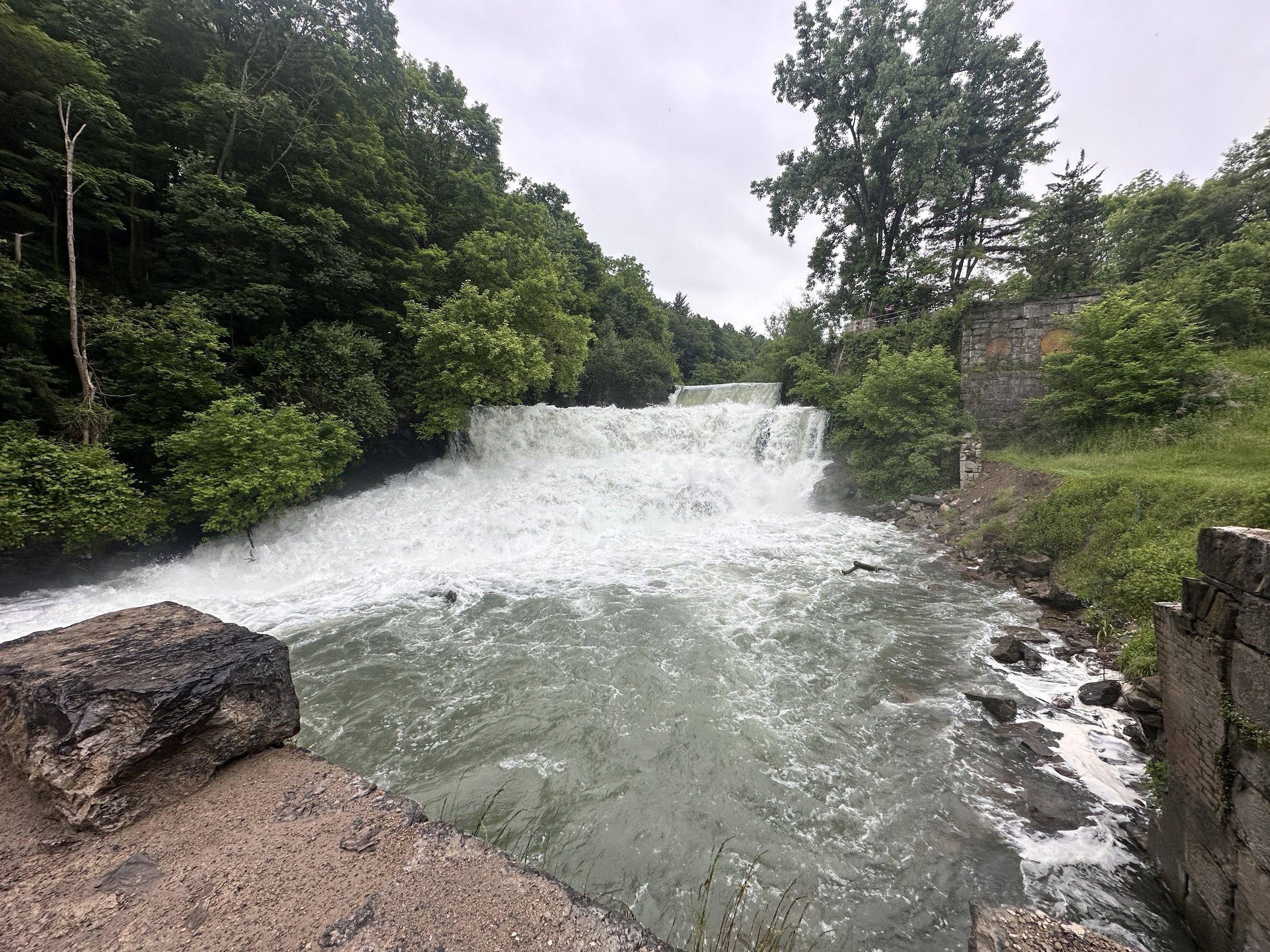
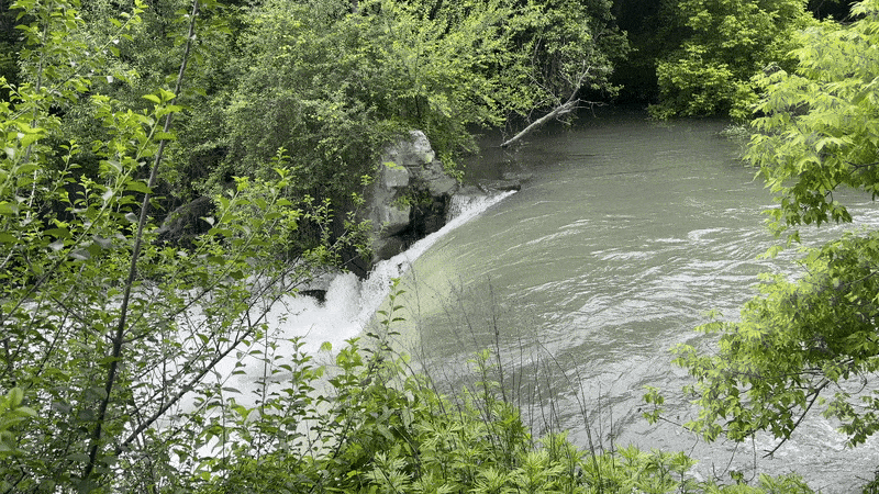
Especially cool: the little waterfall behind the waterfall… I liked seeing that. I suspect that dries up when the water volume recedes during normal times, but I’m not 100% sure about that. I can say that the best time to see any waterfalls is after a deluge like we’d had a week or so before. Amazing volume of water rushing through this outlet. Made me wish I had a raft. And knew how to whitewater raft in the first place.
The Keuka Outlet Trail stretches for miles, running all the way from west of Penn Yan, not far from Seneca Farms, to Dresden just off of Seneca Lake. I’ll have more waterfalls from this trail in the coming months… stay tuned.
Cayuga Lake & Ithaca
In April I joined my friend Ryan, a local Ithacan, to scope out some campsites for an upcoming Teslacamping trip with my friend Michael, who would be driving his Model Y Performance in from Buffalo to spend a weekend in the Finger Lakes. Michael and I had been talking about doing some joint Teslacamping for a few years now, and we’d decided it was time. Ryan and I found the perfect spot at Taughannock State Park in Trumansburg: in the woods but with a view of the waters of Cayuga Lake - albeit through the trees, which were far more leaf-covered in mid-May, when we returned for our weekend outing.
Situated on the southern shore of Cayuga Lake, as of 2020 the city's population was 32,108. Ithaca is a college town, home to Cornell University, an Ivy League university, as well as Ithaca College and a nearby community college.
Ithaca is named after the Greek island of Ithaca; most everything else in this area is named for the Indian tribes that inhabited the area first. Cayuga Lake is named after the indigenous Cayuga people. Cayuga is the longest of the 11 Finger Lakes, and is the second largest in surface area (marginally smaller than nearby Seneca Lake. It is just under 39 miles (63 km) long, with an average width of 1.7 miles (2.8 km), and is 3.5 mi wide (5.6 km) at its widest point. Cayuga Lake is approximately 435 ft deep (133 m) at its deepest point.
Ithaca is a very liberal city, largely in part due to its proximity to Cornell. Locals sometimes refer to it as “Little Portland”. It was common to see Priuses here before they were popular elsewhere, and a large number of Teslas and other EVs have graced the city’s streets, far more per capita (in my estimation) than other areas of upstate New York. Ithaca is filled with activism, with folks fighting for equality and equity, against food insecurity and hunger, and against climate change. The day we pre-tripped our Taughannock Falls camping weekend, “Hands Off” protests were taking place across the country, and we decided to drive into the city and visit the Ithaca Commons, where more than 300 people lined the streets holding signs in protest. Signs and murals throughout Ithaca point raise alarms about the environment.
“Ithaca is Gorges” is a trademarked slogan of the local visitor’s bureau, and a point of pride for local residents - you often see it on t-shirts and bumper stickers throughout Ithaca and Tompkins County. It points to the fact that there are between 50 and 150 waterfalls in and around Ithaca - the actual number depends on what you consider to be a ‘waterfall’ as opposed to ‘falling water’. Many of those waterfalls are in in gorges carved by glaciers millions of years ago. Those glaciers gave this area unique and beautiful topography that makes it a tourist attraction today; the same glaciers carved out the 11 ‘Finger Lakes’, as well.
Want to check out our Teslacamping weekend, Two Teslas at Taughannock? Click here - coming soon. Want to view a very details map of Ithaca’s many waterfalls? Click here.
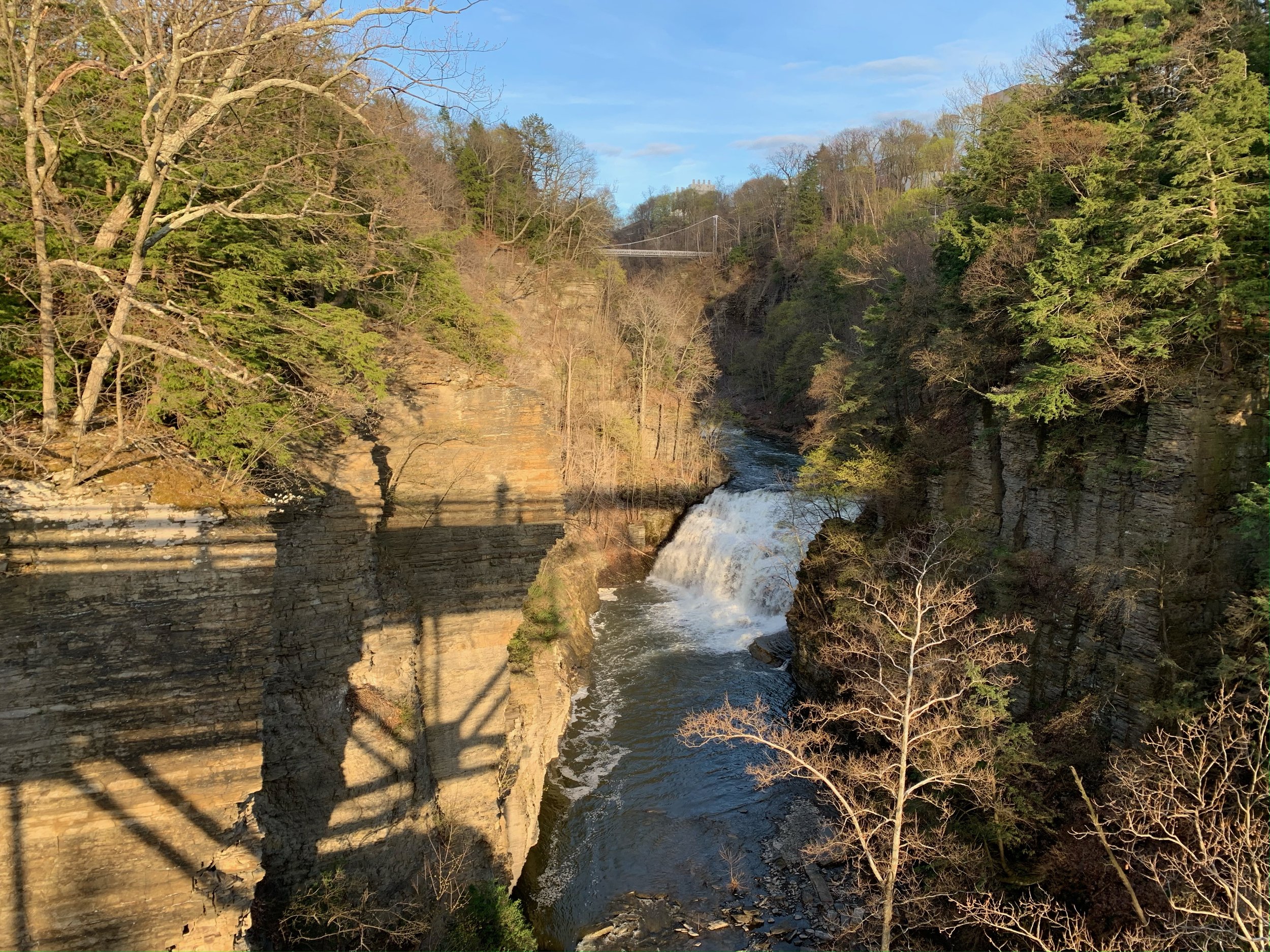
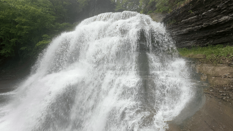
Ithaca Falls
Ithaca Falls is one of the more notable waterfalls in Ithaca, with a height of 150 feet and a width of 175 feet. It is the largest waterfall in the Ithaca area and is known for its impressive drop and width. In the chain of waterfalls, it is the lowest of the falls that make up Fall Creek, found just before the creek reaches its basin of Cayuga Lake.
The splash pool and creek just below the falls are a popular spot for fishing. The area around the base of the falls was owned by Cornell University before being sold to the City of Ithaca in 2000 as a part of environmental cleanup. A house near the base was razed, and a park added, which allows for a short (and, some say, steep) hike to get a closer look. On this trip, we didn’t… there were too many other waterfalls to see.
Stewart Avenue
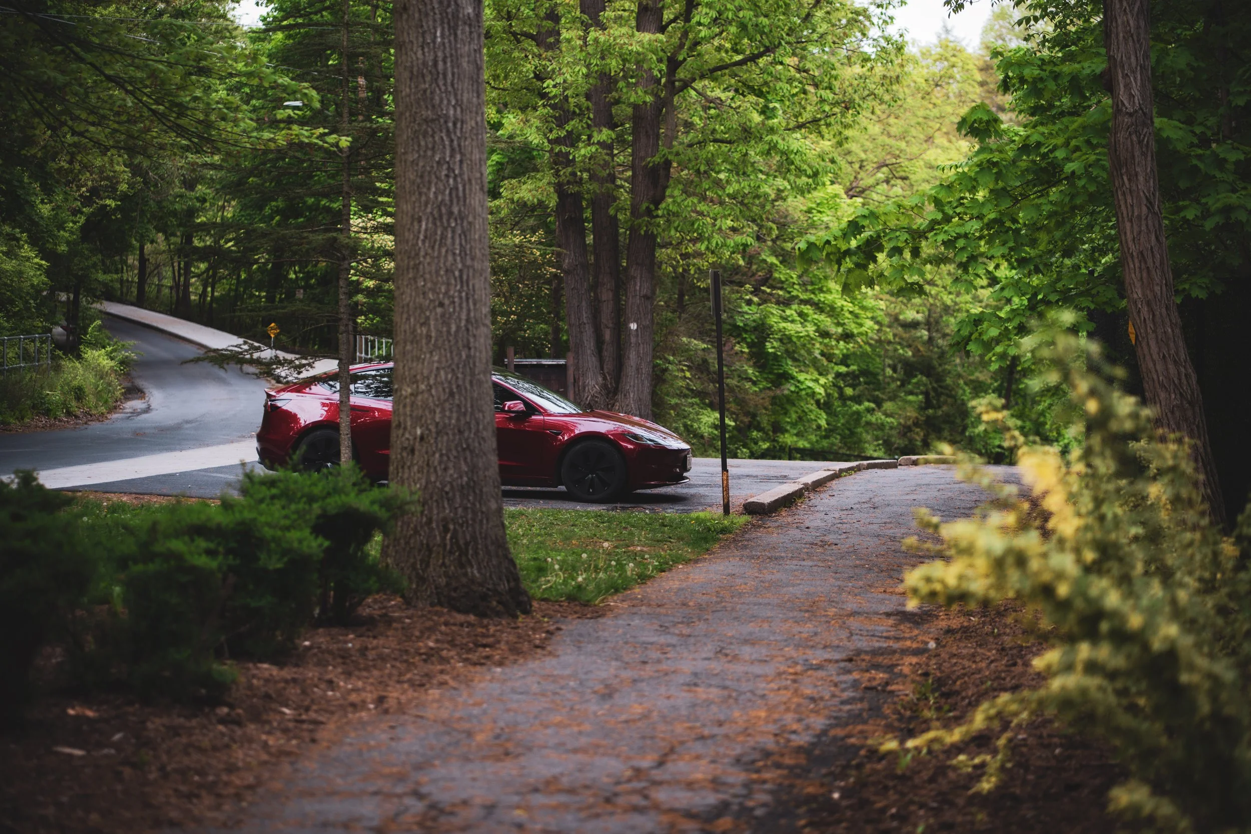
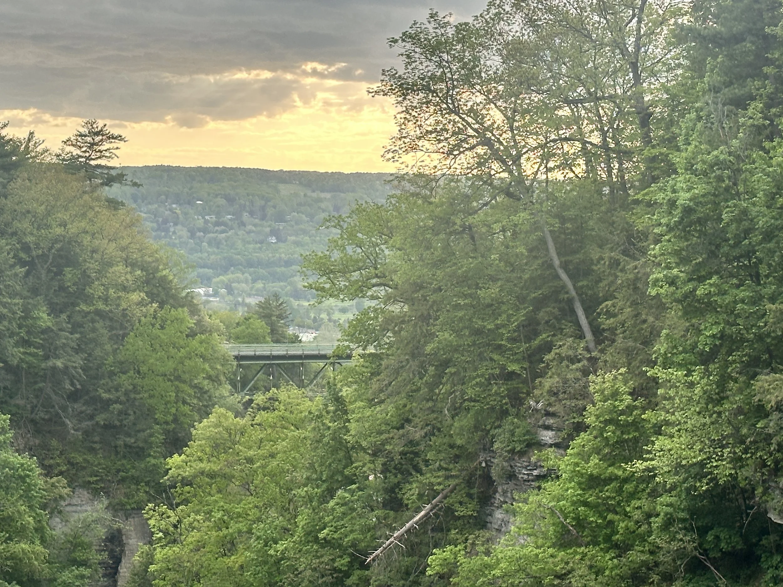
Our next stop would be the Stewart Avenue Bridge, which spans Fall Creek Gorge. Michael and I spotted the bridge during our photoshoot in front of Ithaca Falls, and I quickly called Ryan to find out how to drive to it. It looked like it would offer some nice scenery, and it certainly did. Michael exited the vehicle and set up on the bridge, camera in hand, and I made a couple of passes so we could get some footage of Red Rocket, as well.
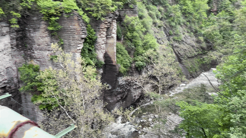
From the bridge, as you look ‘down’, you see the top of Ithaca Falls and, beyond it, Cayuga Lake. If you look ‘up’ - away from Cayuga Lake - you see Forest Falls. Unfortunately, Forest Falls is now inaccessible due to deaths that occurred there.
Ryan tells us that Carl Sagan’s former home is adjacent to this bridge. You can see it to the left of the bridge, in the video below…
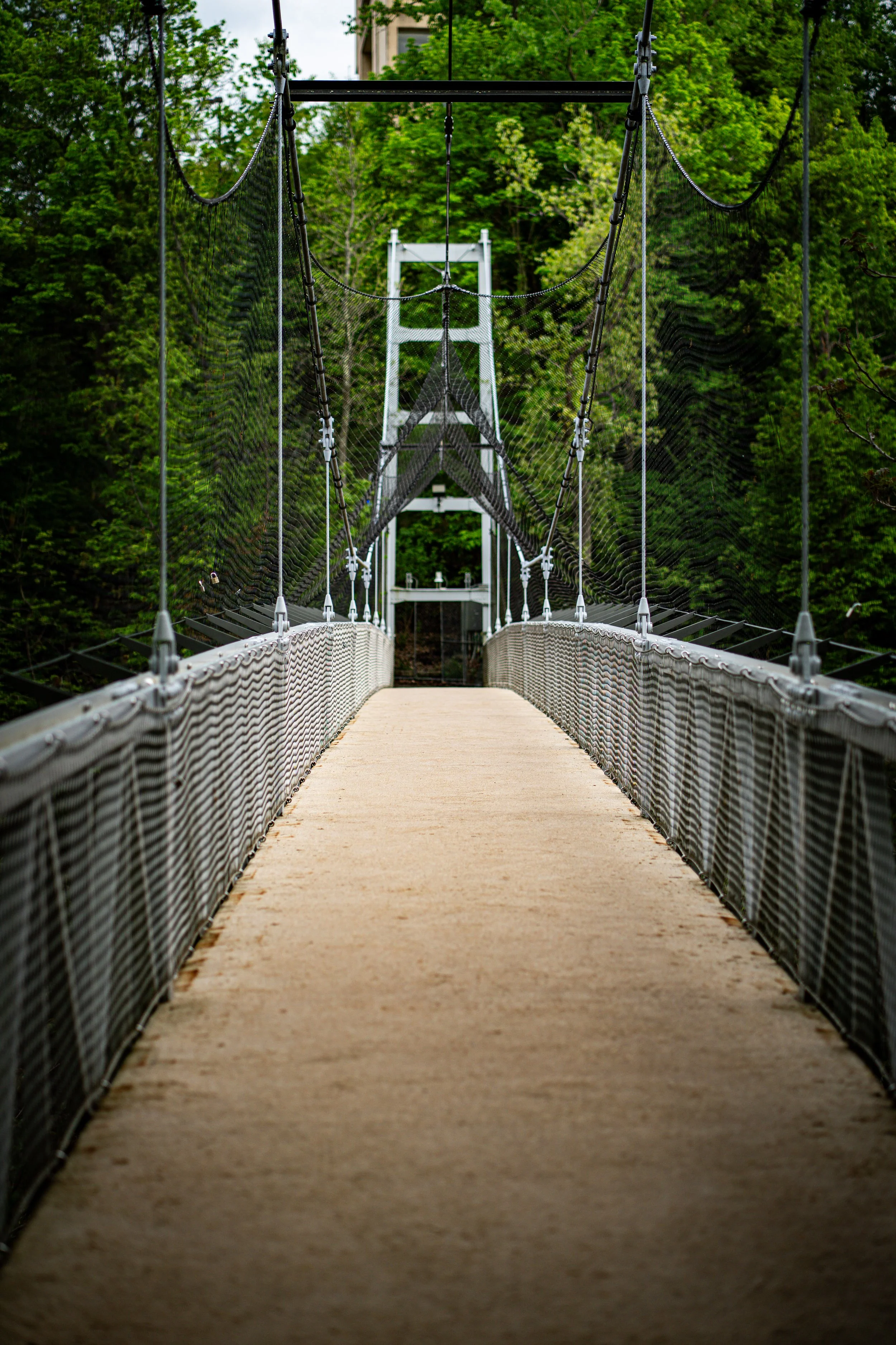
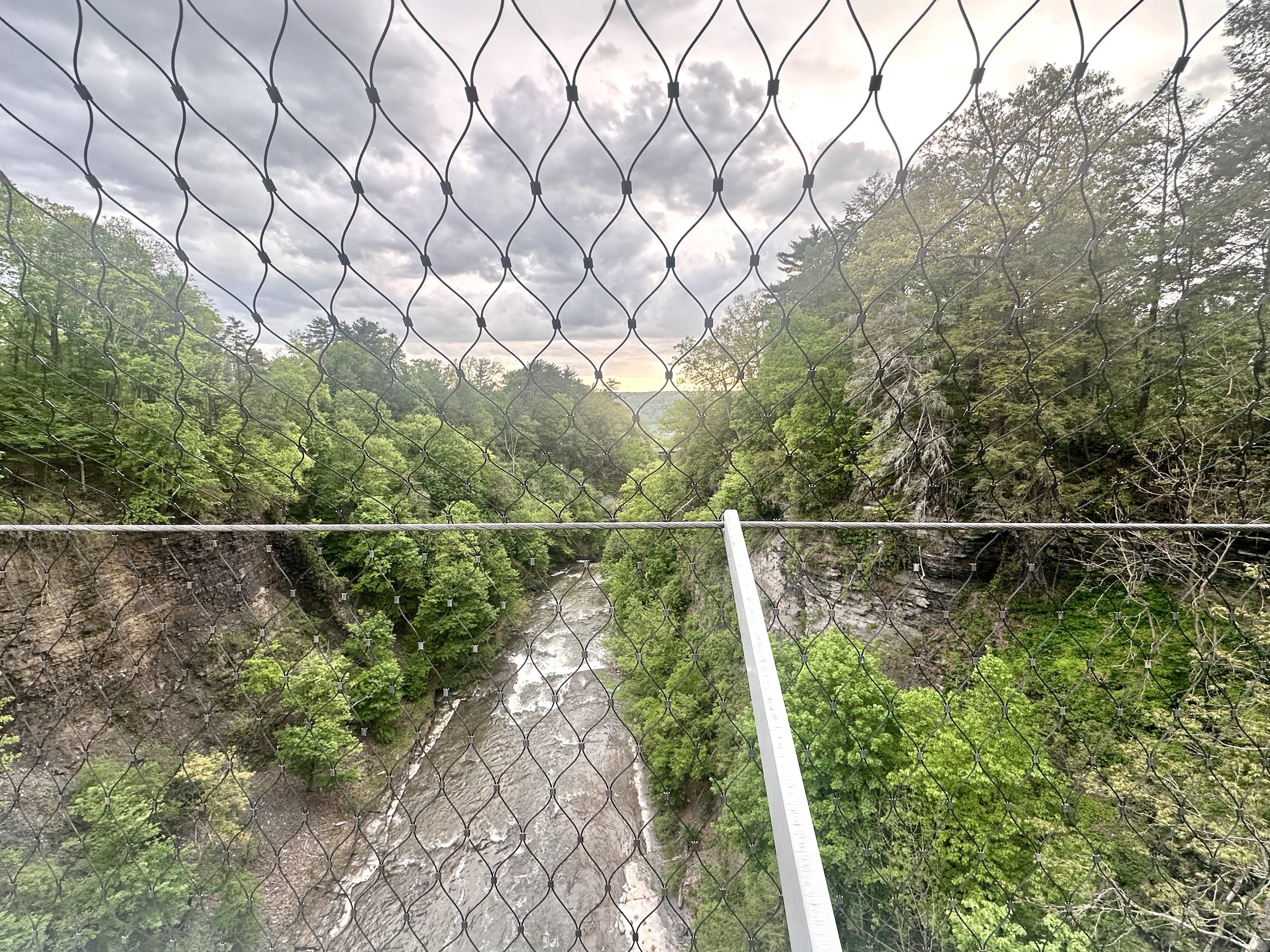
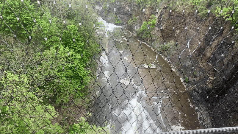
Suspension Bridge
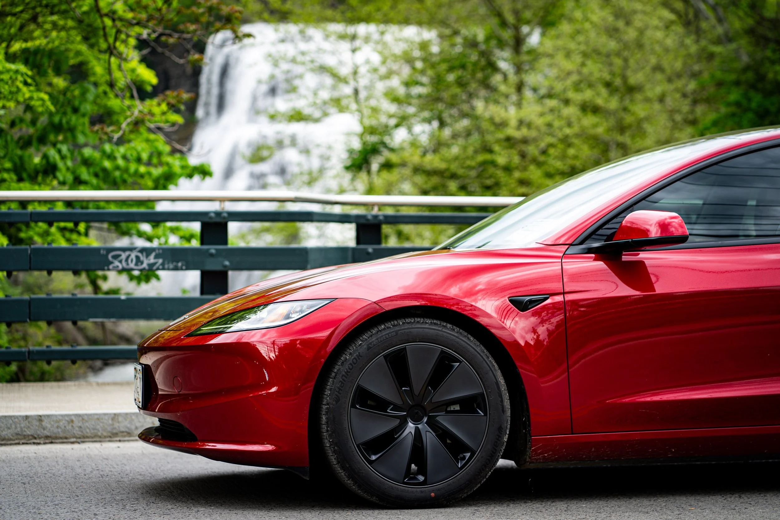
Our next stop was the suspension bridge over Fall Creek Gorge, where Michael found the lighting to be perfect for a little Red Rocket photoshoot. I love how the trees and sky shine in the reflection off this car. Michael noted that the color of the car changes with the lighting and even the angle - that’s the new ‘ultra’ red paint scheme introduced with the Highland model. It does make for some magnificent photography!
The Fall Creek Suspension Bridge was built in the 1940s. It is situated up the ‘Gun Hill’ - an old smoke stack remains on the former site of the Ithaca Gun Company, manufacturer of shotguns for over a century, and one of the businesses powered by Fall Creek. Looking down, you can still see the decaying remnants of a power plant.
Cornell students remember this bridge being referred to as the ‘Kissing Bridge’ - legend has it male students would take their female counterparts here and tell them that if they didn’t kiss in the middle the bridge would fall.
Safety nets were added to the bridge, and nearly a dozen other bridges in the area, by Cornell University to prevent student suicides, circa 2010.

Lower Falls
Robert H. Treman State Park . The park is about five miles south of those shown above, and is located in the town of Ithaca, as well as the towns of Enfield and Newfield. (Not that this park isn’t to be confused with Robert H. Treman Marine Park, a marina at the southern end of Cayuga Lake.)
Robert H. Treman first purchased land in Enfield Falls in 1915, working to improve the property by planting over 1,000 trees. He and his wife, Laura, donated the land to New York State in 1920 for the establishment of Enfield Glen State Park. The park was later renamed in Treman's honor following his death in 1937.
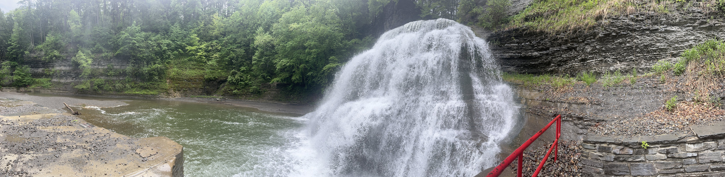
Robert Tremain State Park has numerous waterfalls along a 4.5-mile (7.2 km) round-trip hike along Enfield Creek and the deep, narrow gorge known as Enfield Glen. A natural swimming pool is located at the easternmost waterfall, known as Lower Falls. Lucifer Falls, a 115-foot-tall (35 m), multi-tiered cascading waterfall, is a short hike from the western portion of the park. Views of Lucifer Falls can be found along the gorge trail, in addition to overlooks along the rim trail. (We skipped this, but Ryan highly recommends it).
During the summer, this body of water is dammed and a tidal pool formed, one which is actually an amazing little swimming hole, complete with lifeguards and two diving boards. Imagine swimming here, diving and doggie paddling just feet from a 115-foot-tall waterfall? Don’t bring your dog, though - they’re not welcome in the pool here.
The Finger Lakes Trail actually connects to the southern edge of the park here. Avid hikers might be interested in checking this railway out during their visit - you can find more information here.
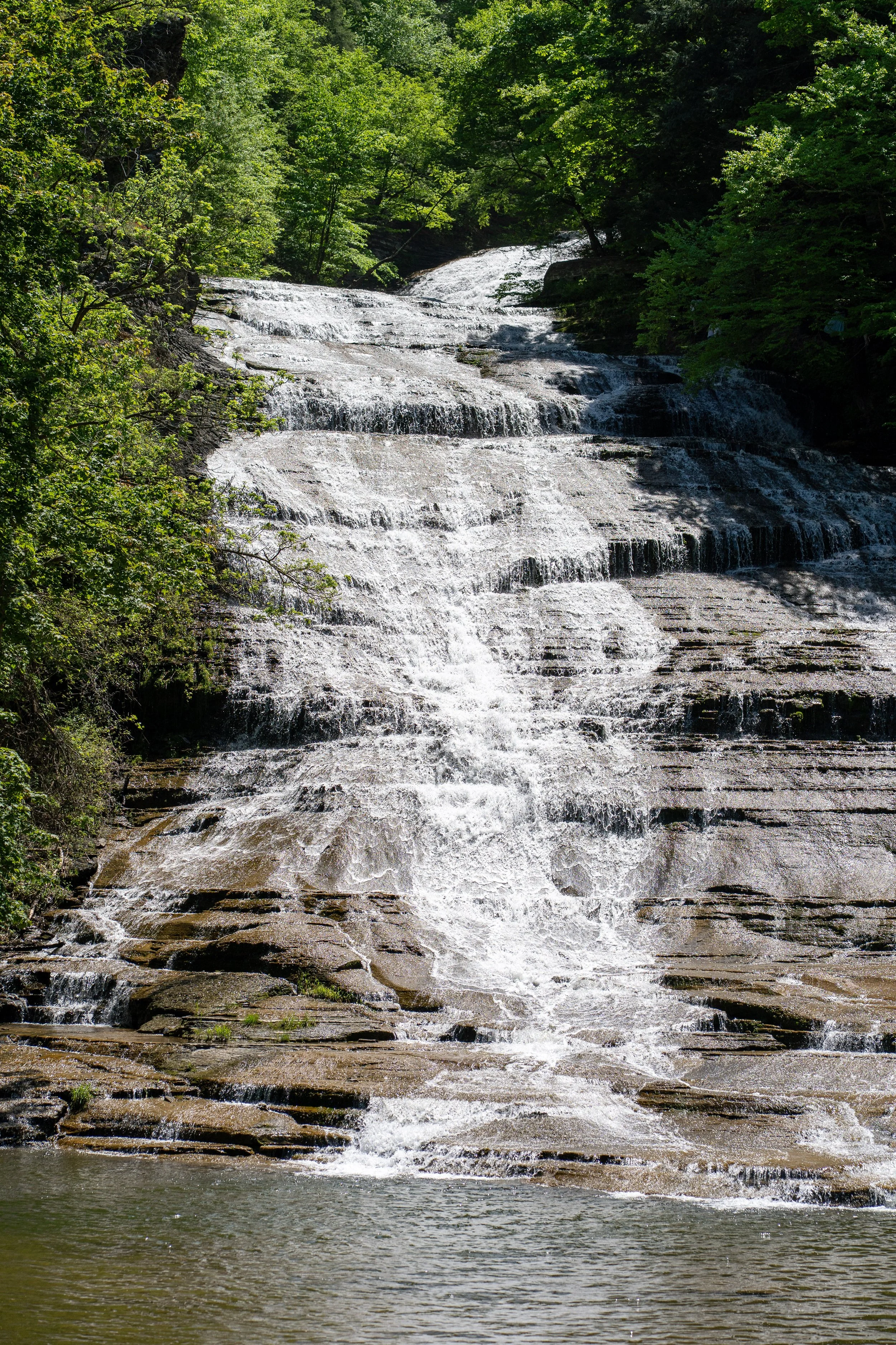
Buttermilk Falls
Our next stop was Buttermilk Falls State Park. Situated just over two miles from Treman, and halfway back to Ithaca, Buttermilk Falls was named for the frothy appearance of its churning waters, which those who named it in 1866 believed resembled the appearance of buttermilk, with its “thick, frothy foam.” The original 164 acres of the park was gifted to New York State by Robert and Laura Treman in the 1920s; it has since nearly quintupled in size thanks to land acquisitions by the state in the years since.
Buttermilk Falls State Park features 10 waterfalls in total, with Buttermilk Falls being the main attraction. Like other waterfalls around Ithaca, each of these was glacially formed, made up of Devonian shale and sandstone formed in horizontal layers, creating flat slabs and angular edges as they erode and fracture.
This park is noted for its network of nature trails, including:
Gorge Trail, which follows Buttermilk Creek as it cascades, dropping about 600 feet (180 m) along the trail.
Rim Trail on the other side of the creek, which make for a loop of about 1.5 miles (2.4 km).
Bear Trail which continues up Buttermilk Creek to Lake Treman Falls and Lake Treman. The trail to and around the lake is another 1.5 miles (2.4 km).
Larch Trail, which circles a marsh near the main (lower) parking area and is about one mile (1.6 km) in length.
This park also serves as a spur of the Finger Lakes Trail.
Buttermilk Falls offers a campground, as well, but we found it to be a meadow-like setting offering less privacy than Treman or our ultimate choice, Taughannock Falls. It also offers a wading area for dogs! Trojan and I will definitely be returning here this summer…
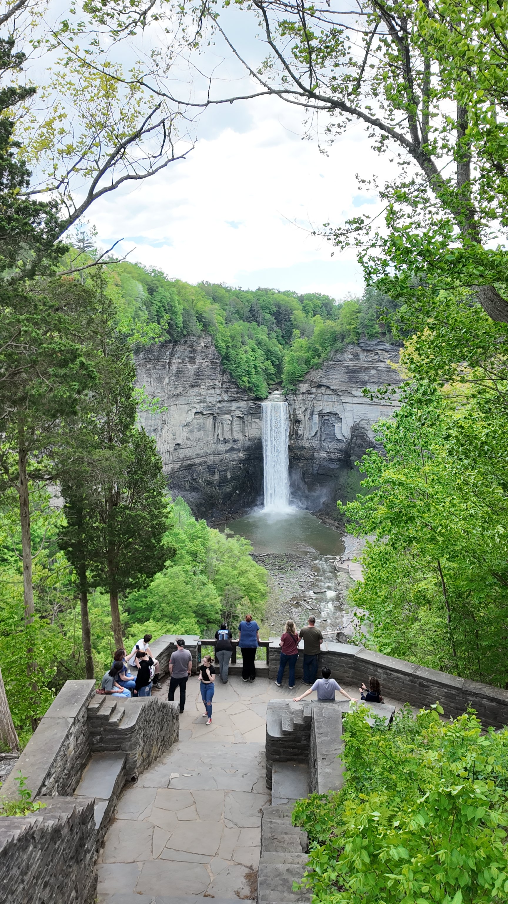
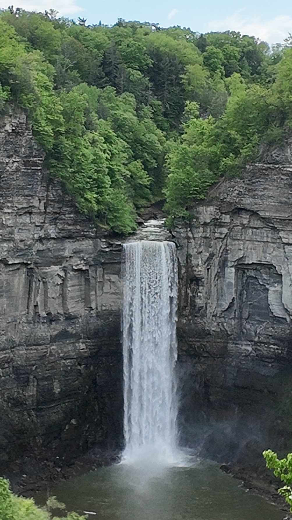
Taughannock Falls
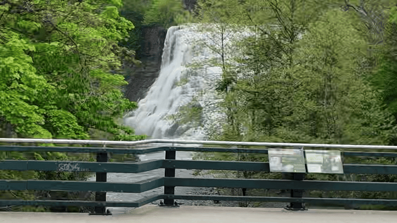
The signature falls of Cayuga Lake is definitely Taughannock Falls, located 10 miles from downtown Ithaca at Taughannock Falls State Park in Trumansburg.
Taughannock Falls' main falls is a 215-foot drop (66 m), making it 33 feet (10 m) taller than Niagara Falls! (It boasts significantly less volume, which is what makes it less impressive). Visitors to the Scenic Falls Overlook and its many hiking trails seems to multiply exponentially after a rapid snowmelt or rainstorm, when said volume can increase the awe factor substantially.
The waterfall is part of Taughannock Creek, which flows through a long gorge with cliffs up to 400 feet (120 m) high. In addition to the 215-foot main waterfall, two additional waterfalls are located within the park: a 20-foot (6.1 m) waterfall known as Little or Lower Falls, located downstream of Taughannock Falls, while the 100-foot (30 m) Upper Falls are found upstream.
The 0.75-mile-long (1.21 km) Gorge Trail leads to a viewing area at the base of the falls and also passes by Lower Falls. The 1.5-mile (2.4 km) North Rim Trail and 1.2-mile (1.9 km) South Rim Trail can be connected to form a loop hike which offers views of Upper Falls. Be forewarned: these hiking trails include a bit of an incline - and some stairs!
A publicity stunt masterminded by Taughannock House Hotel owner John Thompson in 1874 involved hiring Canadian acrobat "Professor Jenkins" to cross a 1,200-foot-long tightrope suspended 350 feet above the creek. He is said to have crossed twice over two days, at least one of those times while blindfolded and wearing "Chinese wooden shoes." Jenkins had previously crossed Niagara Falls gorge the same way.
Taughannock Falls State Park includes a 0.75-mile-long (1.21 km) Gorge Trail, which leads to a viewing area at the base of the falls and also passes by Lower Falls. The 1.5-mile (2.4 km) North Rim Trail and 1.2-mile (1.9 km) South Rim Trail can be connected to form a loop hike which offers views of Upper Falls. Visitors may also drive to a viewing platform - see photos below - where they’ll find a gift shop.
Two free EV chargers are located at the portion of the park closest to Cayuga Lake. This section offers swimming, fishing, and a boat launch, as well.
SPECIAL THANKS…
Special thanks to my fellow Teslacamper and EV road tripper Michael for many of these photos and videos, as well as my friend and day-trip co-pilot Ryan for his guidance and photo contributions. Looking forward to more camping with Mike and more road trips with Ryan in the near future. When you’ve got a Tesla Model 3 and live in such a beautifully-scenic region, you just have to go exploring…